
Well, construction is moving along rapidly on street works around the central city, and just as quickly more “Accessible City” transport projects are out for consultation. The third set of Accessible City projects are open for submissions until this Tuesday and I have to say I’m generally rather underwhelmed…
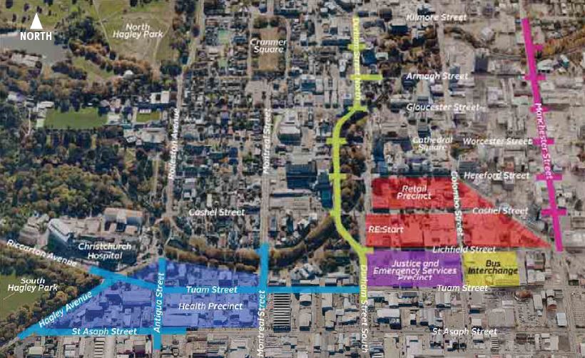
In this latest batch, there are three street sections being proposed:

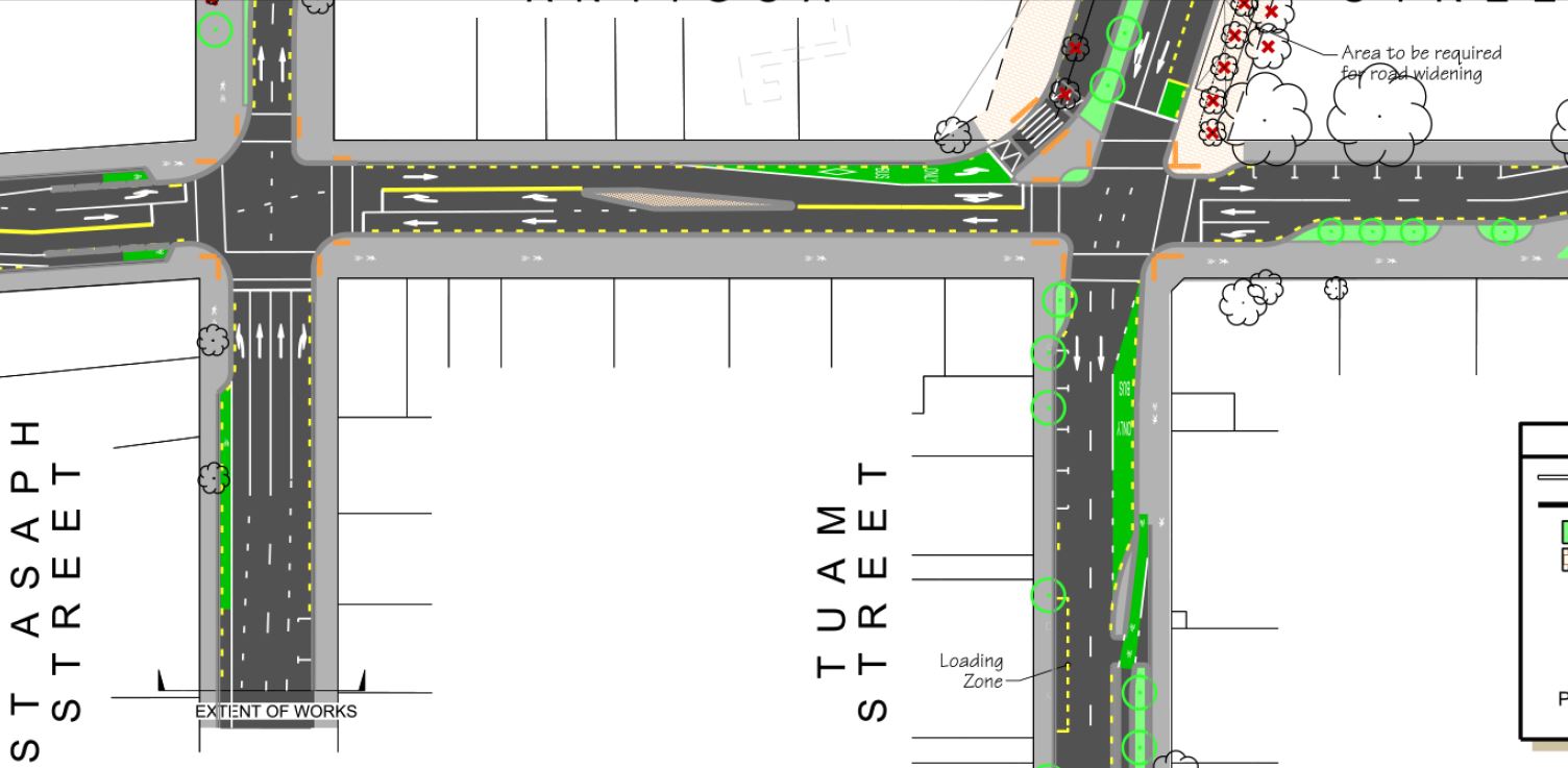
- Firstly the one-way section of Durham St & Cambridge Tce, from Kilmore St to Tuam St is being worked on (actually, it’s a pity that the plans don’t include the Kilmore intersection itself, as there’s a horrible pinch-point right there by the slip-lane as you enter Durham St). The general gist for cycling is a 4m-wide shared path on the river side (well, between Armagh and Cashel; then it continues to link with the Avon River pathway route); potentially useful in theory, although it will depend of course on how well the path user interaction works (also not that helpful if you’re trying to access a destination on the right-hand side of the street)
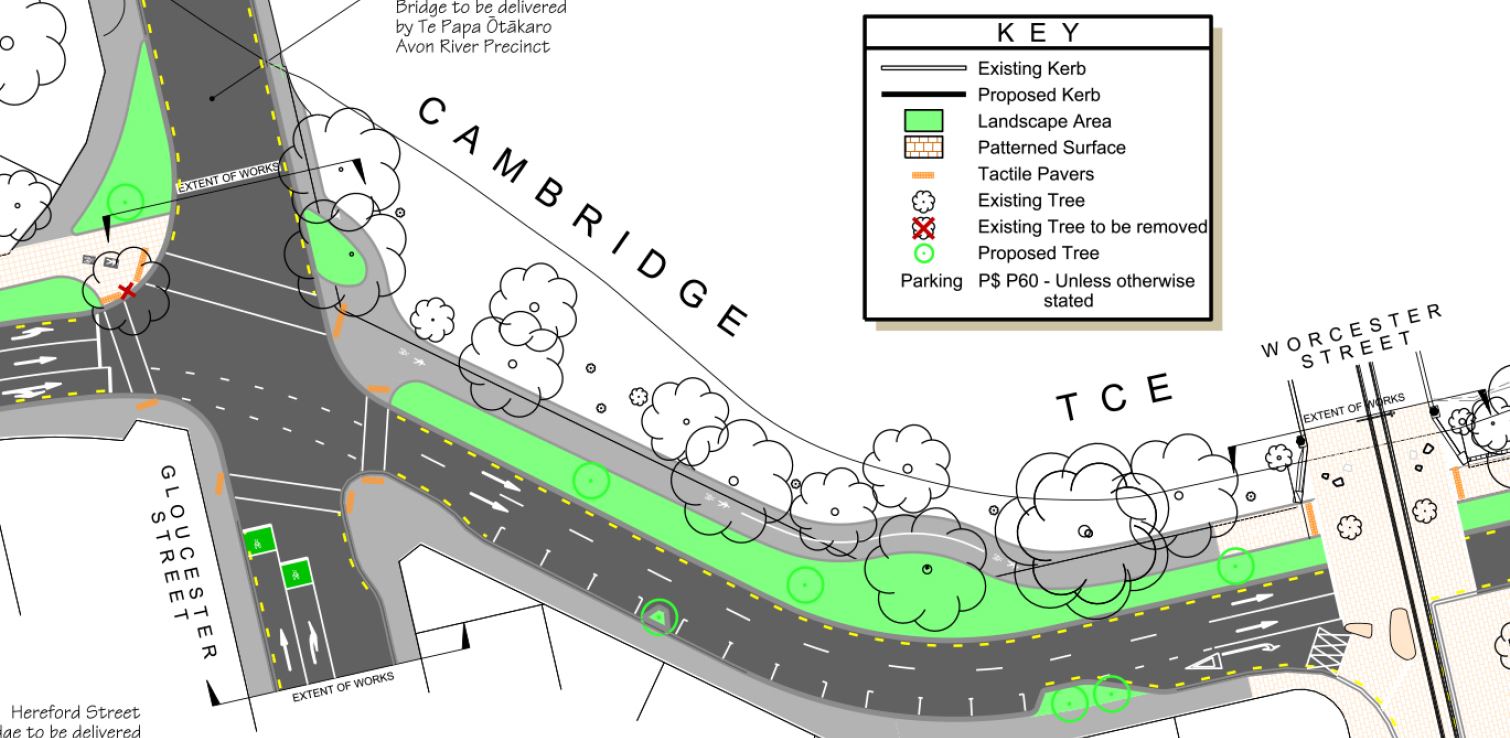
It’s also not clear exactly how the path crossings at each side road will work too. Will the signal phasing provide a separate or advance green light for path users before turning traffic? Will it be useable for a person cycling in the opposite (northbound) direction? The consultation material isn’t really specific on these rather crucial little details.
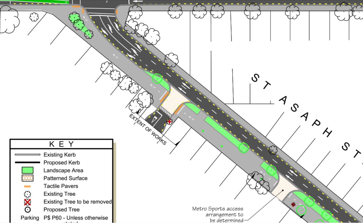
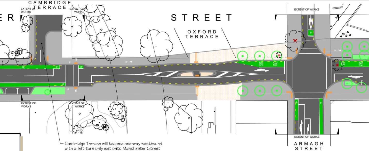
- The next works on offer are Hospital Corner Stage 2; recall that the current street works there previously consulted on were just temporary works to tie in with the new transport interchange opening. Now the final layout has been revealed (I hope they also plan to do something about the abysmal signal phasing for path users at Hospital Corner itself).
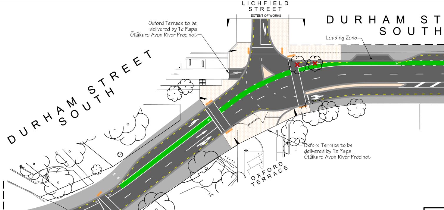
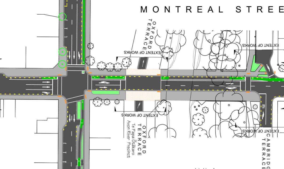
I was expecting to see more use of separated cycleways, and yes, Tuam St’s separated bike facility now continues back to Antigua St (whether Montreal St’s lane is physically separated is a bit vague; seems like space there for separators). What I wasn’t expecting to see was so much use of two-way shared paths again (especially where there often appears to be at least 5-6m of space for separate facilities). Didn’t we learn the lesson from the original Ilam Rd proposals?
The biggest problem with two-way paths (aside from mixing with pedestrians) are what happens at the intersections, especially when in many cases you are expected to swap from one side of the road to the other under the proposed plans (e.g. Antigua St northbound). I can see a lot of riders getting very frustrated with the process (especially if the signal phasing is not very efficient) and just choosing to stay in a traffic lane instead, to save themselves time (instantly earning the ire of many a motorist because they’re using “their road” instead of the cycleway…). One small advantage I can see is that on a couple of corners you will be able to do a left-turn off-road and avoid the signals completely, but there are other ways to do that with a dedicated cycle facility.
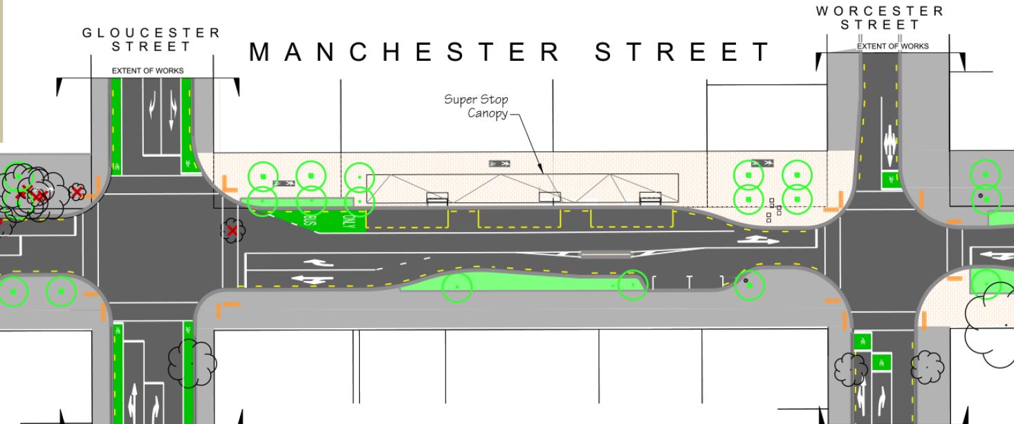
- Finally, the third works are along Manchester St, between Cambridge Tce and Lichfield St. This route is the main bus corridor to the new transport interchange from the north, and there was a bit of flak when additional land was purchased to widen the corridor.
The original Accessible City plan implies a boulevard-style layout, with a separated busway down the middle and service lanes on each side. This would make a lot of sense in terms of pedestrian accessibility, speed management, future proofing for rapid transit, etc. So it was a bit surprising to see the proposed plan looking quite different.
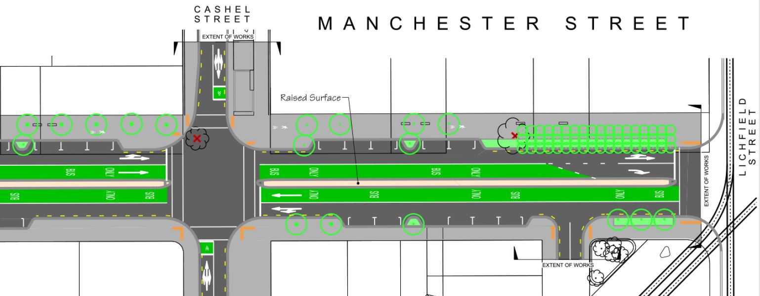
Again, shared pathways seems to be the tool of choice for this corridor. This just seems crazy in a busy urban environment with pedestrians wandering all over the place (especially around the super stops). And it’s only on one side of the road; not much use if you’re trying to get to the other side. While the Eastern Frame pathway will be only half a block away (another shared path I’m guessing?) and the main Colombo St route a block the other way, for those who actually need to access Manchester St by bike I can’t see this being useful. Again, no details on exactly how the intersection crossings will work safely/efficiently either.
So that’s the three proposals. The consultation documents also remind readers that most of these streets will be in the new 30km/h central city zone (except St Asaph/Hagley). I’m not sure when exactly that is meant to kick in (the Minister actually gazetted the bylaw last December), but I’m seeing precious little in the street designs here that would help to encourage these lower speeds (save for a few islands on Manchester St). The surfaces are all smooth asphalt and there’s little in the way of narrow lane widths, horizontal deflections or broken sightlines to slow people down. Perhaps enhancing some of those pedestrian/cycle crossing points with a bit of colour/texture might break up the continuous flows? One can only hope that on the one-way streets the synchronised green wave is now set at a lower speed…
The other frustrating thing about all of these consultations is that it is difficult to see how they fit in with the bigger picture. For example, we’ve seen plans for Lichfield St, we’ve now seen plans for Manchester St, but we have no idea what the Lichfield/Manchester intersection looks like because it’s not included in either. And everywhere there are statements like “final layout to be determined later as part of Te Papa Ōtākaro / Avon River Precinct”, which tells us very little about whether the final product will be usable from a network perspective.
Overall, these proposals are disappointing given the relatively blank slate presented post-quake for these streets. Sure, there are many bits that are a dramatic improvement on what was provided previously here (in many cases, nothing before) but it’s the lost opportunities that may come back to haunt us. I suspect my frustration is accentuated by what I’m currently seeing in various places around The Netherlands (who we’re supposed to be emulating in much of this); generally they wouldn’t be applying these kinds of solutions on the same streets there. Many of them may not be the major designated central city cycling routes but they still deserve better than this. Can we have another go at this?
Submissions on all three of these projects close at 5pm on Tue 26th May. So, if you want to get your thoughts in, you’ll have to move quickly to have your say. Personally I think these ones need a bit more work…
What do you think of these project proposals?
Pardon my ignorance, but who comes up with these designs? Do they consult cyclists in the design process or have any other expert input which pertains to cyclists?
Various consulting firms bid to do each of these packages of work for CERA. While they will certainly have transport planning/engineering skills, I don’t know how much specialist cycle planning/design skills they will have; it varies. I can’t say that Spokes Canterbury (or any other road user groups for that matter) get much say in the design until this consultation phase now.
I find these maps hard to read. Not sure what the solid grey areas are, can’t tell what’s existing and what’s new, the shared paths aren’t labelled — it’s frustrating to figure out.
I have to agree; the resolution of the plans this time is not great and the colours don’t seem to match the key even. Suffice to say that most of these streets are being completely reconstructed, so everything is “new”. The dark grey are road-level surfaces while the light grey areas are paths/islands (i.e. raised above the road).
This looks really confusing for anyone to cycle through. Weaving back and forth on footpath then on the road and back again. Really disjointed.
Why is the bus only lane green like a cycle lane or are cyclists supposed to be using it too?
How hard is it really to have a lane that starts on the left of the map and is continuous all the way to the right hand of the map just like car lanes but for bikes? Seems impossible.
All “special vehicle lanes” in NZ (bus, cycle, high-occupancy veh) can use green; it’s not exclusive to bike lanes. If it says “BUS LANE” you can bike on it too; however all of these shown are “BUS ONLY” (but I could see some being ignored by bikes on the road, e.g. top end of Manchester St).
On reflection, it strikes me that a hospital is a particularly bad place to have shared paths around — lots of infirm people with mobility and visibility issues, moving slowly. Horrible for them to have cyclists vooming past, inconvenient for cyclists.
Thank you for the analysis. My brain is working hard trying to imagine a final product that looks like a fluid network.
I have just responded to each of the 3 proposals in general terms, saying it all looks a bit complicated, surely things can be more straight forward for people on bikes, and referred them to Lenny Boy’s comments. Hope that helps.
These maps are indeed hard to read – was it Einstein who said if you can not explain it simply enough you probably do not understand it enough? From what I do understand from these maps is that they look messy and confusing. I have always thought the strength of Dutch cycle paths is consistency. What are the reasons behind this utter disjointedness? The chain is no stronger than the weakest link. What good does riding on separated paths do when you are forced to merge with cars again after a few meters? It is the merging back with the motor traffic that will actually create dangerous situations. I rather cycle left of the old white line to be honest. Fail.
I agree with the above. A big tick for the cycleways programme until you get into the CBD , then it is back to same ol , same ol , paint and compromise. If we wish to be a world class cycling city then best start at the centre and work outwards.
But are they actually genuine about trying to make Christchurch into a world-class cycling city? The cynic in me thinks it was said as more of a sound-bite than an intended reality for Christchurch. Hopefully I am proved wrong, but looking at the plans above you’ve got to wonder.