
 At long last, the Government (through CERA) has released its final transport strategy for the central city, “An Accessible City”. It’s been almost exactly one year since the draft Plan was released, and about six months since it went to the Minister for consideration.
Just a couple of months ago, a few people were starting to wonder what had happened to it. Apparently it had been delayed until the cost-sharing arrangements between the Govt and Council were finalised, but even after that, a paper still hadn’t been taken to Cabinet. I think many of us had visions of the Government finding the proposed sustainable-transport-friendly plan a little hard to swallow, given their clear transport preferences, and thus watering down the proposals. But finally it has emerged (a nice summary by The Press).
So what has changed from the draft Plan? Well, not much really, and generally for the better:
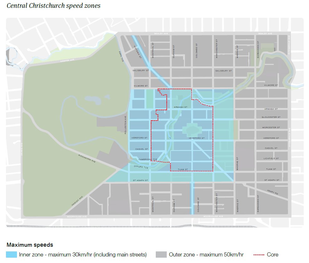
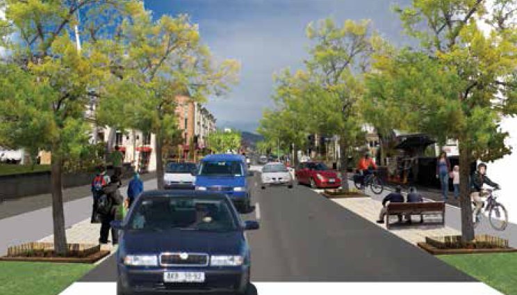
- There’s still a 30km/h slow core for much of the central core and the Victoria St / southern Colombo St “Main Street” approaches. It also now includes lowering the speed on the one-way arterials that traverse it, thus removing the silly inconsistency present in the draft Plan.
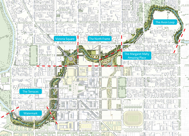
- The city is still ringed with a myriad of key cycling routes, generally likely to be a mixture of high-quality facilities such as separated bikeways, shared pathways, and quiet streets, together with crossings of busy roads. I’ve already seen some draft plans for the Avon River corridor and they looked pretty neat for walking and cycling. A few extra links have been added to the original mix, including a cross-town link via Salisbury St and alongside CPIT, as well as recognising the many connections already existing through Hagley Park as well.
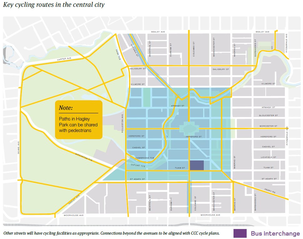
- Copious cycle parking also is suggested, including secure bike parking at the new Bus Interchange and “super stops”, and requirements for parking by building developers.
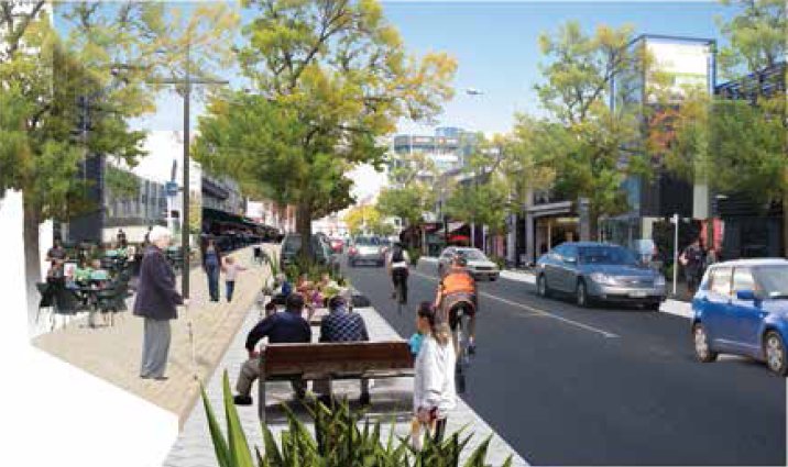
- There’s still a suggestion in the images provided that the one-way streets could have separate cycling facilities as well, including contra-flow cycling to provide two-way access for bikes. Now that would provide a distinct advantage for cycling…
- Importantly, the final Plan also talks about implementation tasks, such as developing design guidelines and concept plans, and mostly by Dec 2013. Not quite sure why they propose to develop “cycling design guidelines” though – the City Council already did that for them… There’s also a “First phase transport project delivery schedule” listed, but it seems to be largely focused on developing many of the arterial roads first during 2014-15 (although I’m aware that work on the Avon River and Frame corridors is continuing along too).
There’s a bit of grumbling on the blogosphere about how this Plan will be terrible for driving/parking around town, and kill off CBD business as a result. I find that laughable on a couple of fronts. Firstly, there is relatively little reduction in access by motor vehicle; you can still get to most parts of the CBD fairly easily (probably too easily in some cases), and parking was always ridiculously easy to find previously. Now there’s just a bit more balance about what is provided across the travel modes. Secondly, the focus is on what will attract people to want to come to the central city – if you provide them a nice enough place they will come, no matter what the transport implications are. That’s been proven countless times overseas; people generally don’t visit a city because it has great suburban shopping malls or all-day parking.
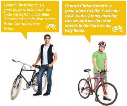
{I had to laugh too that, on page 7 of the final Plan, where a number of “typical road users” are shown and quoted, the bike rider now has a helmet on, unlike the previous “law-breaker” (I’ll bet someone complained)…}
So what do you think of the final Central City Transport Plan?
From a cycling perspective things look very promising. I would have preferred to see the end of one way streets announced and parking facilities restricted to outside the avenues only but I guess the plan is a reasonable enough compromise. I really like the 30k speed limit in the CBD. I do think public transport might be the big loser in the plan however. I really would like to have seen something mentioned about commuter rail or even light rail. It does contain a vague sentence on page 15 about mass transit systems in the future but that is about it. If we want to transform Christchurch into a modern, vibrant and green city, public transport needs to play a vital part I would say.
I’m very pleased that the plan takes notice of the Share an Idea suggestions and that feedback seems to have been taken notice of.
good mix of recreation and commute options to be implemented.
I’m concerned a bit that cyclists are seen as mobile speed bumps to limit car speeds, and that safety is coming second to convenience of road design and vehicles. e.g. Will vehicles be actively discouraged from using Victoria St as a commute route, so it is primarily for local access and cycle routes?