
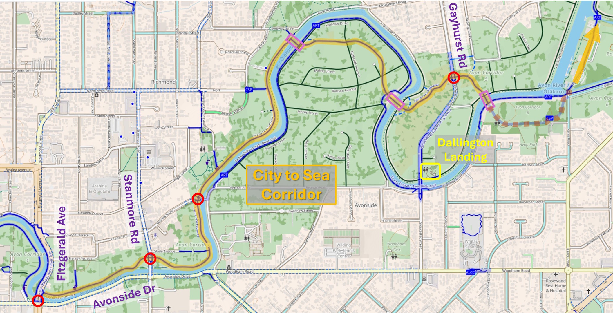
The lovely (albeit windy) weather over the weekend was the perfect opportunity to finally have a chance to check out the first section completed of the City to Sea Pathway. As the name suggests, this shared pathway follows the Ōtākaro Avon River Corridor from the central city eventually all the way out to New Brighton. A lot of work has gone into the pathway, and various road and river crossings along the way.
We started at the western entrance point adjacent to Fitzgerald Ave just north of Avonside Drive. At the moment, it’s a bit tight getting there along the narrow footpath on the road bridge, but there are plans to upgrade this bridge in due course and make some improvements to the path access and crossing at the same time.
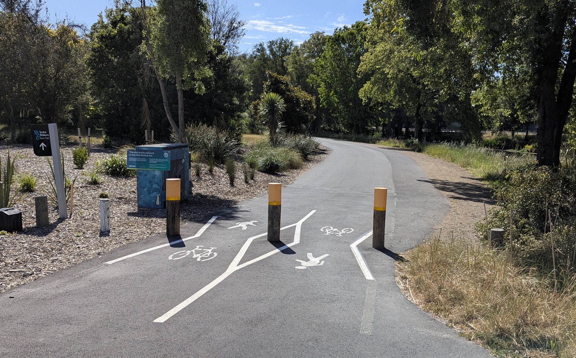
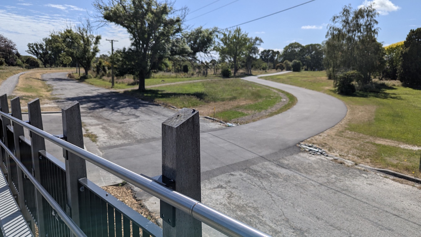
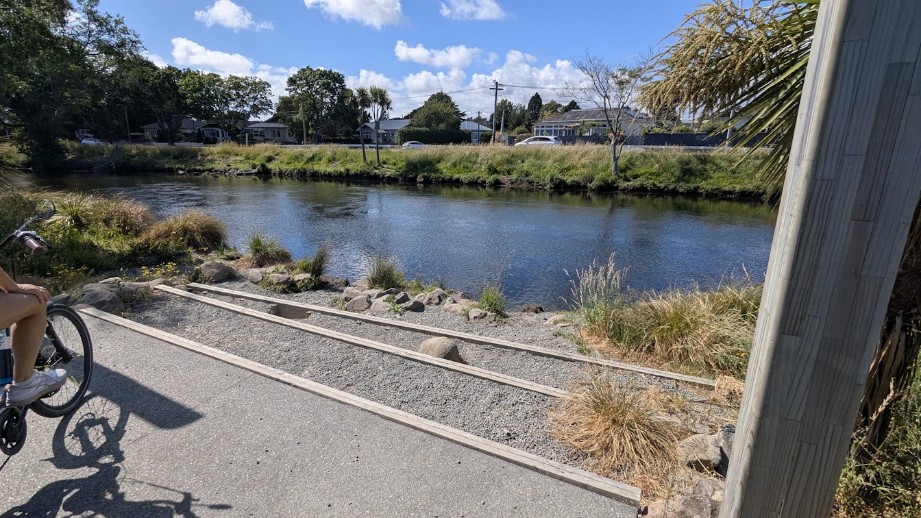
One thing that is very noticeable along the pathway is the big improvement in surface quality. No longer the bumpy, rutted, and sometimes gravelly remnants of the old streets that used to be here. Now you are treated to a lovely smooth pathway at least 4m wide. There are also regular seats and drinking fountains.

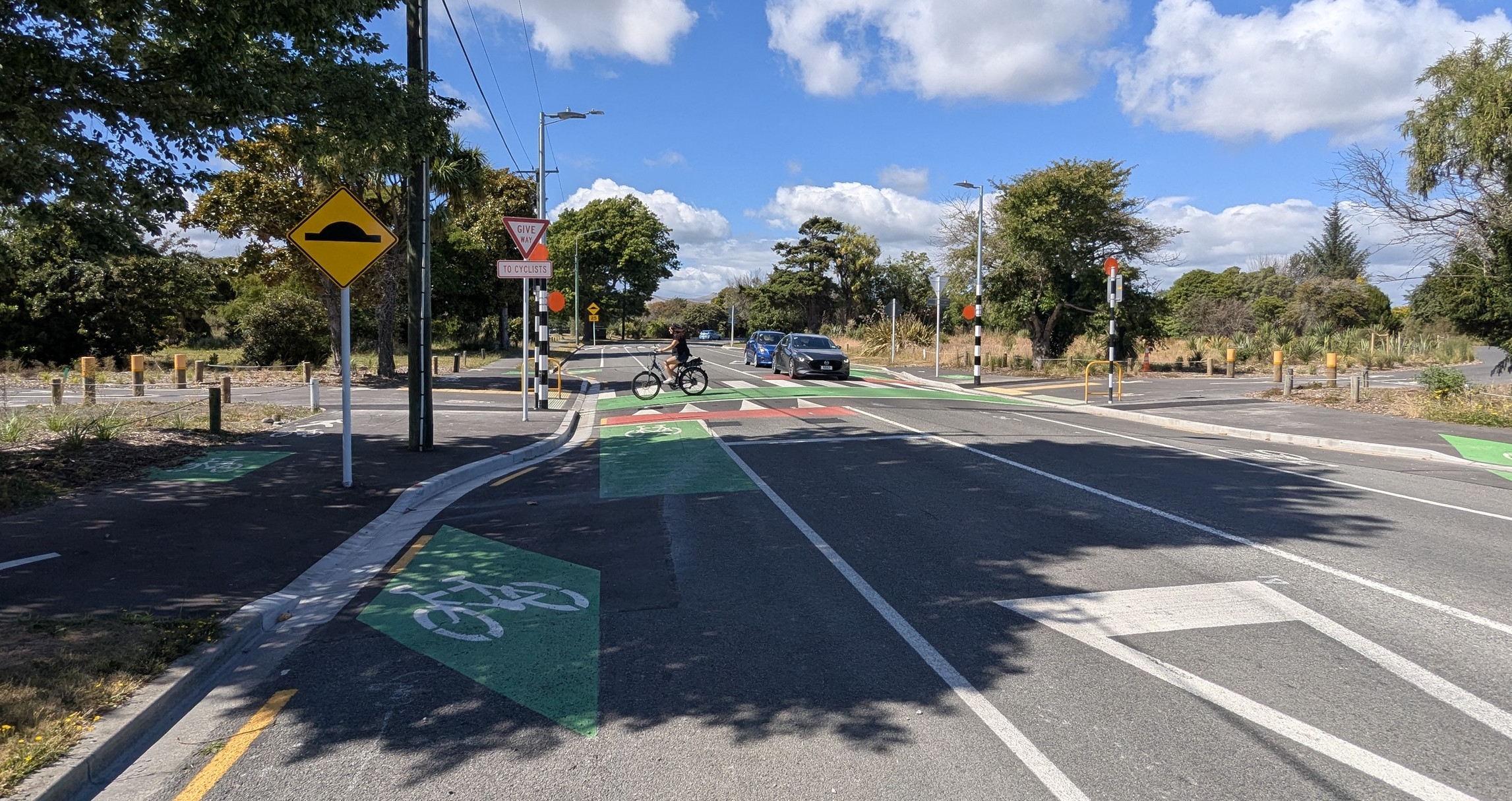
The first part of the route takes you to Stanmore Rd, where (as highlighted a couple of months ago) a new signalised crossing lets you safely get across this fairly busy road.
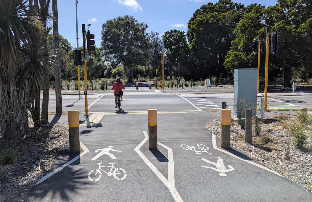
The next road crossing is a raised priority pedestrian/cycle crossing at Swanns Rd. Soon after this crossing is the Richmond Community Garden and Eco-Hub, which appears to be a very popular place especially on the weekends.

The pathway continues on through Richmond (we saw a lot of other cyclists, dog-walkers, and other pedestrians about) and soon approaches the first bridge near Medway St.

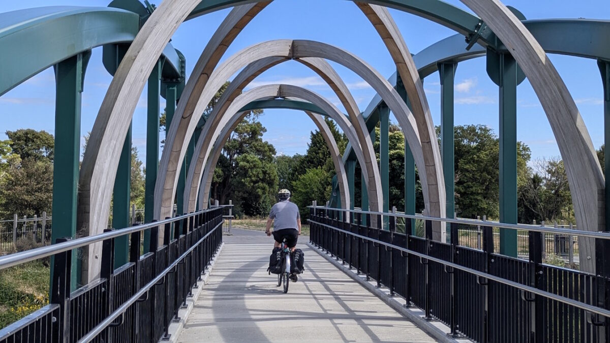
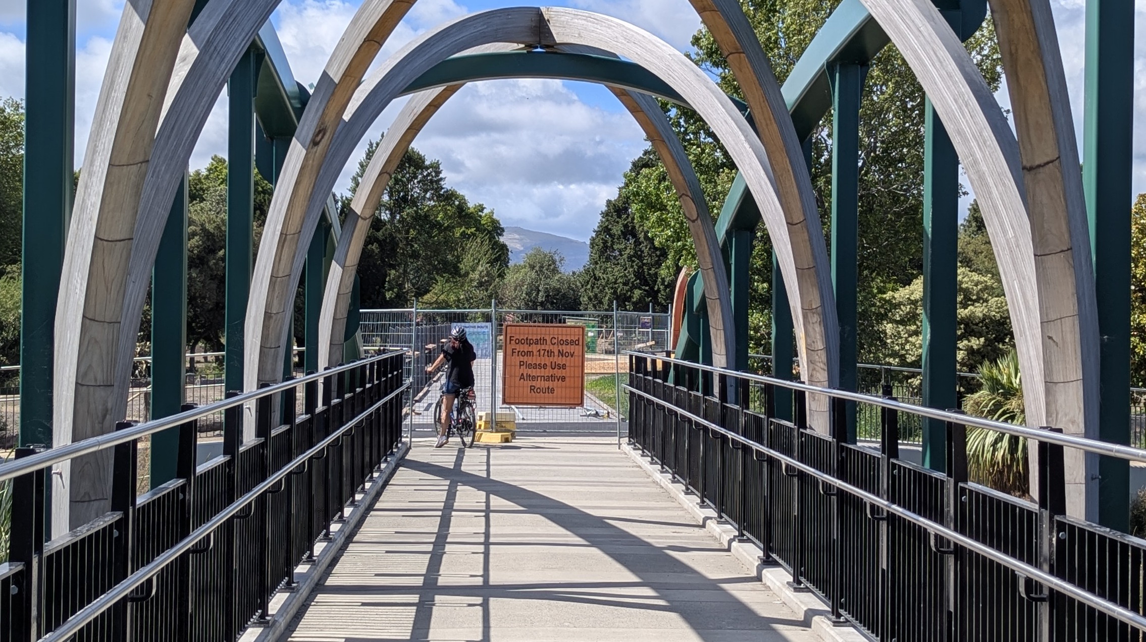
The Medway Bridge was first opened over three years ago, replacing the so-called “munted” footbridge that was damaged in the 2010 earthquake. The new shared walk/cycle bridge certainly is a great improvement in terms of width and ramp approaches.

Once over the bridge, rather than winding around the river loop, the pathway cuts across the North Avonside red zone.
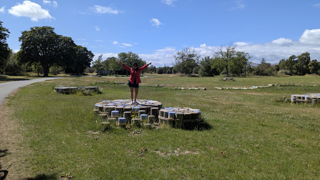
Along the way, the route also features some interesting “features” alongside the pathway. We were trying to work out exactly what they were – play elements for kids, maybe?
While riding along, we had been wondering about the lack of lighting evident along the route, but apparently that is somewhat deliberate to reduce impacts on the area’s wildlife. Energy efficient “dark sky compliant” LED lamps will be on timer sensors, that will dim down and only pulse up if users present – I might have to check this out one evening…
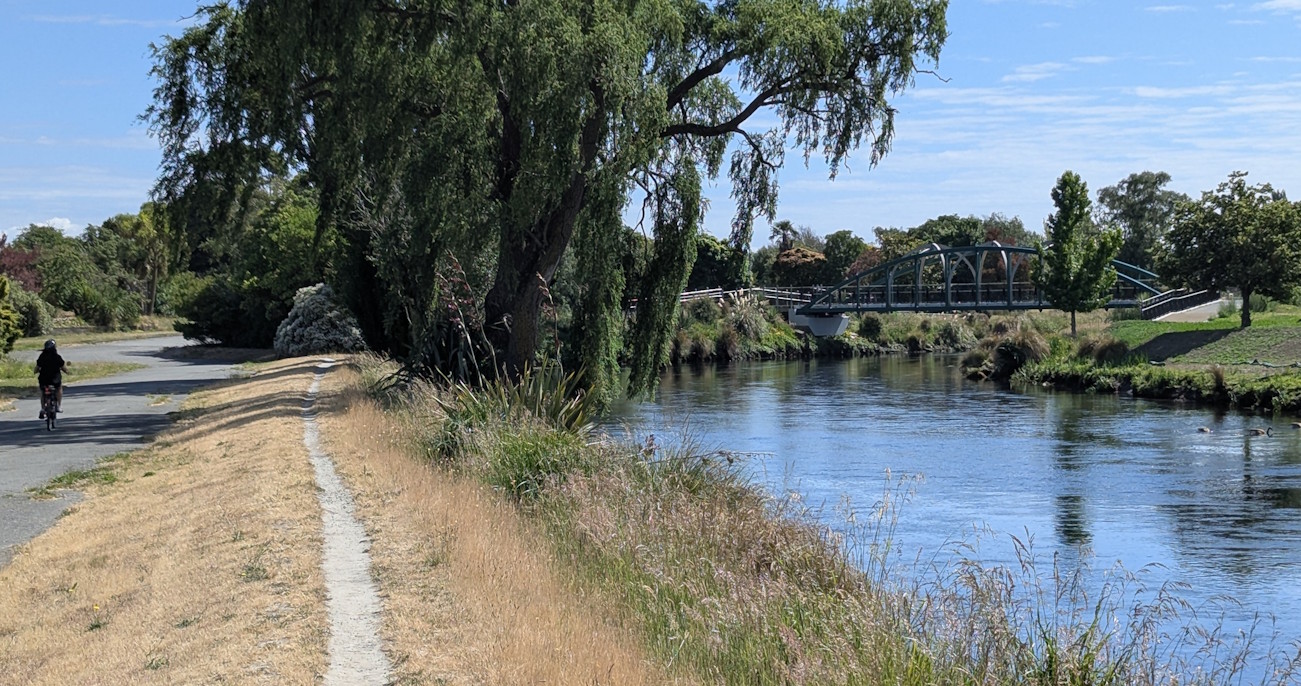
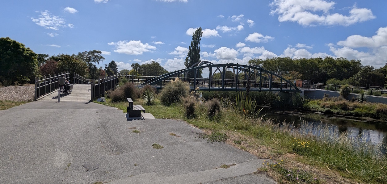
Coming over to the other side of the loop, and we approach the new Dallington Bridge, which was opened back in September.
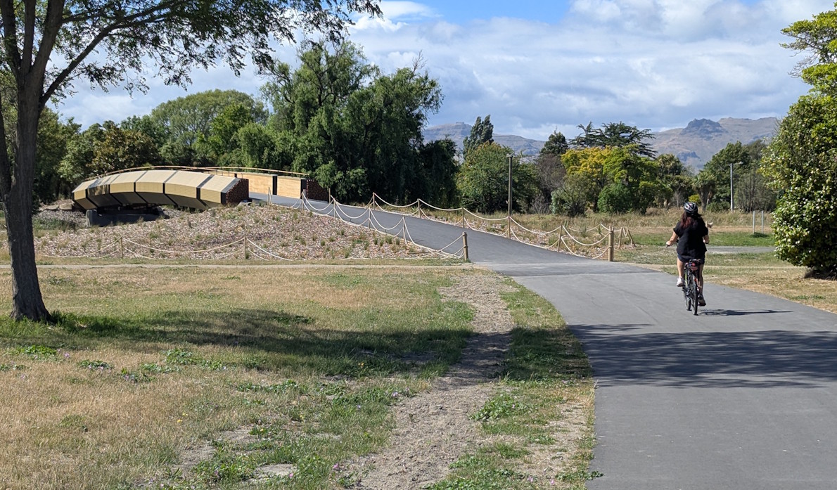
Apparently the new bridge is based on concepts created by engineering and fine arts students from the University of Canterbury, with the design inspired by small traditional canoe-type vessels fashioned from raupō and flax.
Again the bridge had good width, and we quite liked the way that it combined multiple components to create it (not entirely convinced about the yellow colour, but oh well…).

Soon after the bridge we reach the next road crossing; another pedestrian/cycle priority crossing of Gayhurst Rd.
While the pathway continues through the Dallington red zone, we decided to take a slight side detour down Gayhurst Rd to the Dallington Landing area.

This is a nicely created space for stopping to put your feet up, have a picnic, and use the toilet facilities. As the name suggests, in theory you could also set out on a boat along the river here if you wished.
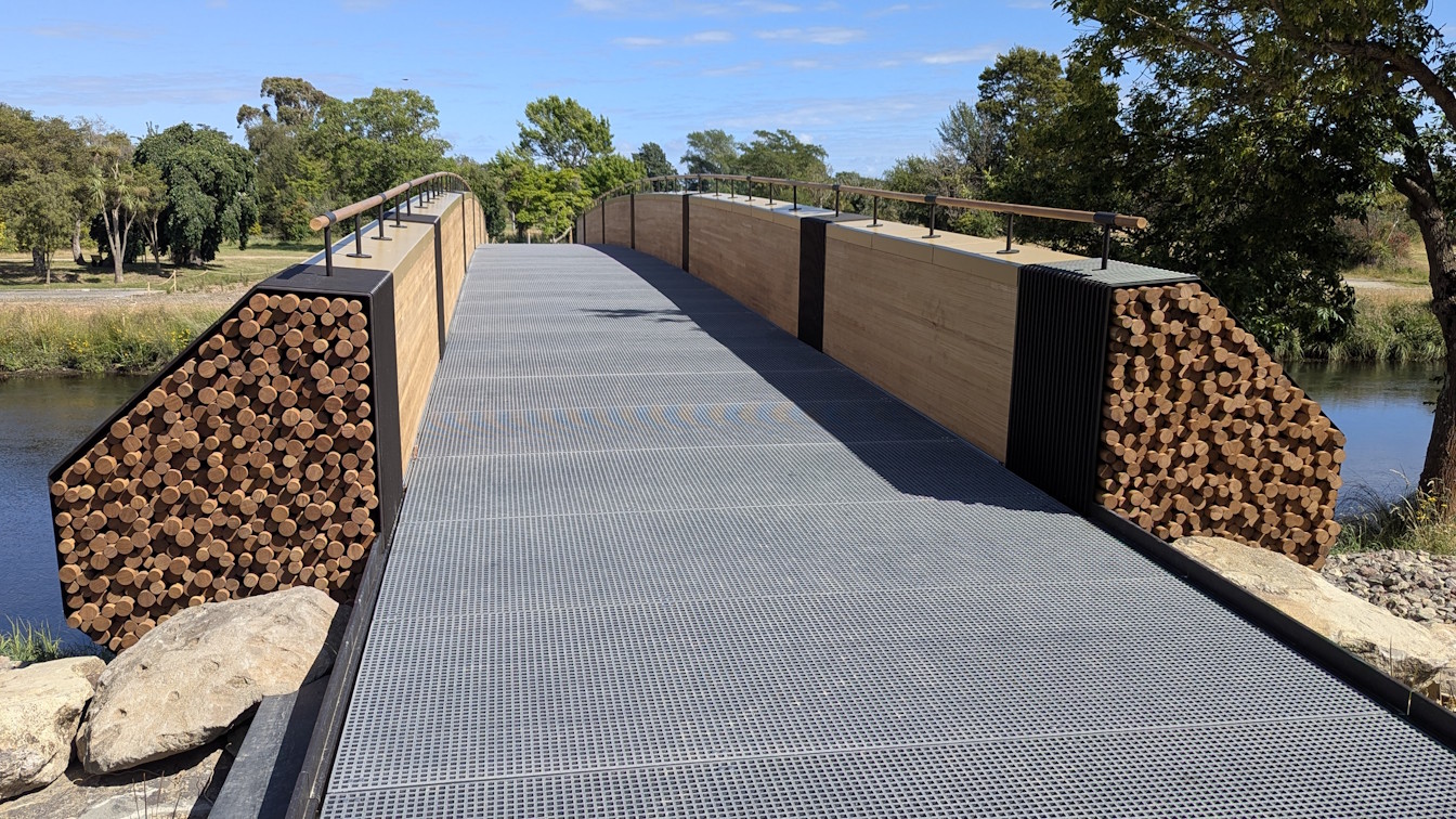
We continued up the former Locksley Ave roadway, now approaching the Snell Place bridge.
This is where we rejoin the City to Sea Pathway again. The Snell Bridge was opened just after the Medway Bridge back in May 2022 and features a somewhat similar structure.
Alas, for now, this is the end of the road (well, path…) for the route, as work is still underway to construct the next stage of the pathway through Avon Park.
As you can see below, it looks like things are nearing completion, so hopefully you will be able to use it in the New Year. At the same time, work is also underway to continue the pathway through Porritt Park and up to the Anzac Drive bridge early next year as well, which will complete Stage 2 of the corridor. As part of that, there are also plans to relocate the rowing facilities to the other side of the river.

If all goes to plan after that, the final section from Anzac Drive through to Pages Road (across Wainoni Rd on the way) should be ready by early 2027. I’m looking forward to being able to check out the entire route in due course!

Overall, Stage 1 of the City to Sea Pathway is looking great, and the large numbers of people out and about along it were testament to its popularity too.
Have you tried the City to Sea Pathway yet?
It’s a great addition to our city! The Gayhurst Road crossing really needs work, though. The drop down to the pedestrian crossing is sharp and jarring. I’ve done a SSS on this to council, who had an engineer check it and said it was standard. How it is, I am not sure. But a good reminder that standards shouldn’t be targets. It’s really uncomfortable to cross on a bike!
Hah, yes, we noted that those kerb drops at Gayhurst Rd were rather jarring too! Ideally something that can be smoothed out a bit…
Great review – have walked some of it. Keen to bike the entire bit that is now open soon. Thanks for the inspiration.