
While there has been a lot of fanfare recently about the opening of the Heathcote Expressway and Coastal Pathway cycle routes, another cycleway has been quietly just rolling out has in the opposite direction…
The “South Express” is somewhat oddly named, heading mostly west as it does (then again, the same could be said about the nearby “Main South Road”…). But, the good news is that you now have a fairly pleasant route to bike all the way from Hagley Park out to Hornby.
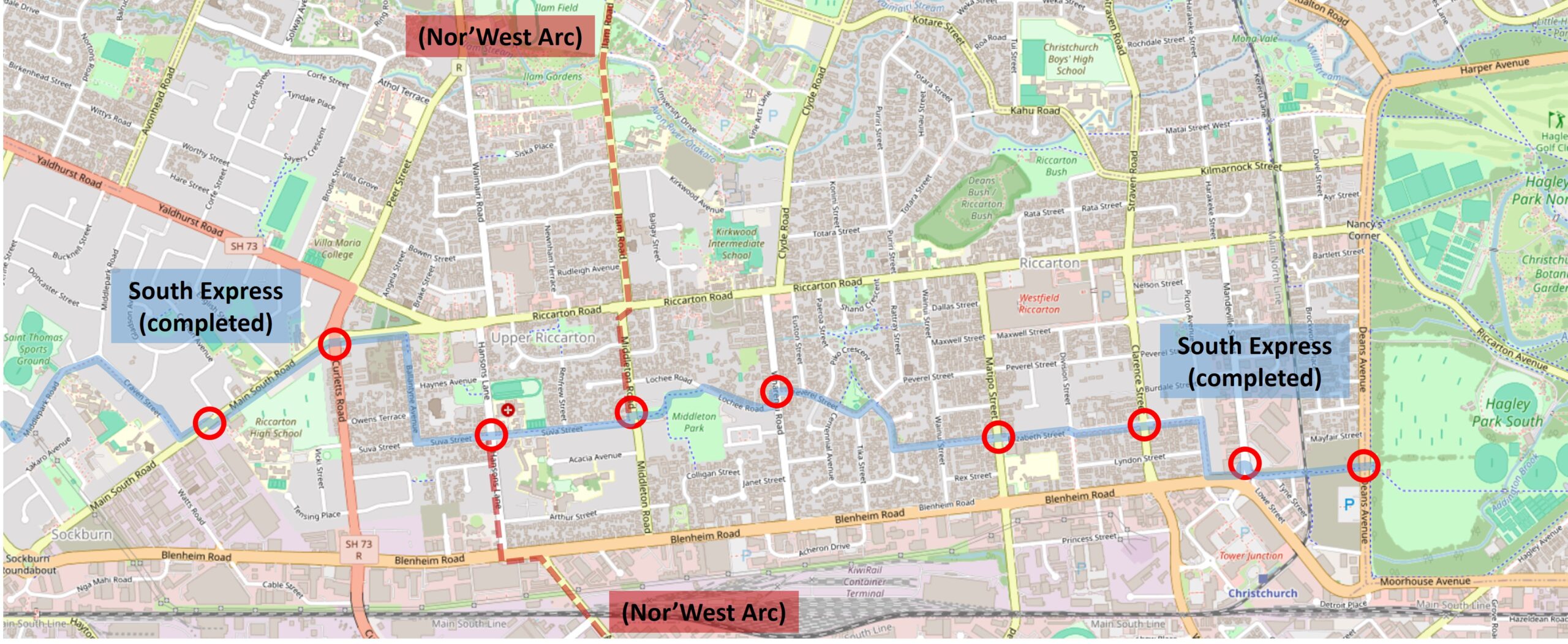
The entire route out there is already nearly 10km (with more to come beyond that) and there are a lot of details along the way, so I’m going to break this preview down into two parts, starting with the section from town to Upper Riccarton.
Interestingly, the original tentative route for this cycleway simply had a straight line running along the Main South Line rail corridor. However, it was soon realised that, while direct, that route would not be very useful in connecting to key places along the way. So it is that the final (slightly wiggly) route takes in various neighbourhoods, schools, parks, shops, and other amenities along its way – much more useful…
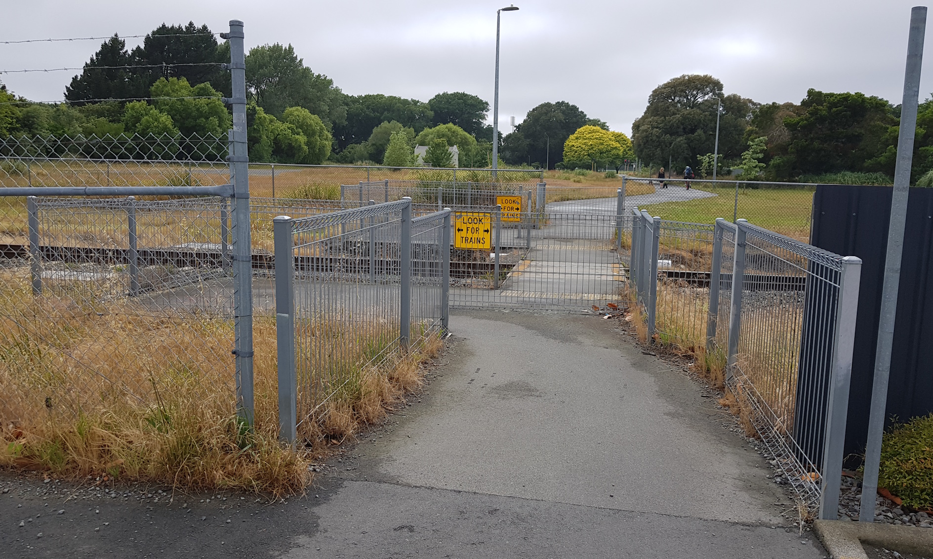
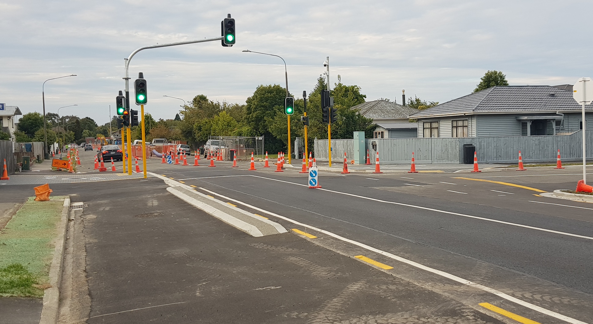
Let’s start from South Hagley Park and head west: having crossed over Deans Ave, the generous shared path leads you to a winding railway crossing maze (at least until KiwiRail install automatic gates like at Matai St) and then heads towards Mandeville St, where an already tortuous wait to cross the street at the (seemingly unnecessary) side-street lights is just as long now with some cycle signals in place.

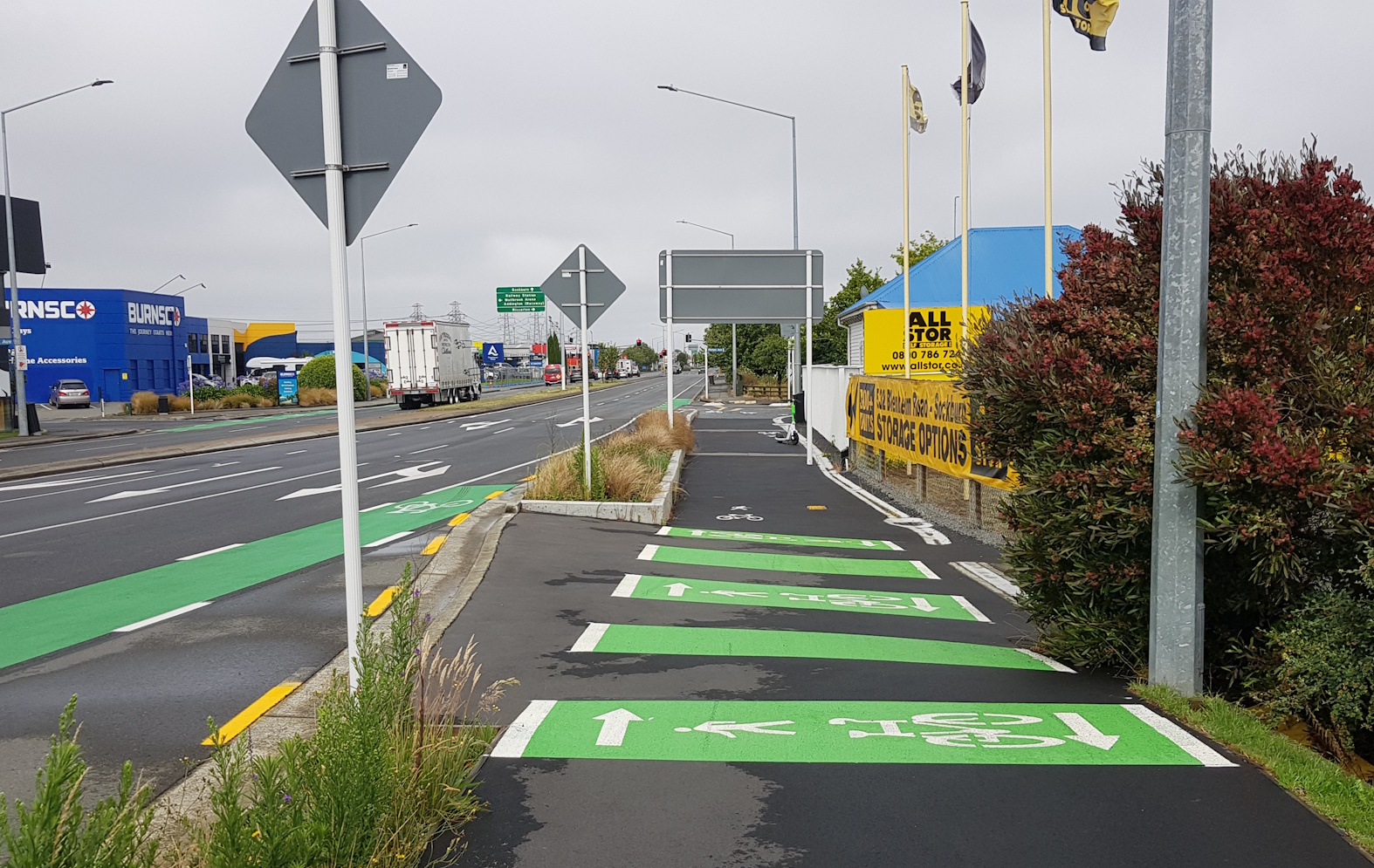
Not a great start; let’s hope we see some improvements on both fronts in the future. Now things start to improve as the route then runs briefly along Blenheim Rd before ducking around to Picton Ave.
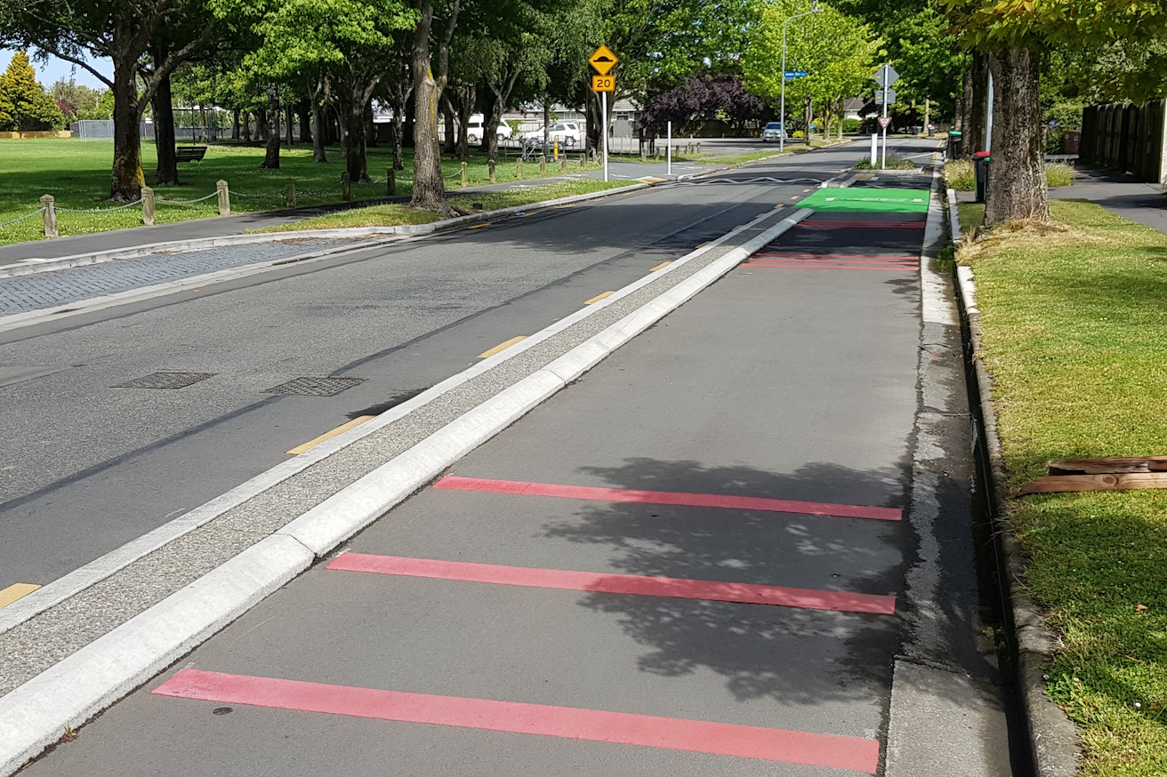
There is a nice cycleway separated from the footpath, and it also features a raised crossing as it heads into Elizabeth St.
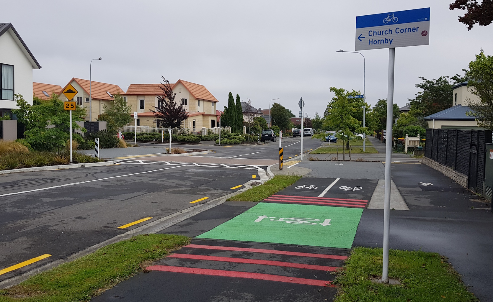
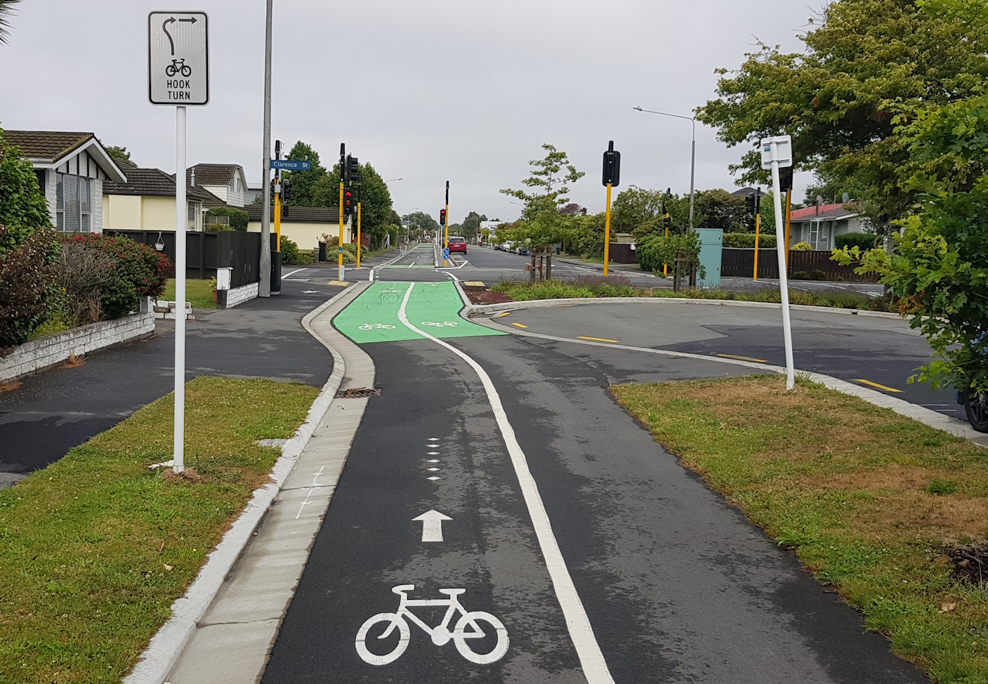
Elizabeth has been turned into a cul de sac here but cycles can carry on through. Crossing busy Clarence St requires a signalised crossing, which is actually pretty responsive as you trigger the approach detector diamonds.
The separated cycleway continues along Elizabeth St; the street was already pretty wide, so on-street parking isn’t even affected. Coming to (the aptly named) Division St, the previous four-leg intersection is now cut in two by a diagonal diverter, as the cycleway switches from the south side to the north side of the street – a handy point to head towards Westfield Mall here too…

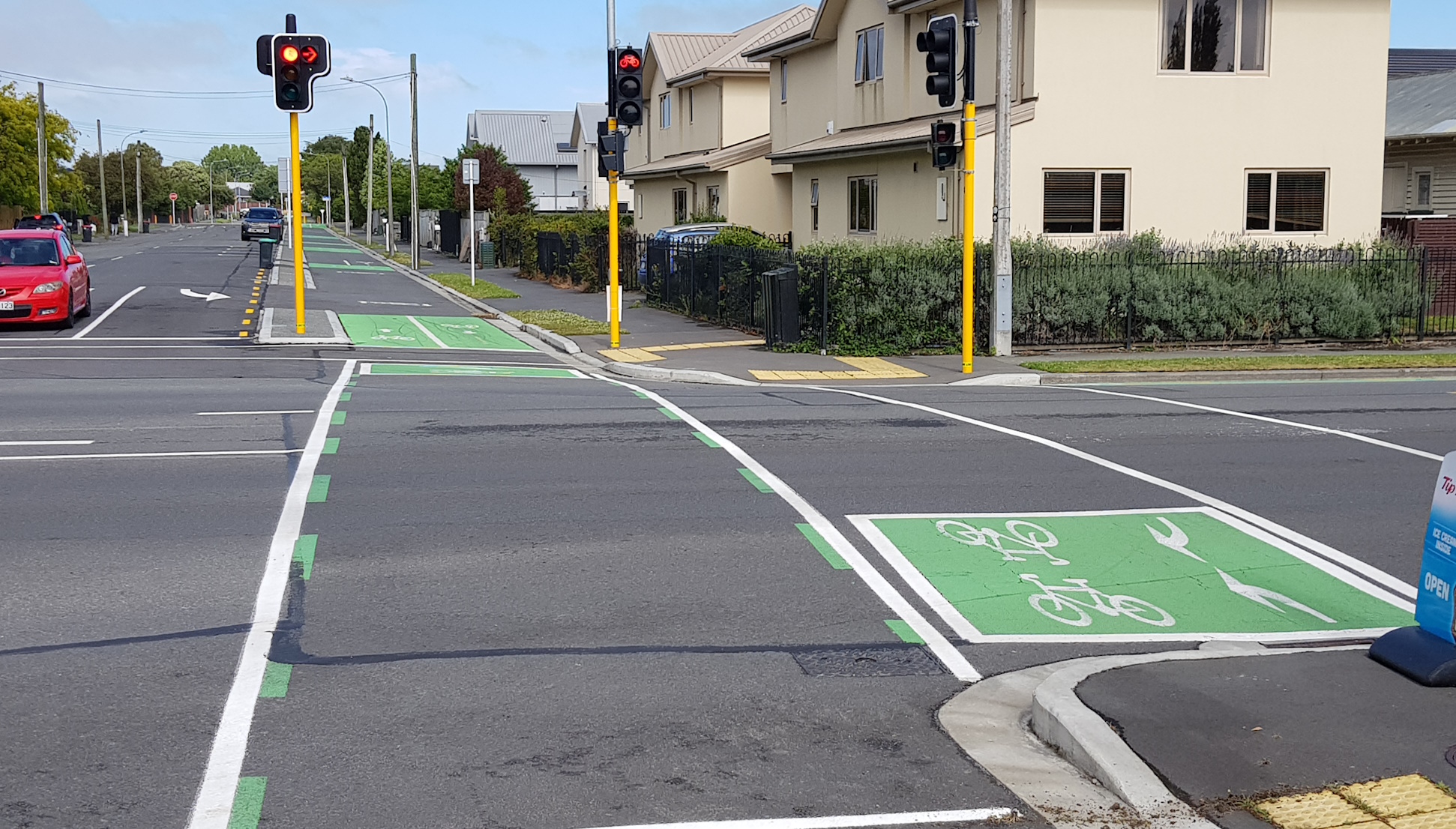
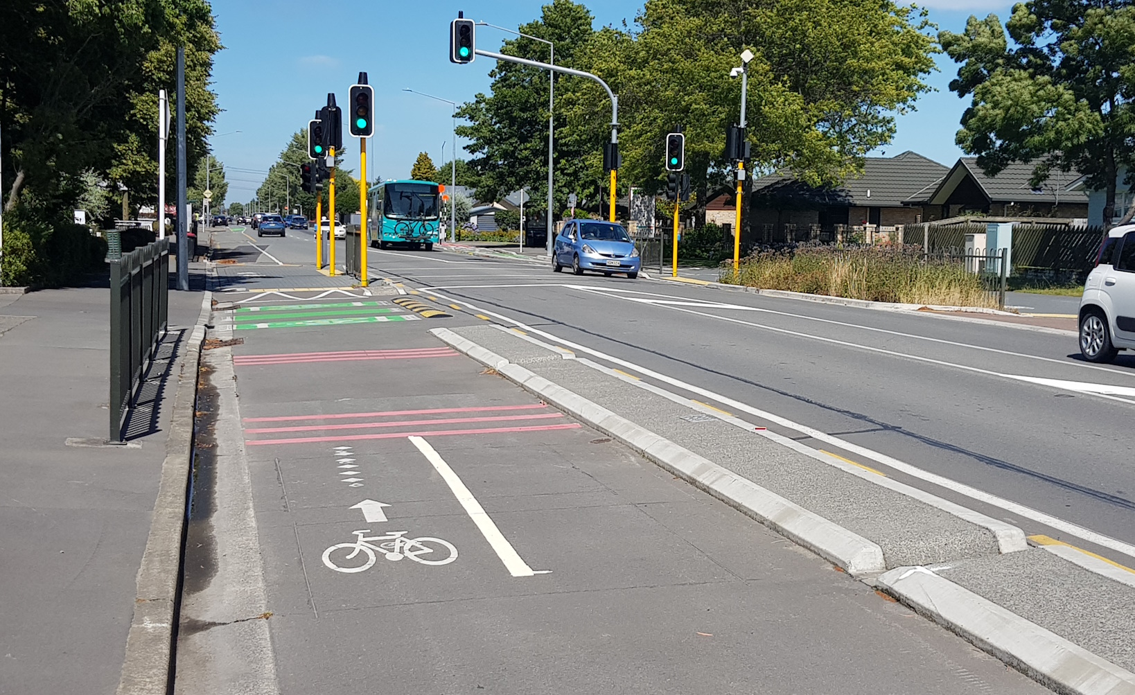
At Matipo St, another set of signals help to get you across this busy road; again the responsiveness of the signals is pretty good.
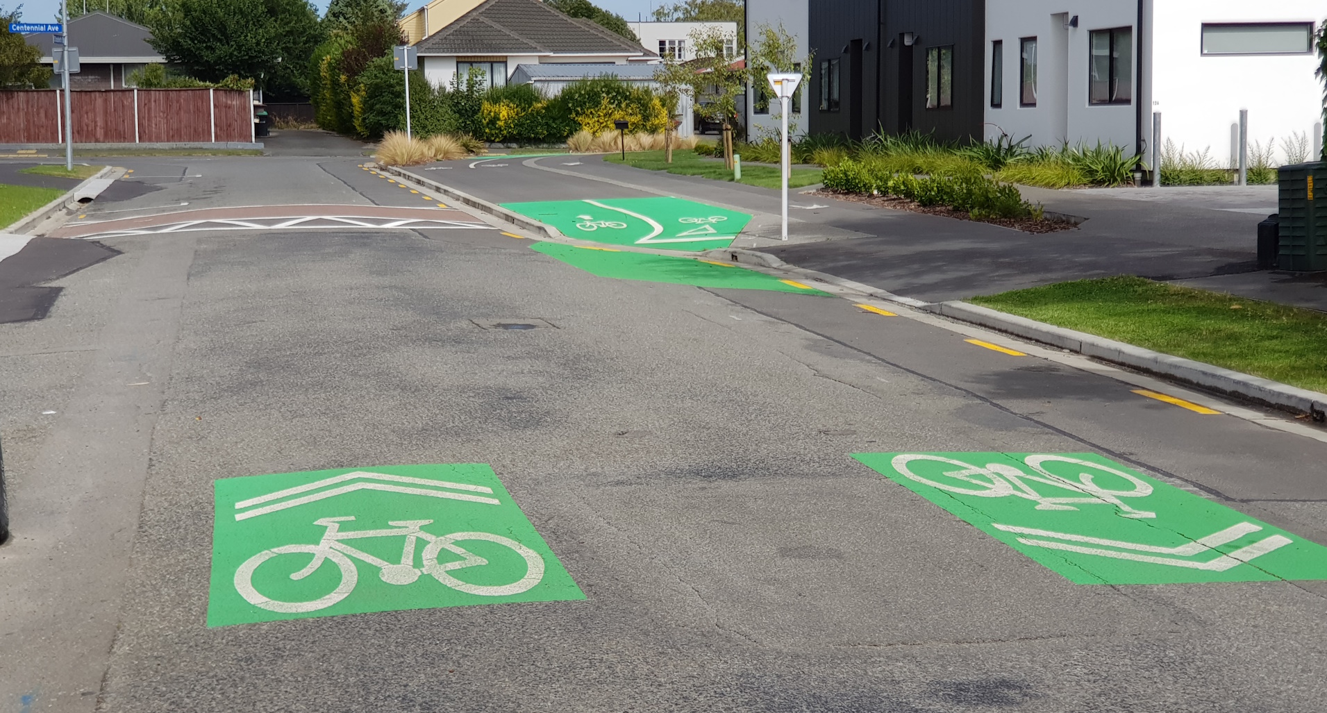
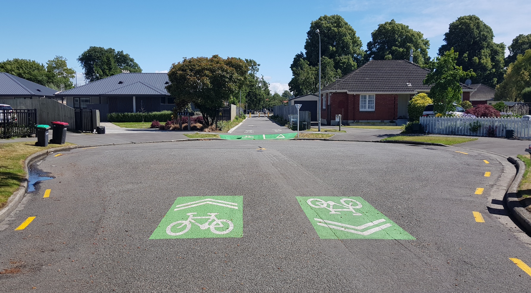
When the separated cycleway crosses over Wainui St (via another raised crossing) it briefly switches to a short neighbourhood greenway in the subsequent cul de sac. But then it pops back off-road as it heads around the corner on Centennial Ave.
The cycleway then crosses over at Harrington Park and runs along the northern side of Peverel St before reaching another set of traffic lights at Wharenui Rd.

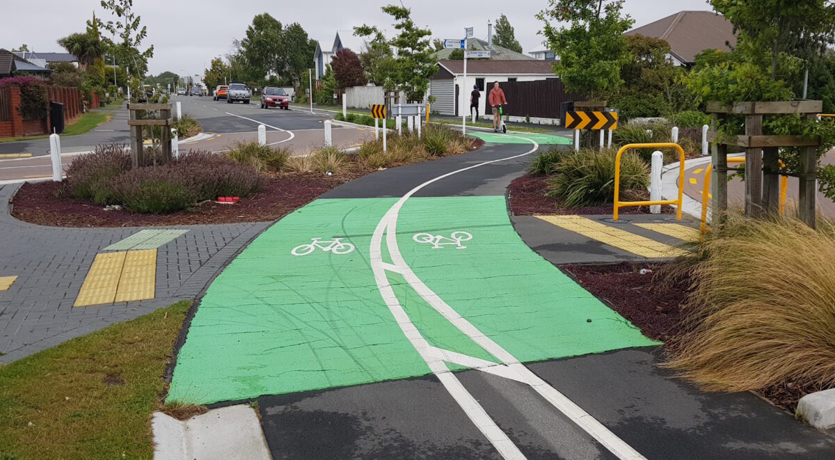
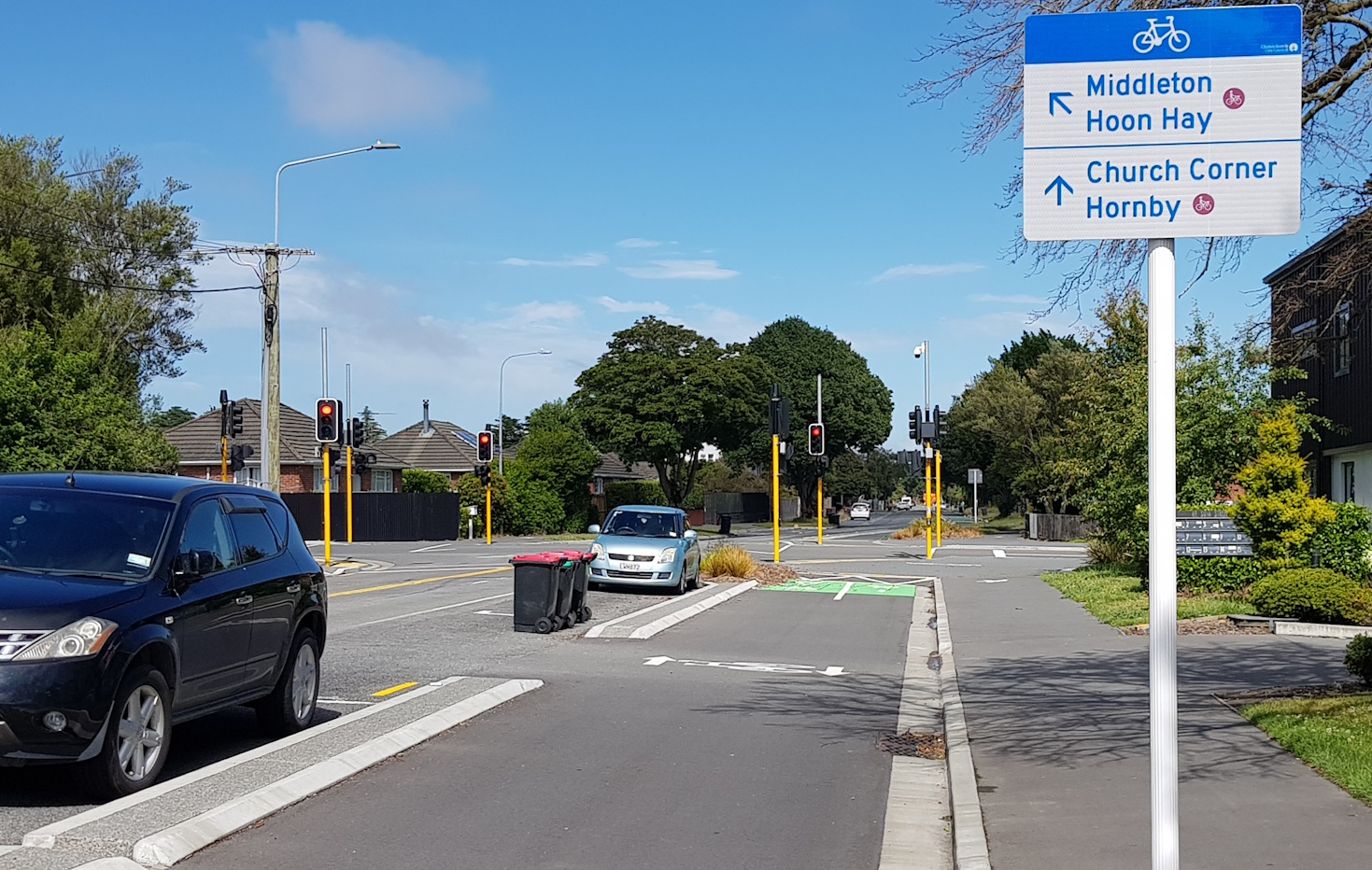
There is a short little dogleg around the corner to Lochee Rd where the separated cycleway then jumps over to run through Middleton Park on a shared pathway.
At Middleton Rd, the cycleway crosses over another set of signals and joins the Nor’West Arc coming in from the north toward university. Along Suva St the separated cycleway is actually part of both cycle routes.
Approaching Hansons Lane, we come across an interesting pedestrian & cycle “Barnes Dance” crossing (actually part of a formal trial), which allows people to head in any direction across this four-leg intersection. Given the number of school kids using this route to access the two nearby high schools, that seems to make a lot of sense.
It is here that the Nor’West Arc heads south towards Middleton and Cashmere while the South Express continues along Suva St. It then veers into quiet Ballantyne Ave where it becomes another short neighbourhood greenway, leading to an accessway that connects to Main South Rd.
The cycleway now follows the south side of Main South Rd, with another signalised crossing at Curletts Rd.
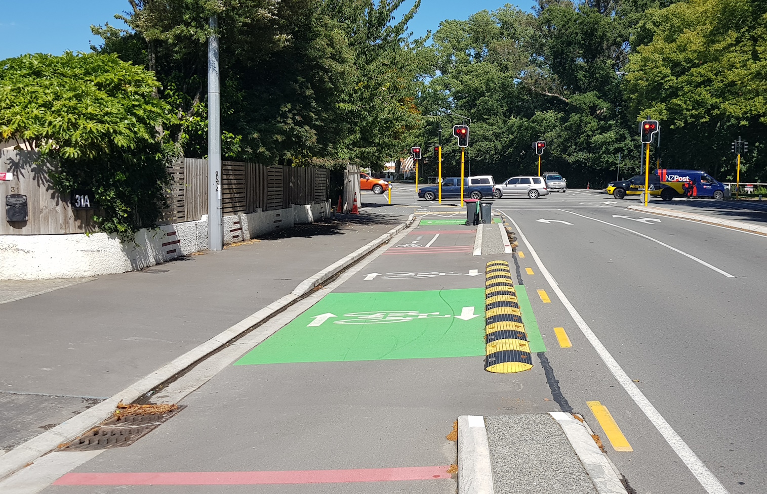
Various bus stops and zebra crossings punctuate the route along Main South Rd, and it also provides a convenient connection to the Upper Riccarton Library.
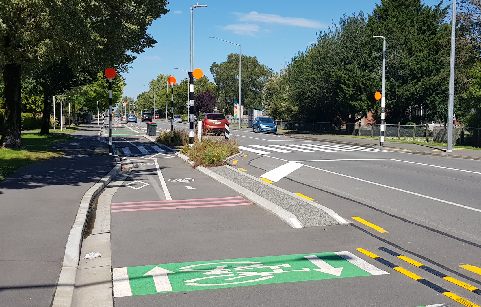
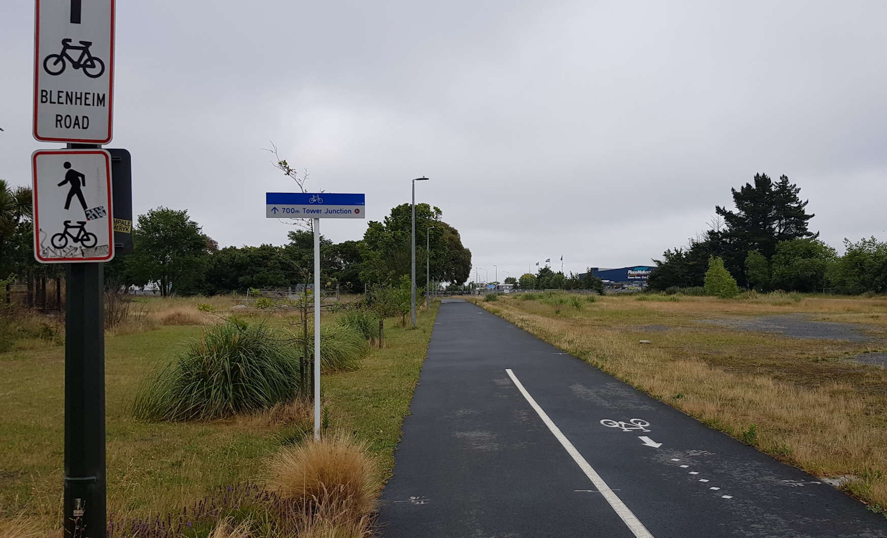
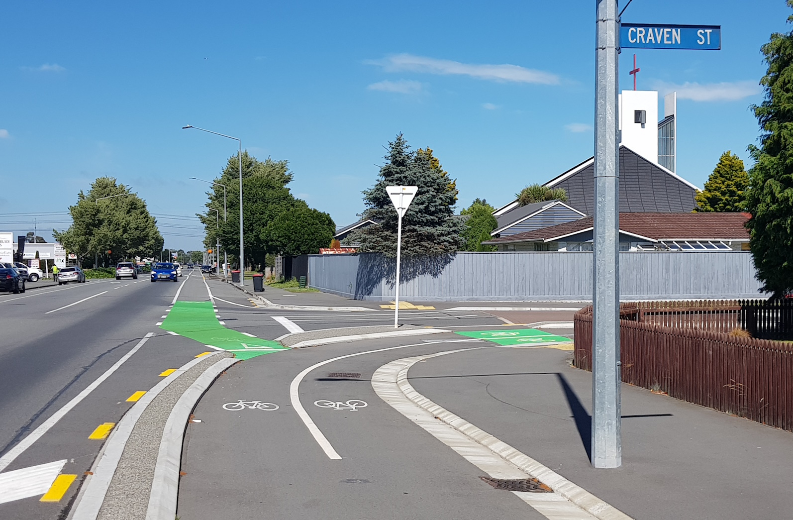
Just past the library, another signalised crossing sees the South Express jump from the south side to the north side of the road. It then veers around the corner into Craven St – but that’s a story for next time…
All up, the South Express is looking like a great connecting route for many different destinations in western Christchurch. The cycleways are mostly pretty generous in size, and the crossing points generally operate well.
Have you ridden the South Express? What did you think?
We live along the cycleway and love it. It helps everyone in our family to commute and access downtown. Our one big quibble is at Matipo street. Lots of families use this to get to the nearby school, but there is no button to activate the signal to the school, and the sidewalk on matipo gets crowded.
We have ridden in from Rolleston on it. (On road to Hornby at the moment!) We found the section from Upper Riccarton a bit difficult to negotiate in places, especially if missed signs, compared to the more recently build sections. There seemed to be a lot of crossings and turns leaving you with the feeling it isn’t the most direct way to go. However that said I can’t wait for it to be completed to Templeton where it will connect with the Selwyn Council built Jones Rd section through to Rolleston. With all its twists and turns it is still way better than the alternate on road routes!
The twists and turns keep it interesting, don’t they? The very straight Selwyn Council built Jones Rd section through to Rolleston (including Manion Road) can be soul destroying to do everyday.
The Mandeville section of the cycleway is very frustrating I find, always waiting for ages for no reason (though the past two times I’ve gone through there I wasn’t waiting for very long so maybe something has changed!!! Also the lack of space and cycle activators on the west side is so annoying.
Other than that and some signage that needs to be more strategically placed this is a fantastic cycle connection
We use this route a lot – and it is safe enough that my son heads to his Ortho appointments on his own even at the busiest time of day. This is the reason we need cycleways – to enable kids to regain independent mobility.
360 degree videos from Southern Express – like streetview but you can look around more.
Renfrew to Matipo: https://www.youtube.com/watch?v=jggXDzAMzjc
Taggert to Renfrew: https://www.youtube.com/watch?v=fOwj6yrwnR8
Transmission Corridor: https://www.youtube.com/watch?v=4O6AlDQpYFU
Reverse: https://www.youtube.com/watch?v=UmXuB8wpixs
Wow these are amazing, thanks for posting.
This is a great route to ride to my kids softball matches at Hagley park from home in Rolleston.
I especially like the new part that connects Hei Hei cycleway to the path that runs south of the Riccarton Racecourse connecting through to Middlepark Road now.