

I’m really pleased to welcome a new writer to our fold: Angela Cassidy! Angela is a particular fan of recreational riding, so look out for more posts about some of her travels – here’s the first one…
One of the roads I cycle most often is the shared pathway that runs alongside the Christchurch Northern Corridor. The path starts on the edge of the city at Cranford Street and was built at the same time as the motorway extension to speed up traffic heading out of city.
It’s been open since December 2020 and has become my ‘go-to’ for an easy fast-paced ride or to connect to other rides in northern Christchurch and North Canterbury.
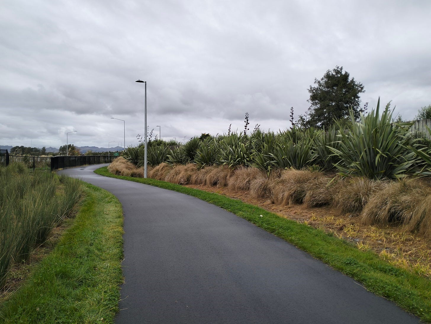
One of things I love about this pathway is that it is smooth tarseal all the way. Post-earthquake, it’s rare to find a section of road that hasn’t been patched up (multiple times) and isn’t sporting a fine selection of potholes along with a scattering of gravel, broken glass and other debris.
The Northern Corridor pathway, on the other hand, is 12 kilometres of largely uninterrupted and blemish-free paving. There’s a couple of road crossings, but you barely have to pause for those. And there’s (usually) no debris.
Being a long, smooth and wide pathway, it attracts a range of cyclists. The road cyclists love it for obvious reasons. It’s ideal for a good fast-paced ride.
Part of the pathway skirts behind Redwood and Belfast so it’s well used during the week by commuters and school children. It’s also popular with older people going for a midweek ride – alone, in pairs, or in groups. And in the weekends, it attracts families with children on bikes, as well as dog walkers, runners, and an increasing number of people who are new to cycling, often on e-bikes.
It’s not the most scenic ride around Christchurch (the hills or the river are better for that). But there are some points of interest along the way. It passes by several green spaces, including Owen Mitchell Park, the Styx River Conservation Reserve (at Redwood Springs), Belfast Cemetery and Otukaikino wetland. There’s the enormous Neil Dawson sculpture, Fanfare, which consists of lots of little windmills and is lit up in different colours at night. And if you’re out late (or up early), you can check out the rainbow lighting that moves across each of the three motorway overbridges.

The pathway is mostly flat, with a short climb up an overpass crossing the railway line. Heading out of the city, there are views from here to the Southern Alps (on the west) and to Mount Grey (looking ahead) in North Canterbury. Going back the other way, there are views of the Port Hills.
There’s lots of native planting alongside the pathway, including some very healthy toetoe and flax. (There’s also plenty of weeds and I often see a grounds crew out during the week with their sprays and weedeaters.)
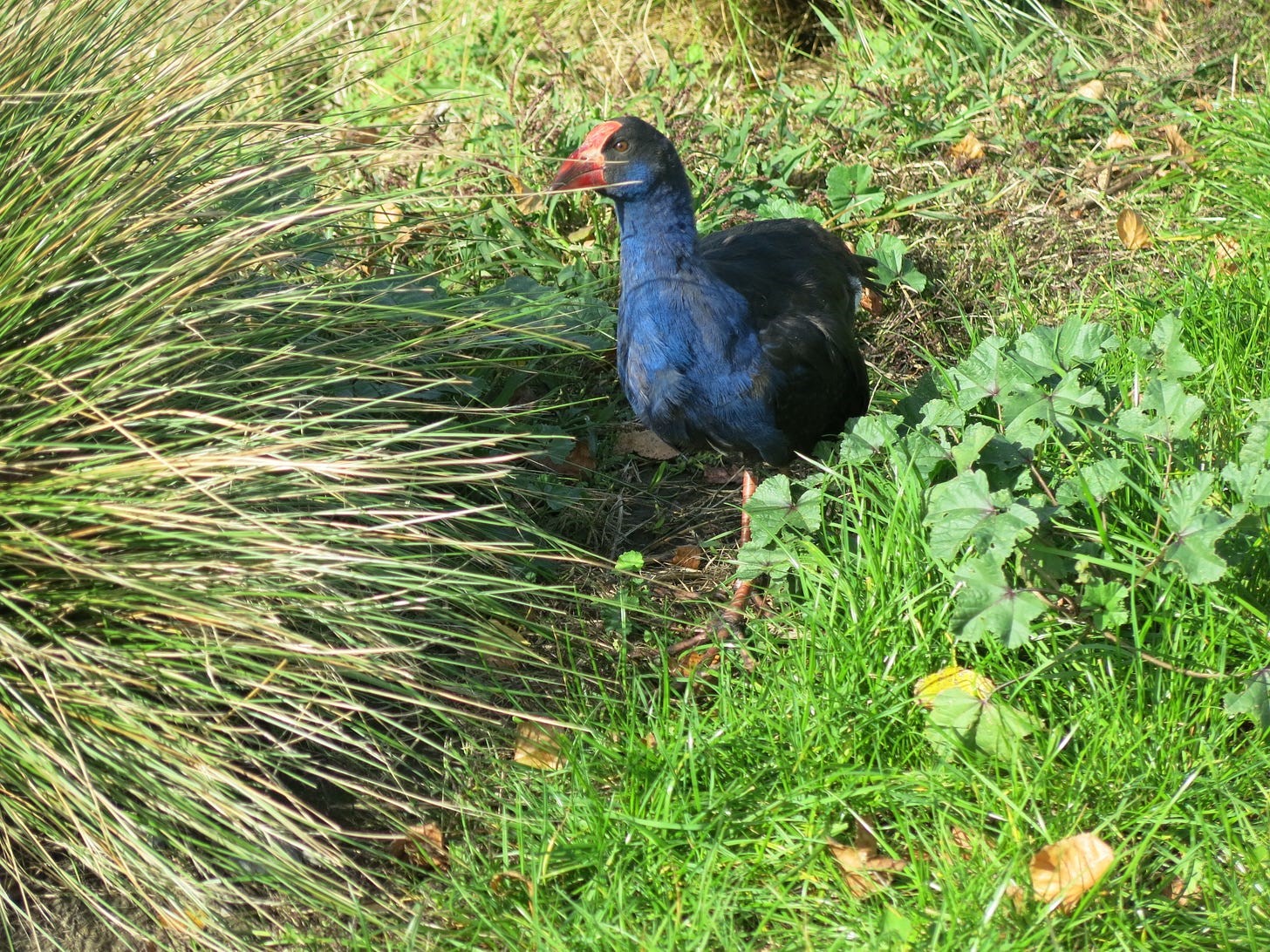
Pūkeko have made their home along the pathway, and I’ve noticed lots of new chicks this year. The adult pūkeko are very protective of their young and will hiss and call as you cycle by.
There’s a couple of sections of the pathway that flood after heavy rain. The pathway drops underway the motorway at one point, which happens to be right next to a stream. But it’s not too deep and if you take it slowly, you can usually get away without wet feet.
The other flood-prone section is just over the Chaneys off-ramp. Every winter, cyclists create a big muddy mess by riding over the nearby grass. But, again, the ponding is not that deep and riding through slowly is the easier (and less slippery) option. I recently noticed some contractors working on this section, so I’m hoping that was something to do with improving drainage.
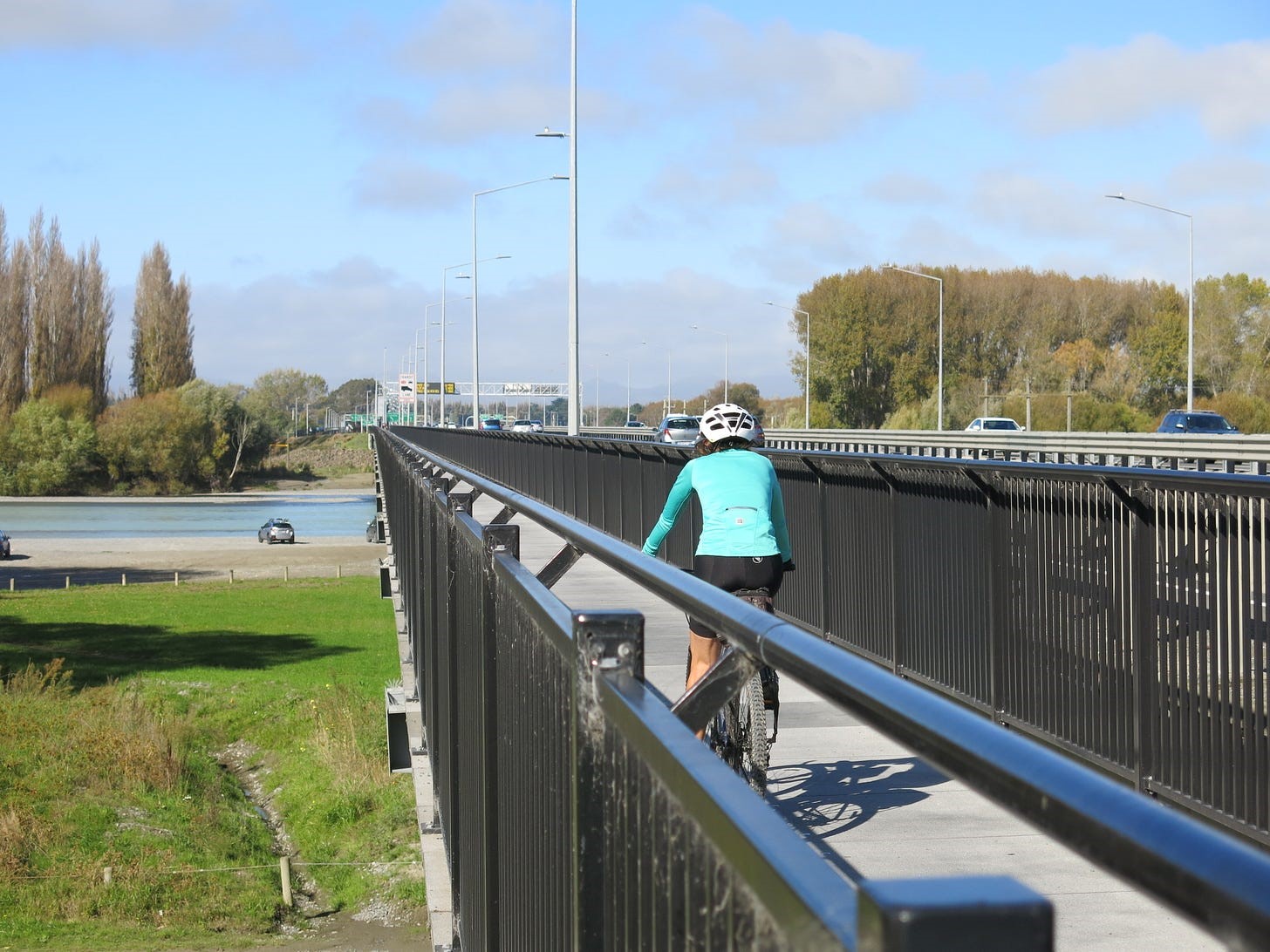
The best bit about the pathway is that it continues past the point where the Northern Corridor joins the existing motorway. When the motorway extension was built, Waka Kotahi helpfully added a cycle bridge to the Waimakariri River bridge and continued the pathway all the way to Tram Road, where it connects to a new cycleway through to Kaiapoi. There are also connections from the pathway to recreational tracks along both sides of the Waimakariri River.
The pathway is super-convenient for me. I happen to live close to the Papanui Parallel cycleway, so I only have to cycle a few hundred metres on-road before I join up to the Northern Corridor pathway. From here, I can cycle out to Kaiapoi to visit family, who happen to live close to the cycleway at the other end. Or, if I want a longer ride, I can carry on and connect to the Passchendaele Memorial Path through to Rangiora.
Alternatively, from Kaiapoi, I can follow the riverbank around to Pines Beach and head north along the coastal track to Pegasus and Waikuku Beach. From there, I can follow the Ashley River (on off-road tracks) all the way to Rangiora and then loop back to Kaiapoi and Christchurch. That’s a good weekend ride, with a mix of gravel, tarseal and mountain bike track.
I also use the Northern Corridor pathway to get to the shopping centre at Northwood, or to loop back home if I’ve been to the mountain bike track at McLeans Island and am returning along the Waimakariri River. And I cycle a short section of the pathway to connect with the pathway along QEII Drive if I’m going for a ride to or from the beach or Bottle Lake Forest in eastern Christchurch.
It’s a very handy pathway. Thanks Waka Kotahi.
Getting there:
- If you’re cycling from the central city, take the Papanui Parallel cycleway and cut through Rutland Reserve when you get to Paparoa Street School.
- If you live in north Christchurch, you can access the pathway from Rutland Reserve, Cranford Street, Winters Road, QEII Drive, Prestons Road, Radcliffe Road, Belfast Road and Factory Road.
- If you’re driving, you can park in Cranford Street near Placemakers or park near one of the other access points. There’s also a small carpark by the Fanfare sculpture on Main North Road if you want to start further along the pathway.
Awesome write-up Angela!
The path along the Northern Motorway and into the back of Kaiapoi it a real gem!
Thanks for the comprehensive and welcome promotion of the CNC Shared Path. The path is such an asset.
I live on the Papanui Parallel and regularly use the CNC path for exercise and as a feeder to explore the countryside north.
The recent path works at Chaneys was indeed to fix the flooding problem. Regarding flooding of the path/creek underpass: if necessary, it can be bypassed by riding over the Belfast overpass and then following Guthries and Fords roads.
Along the CNC path there are toilets at the Belfast Cemetery, the Otukaikino Wetland and south side of the Waimakariri bridge. Handy to know if needed!
Over the last thirty days the average daily cycle count is about 225. From memory the number is over 300 during warmer months.
Night riding along the path is fun!
There are the storyboards to read along the way to help understand the history and features of the area you’re riding through.
https://biketoberchch.nz/event/styx-river-puharakekenui-northern-motorway-path-tour-2021/
For a while I was living in Rangiora and coming into town using the CNC shared path. I have to admit it took me a while to find the whole cycleway route – my first trip was Lineside Rd, main St though Kaiapoi, the old Waimakariri bridge, Chaneys, and Main North Rd (retracing the route I used many many years ago). After that the full cycleway route is a dream.
It beggars belief that a similar pathway was not constructed along the southern motorway extension between Halswell /Prebbleton and Rolleston.