
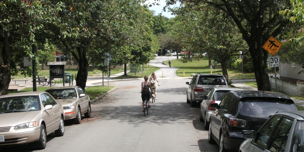
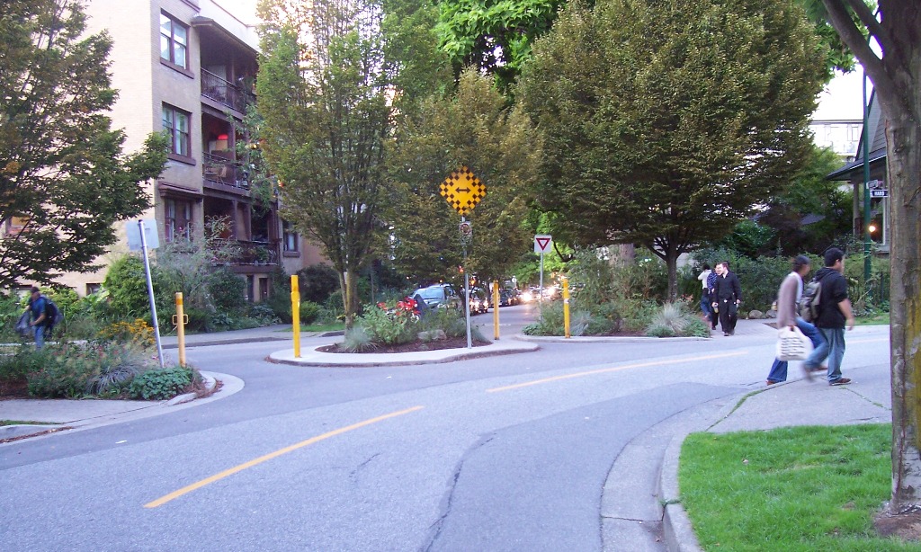
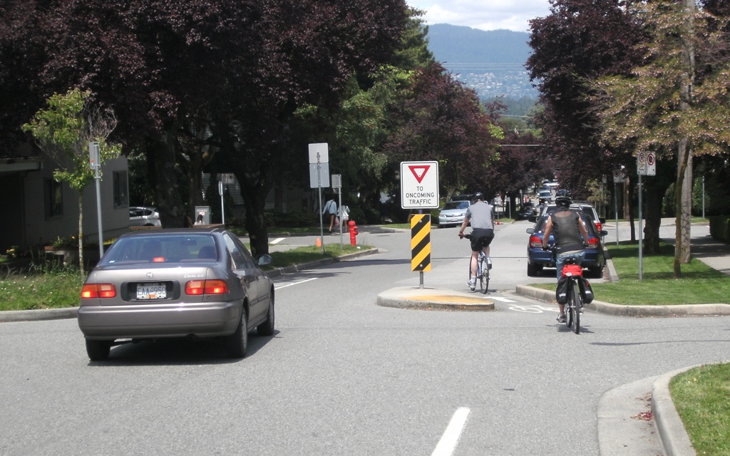
Some of the best cycle routes I encountered in Vancouver had virtually no cycle facilities on them… The City of Vancouver (pop.600,000 within the 2.2million Greater Metro area) has about 450km of bike routes. While some of that is conventional bike lanes, pathways, and the new separated bikeways, the backbone of the network is about 250km of “local street bikeways”. These are mostly on-street routes that focus on reducing motor traffic volumes/speeds and providing assistance across busy roads, to make for a more pleasant cycling experience (and there were lots of people out there cycling).

In other cities, these have been known as “bike boulevards”, “quiet streets”, and “neighbourhood greenways”. I like the last term particularly, as it highlights a number of key features:
- They provide advantages for people cycling and walking in their neighbourhood
- They provide access for locals to a range of neighbourhood facilities, e.g. shops, schools, parks
- They often incorporate “green” aspects to the route, e.g. plantings, swales, raingardens
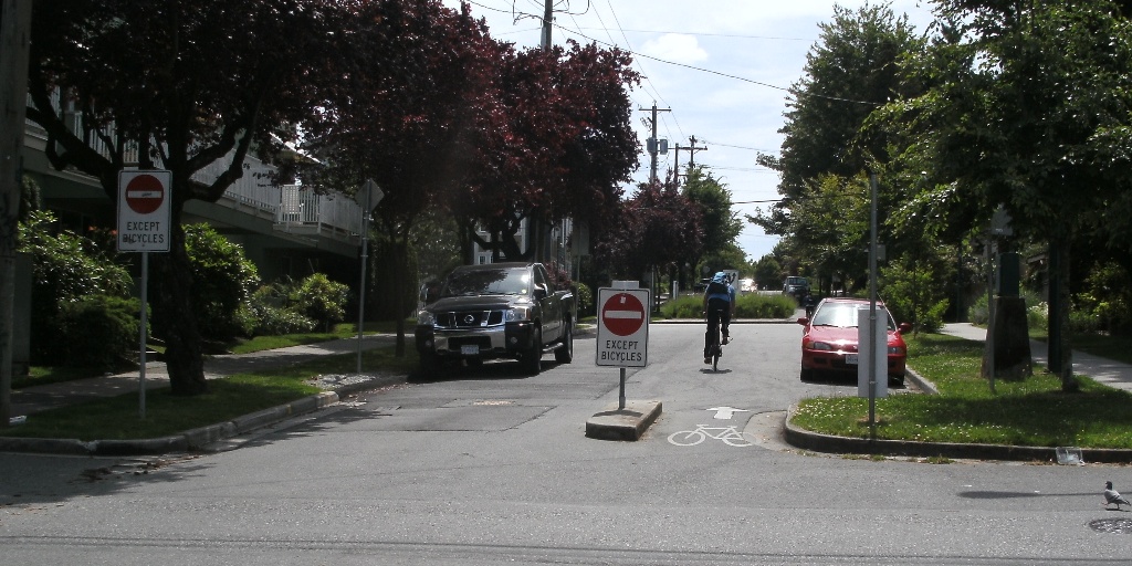
Bikes (and peds) only through here…
Neighbourhood greenways use a number of different tools to help create friendly and intuitive routes:
- Comprehensive signage to make people aware of the route and its destinations
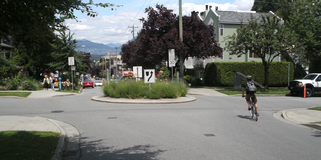
- Intersection controls that slow/divert motor traffic, e.g. mini-roundabouts, one-way entrances
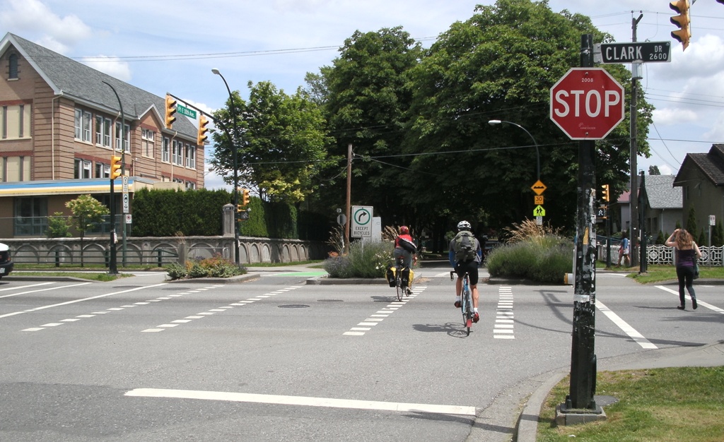
- Facilities to assist crossing busy roads, e.g. central islands, traffic signals
- Lower speed limits along the route (e.g. 30-40km/h)
- Mid-block devices to slow down or restrict traffic, e.g. humps, islands
- Where necessary, short lengths of pathway or cycle track to help “join the dots”
Because they are relatively low-key treatments, neighbourhood greenways generally cost a lot less than conventional cycleways. At the same time, they also tend to benefit pedestrians and motorists as well because of the speed-related safety benefits.
Neighbourhood greenways work particularly well in grid networks, where there are alternative parallel routes for motorists; this is probably why they have succeeded quite well in North America. Some good examples can also be seen in Seattle and Portland. Christchurch’s grid layout in much of the city therefore makes it a good option here too; it’s not hard to think of suitable routes.
We used these in Vancouver and they are fantastic! Would love to see them in all NZ cities, especially Christchurch and Nelson – our new biking town…