
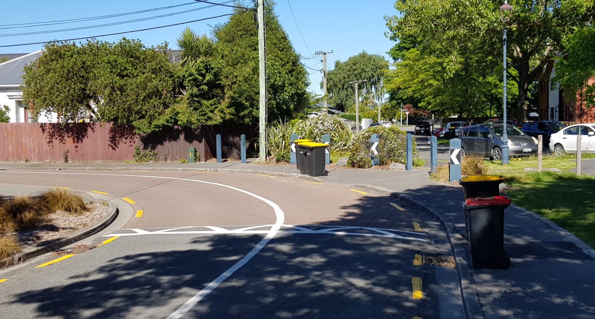
Having settled into my new house, I’m starting to check out the local neighbourhood to see what handy routes there are to get around on my bike. Not far away from me on Hastings St, there is a very useful cycle connection if I’m trying to head east-west across the suburb:
At this point, Hastings St is split into two, with only pedestrians and cyclists able to get between the two legs via a path connection. In technical terms, this is called a “modal filter” and is a very useful to provide some network advantage to active travel modes over motorists.
This link is an older one connecting two sections of quiet street, but we’re also starting to see similar modal filter bypasses along some of the new Major Cycle Routes, including the Heathcote Express, Rapanui-Shag Rock, and South Express cycleways. In the Netherlands this is an important tool in developing good cycle networks of quiet streets – they’re not quiet streets if motor traffic can still drive along them…
Have you come across modal filters in your cycling journeys? Where?
Yes, there’s a good one I use that connects/crosses Bamford Street and Barton Street in Woolston. A quick and safe short cut to the Tannery from Ferrymead. I have no idea how to get the link on here, sorry!
This is part of a very pleasant quiet route from Ferrymead Bridge along the banks of the Heathcote to the junction of SH74 and Ferry Rd. Depending on the tides it’s either under the bridge (can be slippery) or round the Ferry Rd roundabout. Both routes converge at Gould Crescent / Heathcote River and cycle/pedx bridge over the Heathcote River that leads onto Bamford St and the Tannery.
Try the following links:
https://www.google.com/maps/place/Christchurch/@-43.5546163,172.687577,592m/data=!3m1!1e3!4m5!3m4!1s0x6d322f4863c5ed01:0x500ef8684799945!8m2!3d-43.5320214!4d172.6305589
https://www.google.com/maps/place/Gould+Crescent,+Woolston,+Christchurch+8023/@-43.5539425,172.6879508,838m/data=!3m2!1e3!4b1!4m5!3m4!1s0x6d3189d4f521b4e3:0x46a8c5aa42a56a99!8m2!3d-43.5539453!4d172.6894984
PS Biking on the other side of the river is also quiet – but the bridge under the motorway is VERY LOW!! Walking advised. The end points are:
– Cumnor Terrace by the Tannery
– Ferrymead Heritage Park and Bridle Path Rd