
Last week, the Christchurch City Council finalised and adopted their Annual Plan for the 2025/26 year. This is the annual review of where Council will get their income from (e.g. rates, fees, Govt subsidies, etc) and what they will spend it on across the city. Inevitably this covers a wide range of different types of projects and activities, and cycling facilities are within that mix as well.
With the current Government being rather hostile to ongoing cycleway funding (and several City Councillors not very amenable either…), it can be a challenge to get many gains in that area. But there have been a few wins agreed to in the 25/26 Plan.
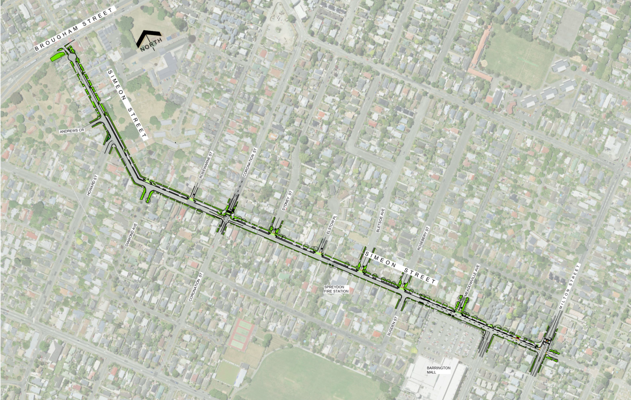
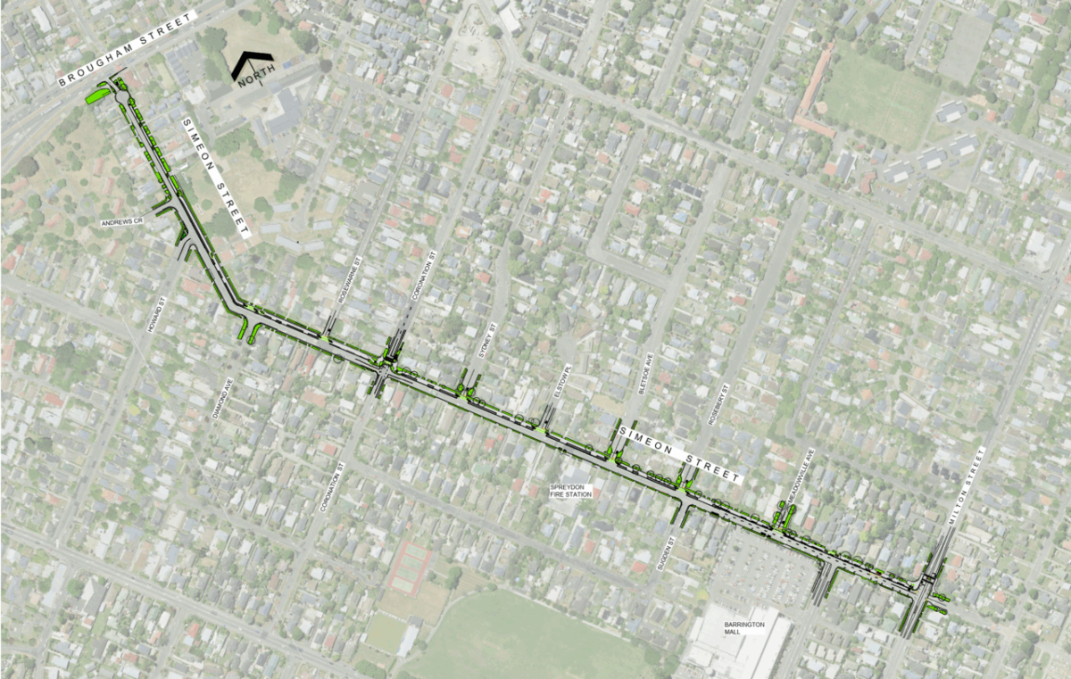
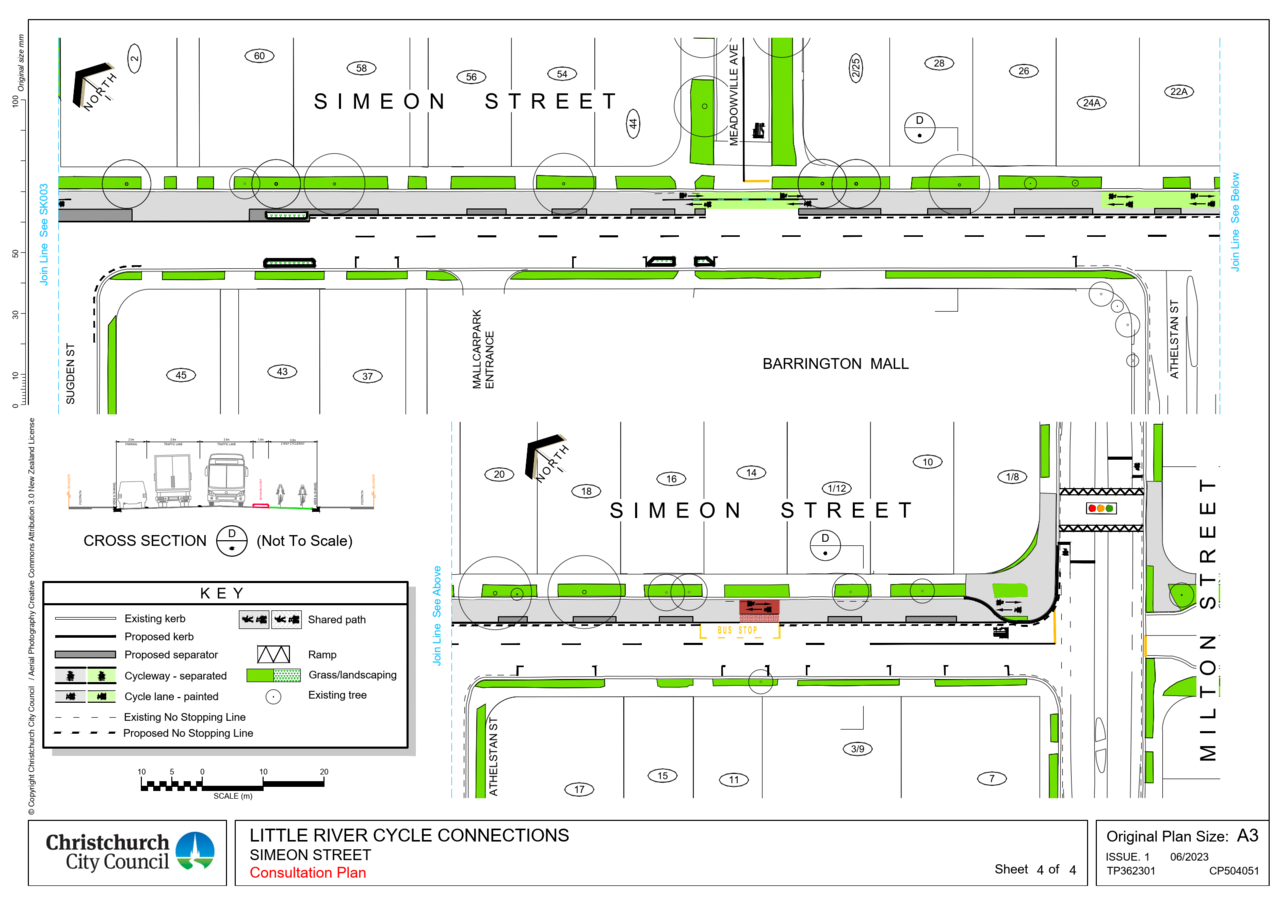
First up is the go-ahead of the (ironically named…) Simeon St cycleway. This is a local cycleway connection in Spreydon that will connect the current Little River Link and Quarrymans Trail Major Cycle Routes, as well as facilities in between such as Barrington Mall and nearby schools, parks, and residents.
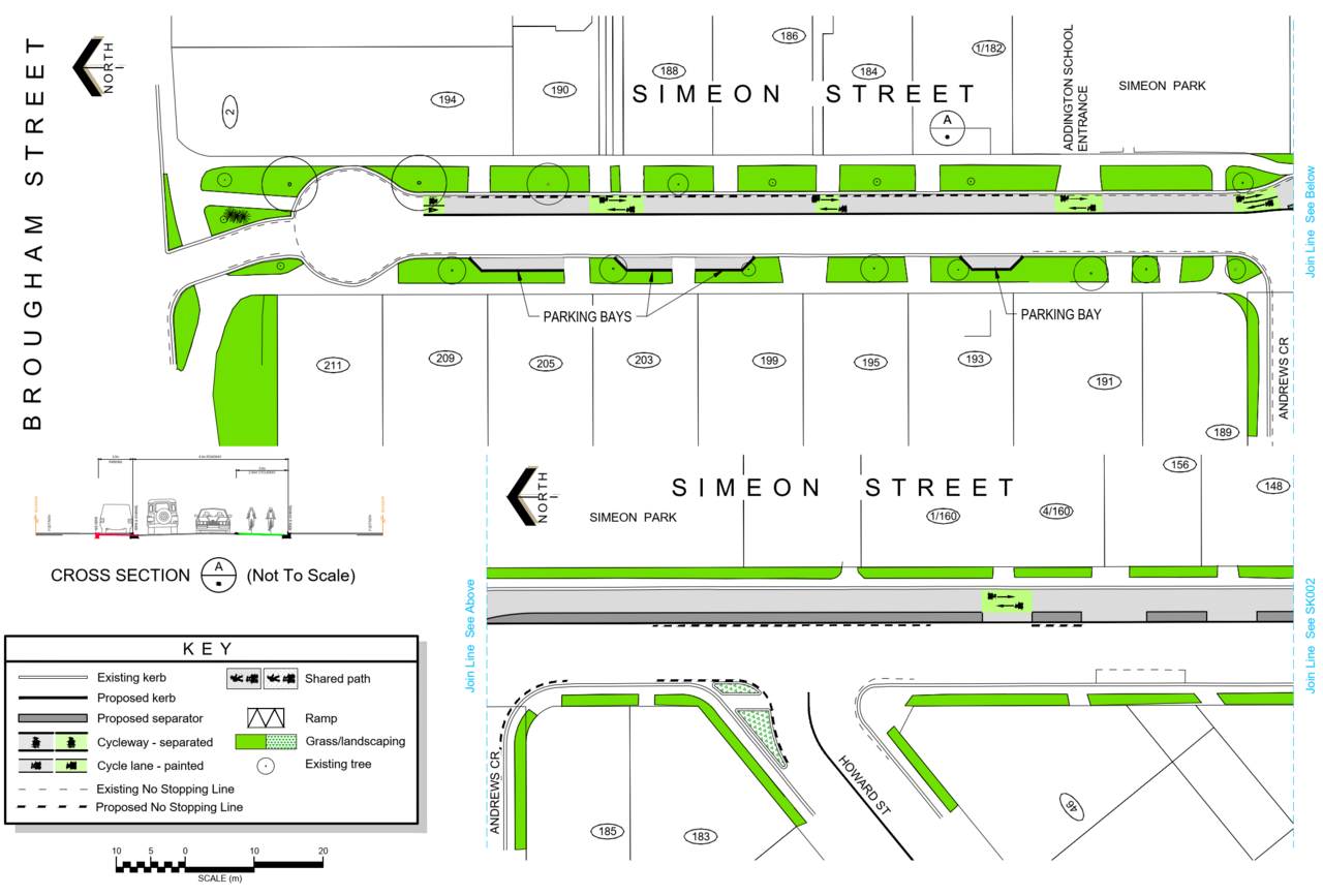
The route will largely be a separated cycleway with a priority crossing at Coronation St and a signalised crossing over Milton St. Construction is planned to start in the coming year.
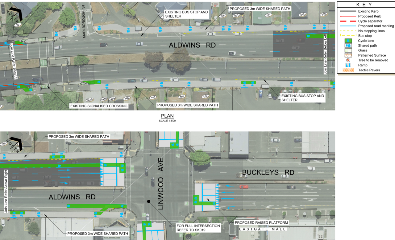
Across town in Linwood, the Te Aratai College Cycle Connection will also get underway this year. Again, this will provide a local cycle link between two Major Cycle Routes; the Rapanui-Shag Rock and Heathcote Express.
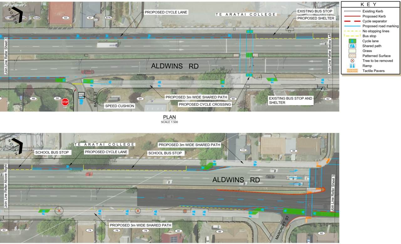
Using a combination of shared paths and protected cycleways, the route will run along Ensors and Aldwins Rds providing safe connections to Te Aratai College, Eastgate shops, and Linwood Park.
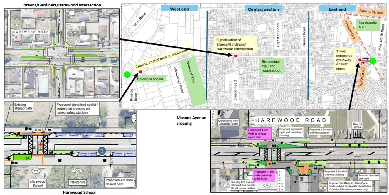
Meanwhile, in the northwest, we’ve all grown weary of the interminable saga that the Wheels to Wings cycleway has become, but there are at least a few wins out of the Annual Plan. The Breens/Gardiners intersection with Harewood Rd is set to be signalised, some minor crossing improvements near Harewood School will be installed, and we will at least get a tiny part of the Wheels to Wings route connecting the top end of the Nor’West Arc with the Northern Line cycleway. Sigh, I guess we’ll take it for now…
Overall, it’s a few further welcome gains to slowly build up a growing cycling network around Christchurch.
What do you think of the agreed 2025/26 Annual Plan?
Great to see some progress coming, despite the Government and certain Councillor headwinds. We’ll see more of a network effect when these links are completed, and it’s particularly excellent to see Te Aratai College getting that safe link. Ensors/Aldwins is so unsafe that I completely refuse to cycle there at the moment. After all, one of the first things in safe cycling is choosing safe routes.
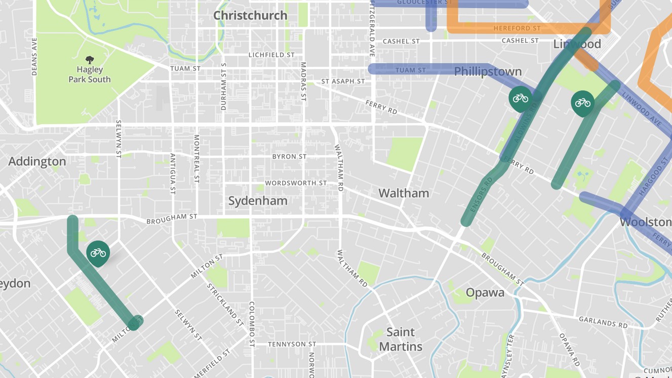
Where is the first image from please, and what do the blue and orange lines mean? Is that more on-road cycle lanes coming, while the teal/green denotes separated infrastructure?
Blue is bus route improvements (e.g. new shelters) and orange is pedestrian area improvements (e.g. new crossings and paths); there are a quite a few different projects under CCC’s Way Safer Streets programme. I switched off the icons for these to avoid distraction but it didn’t remove the underlying colours.
Interestingly the smith street cycleway that’s in the 1st image is already done. Its just traffic calming and sharrows for the most part but it’s a nice connection from ferry road and connects up two schools and a fair few shops to the rapanui shag rock cycleway (and the ancient 12 bike route). Seems that the plan for more secondary cycleways that connect to the main ones is already paying off.
Smith Street is an example of a win win for residents who don’t enjoy living on a street where traffic speeds can be excessive and for those who need to bike along there. It’s a big improvement. The small stuff is really important to get the best out of our recently built cycle infrastrucuture. Another example was in operation for the first time today, so a huge shout out to CCC and Kiwirail. Light controlled crossings for pedestrians and cyclists at Harewood Road, Langdons Road, and Sawyers Arms Road railway crossings are here.
Our Wednesday Wheelies Bike Group enjoyed a direct ride along the Northern Line Cycleway today from Kilmarnock Street to Northwood. Something not possible until now as the Harewood and Langdons Road crossings were not only inconvenient to traverse in a group but potentially unsafe. As if to celebrate the occasion the sensors kicked in lickety split and there was barely a stop at any of the three crossings. Joyful stuff.