

Most weeks, one of my rides will take me along the Ōtākaro Avon River to the sea. I think it’s one of the best recreational rides in Christchurch (the Summit Road probably being my favourite).
It’s a peaceful ride away from the traffic, and there’s lots of open space and great views of the estuary, hills and river. And it’s accessible to cyclists of all abilities. You can have a gentle ride meandering beside the river. Or, provided you’re watching out for dogs and pedestrians, you can go flying along the gravel stop banks, or what remains of the pre-earthquake sealed roads, and get a decent workout.
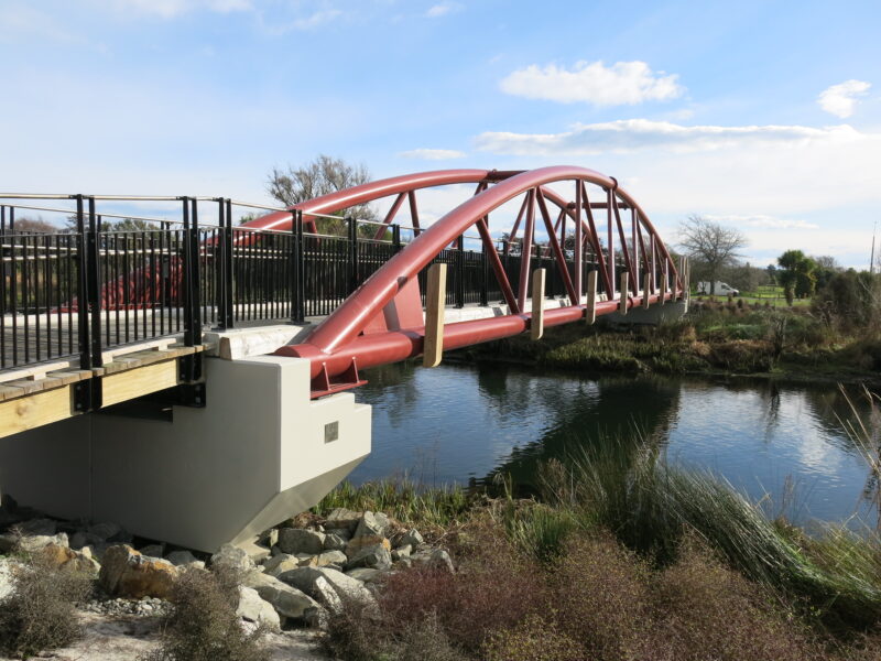
There are lots of options for how you do it. The addition of three new pedestrian/cycle bridges (plus existing road bridges) means you can ride as far as you feel like, and then head back on the other side of the river. Or you can cycle all the way to the sea, and then loop back to the city via a different route.
I usually take Te Ara Ōtākaro Avon River Trail, which is a transitional trail put in place to enable walking and cycling while the future of the river corridor is being determined. It officially starts on the corner of Barbadoes Street and Cambridge Terrace – but I start on the east side of Fitzgerald Avenue or Stanmore Road to avoid having to deal with busy road crossings.
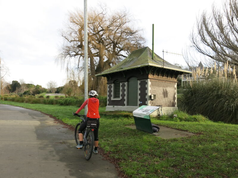
For much of the way, you can cycle on either side of the river, but there are some places where roads are still open on one side so you’ll be sharing with traffic. If starting at Barbadoes Street, I suggest setting off on the true right of the river (that is, the right side if you are looking in the direction the river flows to). This first section is well-sealed with healthy native plantings along the riverbanks. It’s also where you’ll spot the first of several old pumphouses.
When you get to Fitzgerald Avenue, you’ll need to cross at the lights, and then go over the bridge on the footpath to the true left of the river. Alternatively, you can cycle in the traffic alongside Avonside Drive and join the trail at Stanmore Road (crossing to the left side of the river) or further along just before Woodham Road (staying on the right side of the river). From here it gets a whole lot simpler because there are long stretches with no roads to cross, and the other road crossings are easier to negotiate.
When you get to Swanns Road, make sure you are on the true left of the river if you want to check out the Richmond Community Garden. The gardens were revived after the earthquakes and are full of garden beds, food forests and native plantings, and include a fungi farm and sustainability features.
From here, I prefer to cycle on the true right of the river, crossing either the Swanns Road bridge or the new Medway Street bridge. There’s a good gravel track along the top of the stopbank and the road is closed all the way to Gayhurst Road. Here, I cross back to the true left, where there’s a fantastic new picnic spot and public toilets.

It’s not long until the next pedestrian bridge and I cross over again and stay on the true right all the way through the rowing facility at Kerr’s Reach, over Avondale Road and on to the third new pedestrian bridge on Hulverstone Drive. The trail officially continues on the true right but I like to cross at this point and take the narrow dirt track along the river bank and under Anzac Drive. (Just beware that the underpass can flood after heavy rain or a king tide.)
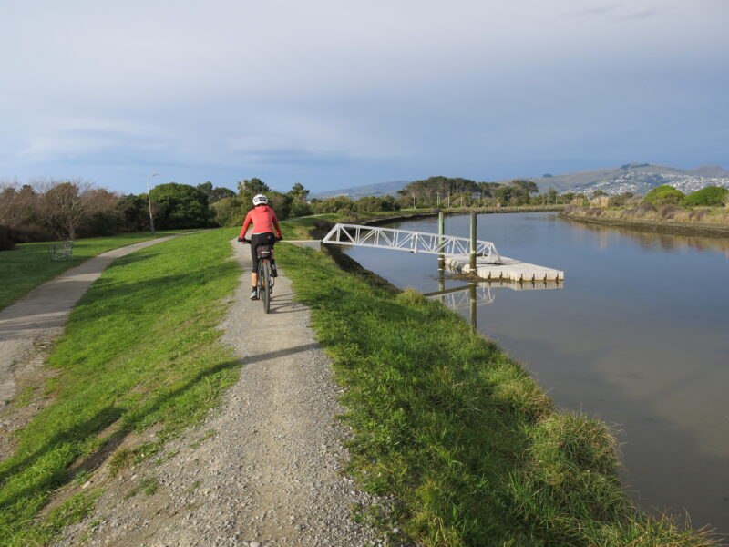
If you opt to stay on the true right, you can either take the underpass on that side (and bump along the riverbank) or follow the trail and cross Anzac Drive at lights further along at Wainoni Road. You can carry on along either side of the river all the way to Pages Road. I prefer the true left because the path is better formed here.
Pages Road marks the end of Te Ara Ōtākaro Avon River Trail so you have a choice:
- You can turn around and head back to the city.
- You can visit New Brighton and have a coffee, go to the library, check out the hot pools or walk on the beach. The playground is popular with families. (At the roundabout, either turn left and go down Hawke Street to get to Marine Parade by the hot pools, or take Seaview Road, which will take you through New Brighton Mall to Marine Parade by the library.)
- You can head north to one of the other beaches or through to Bottle Lake Forest. There’s a coffee cart at North Beach and a café and playground at Waimairi Beach. (Take Hawke Street and turn left at Marine Parade.)
- You can continue your ride along the river and around the estuary. (Go right at the roundabout along Owles Terrace.)
I usually take the last option and ride along the stopbank. It’s an easy gravel ride through to Bridge Street, where you’ll connect to the Estuary Edge Walk. This track is popular with dog walkers, and a bit windier in places, so you’ll need to take it slowly.
As the name suggests, the walkway runs along the edge of the estuary and takes you past a small pier and the Pleasant Point yacht club to the corner of Estuary Road and Ebbtide Street. The first section of the walkway is gravel and has been nicely landscaped with lots of native planting. Then it’s a mix of dirt and gravel track, with a boardwalk section for the final stretch around to Southshore. (There are toilets and a playground at South New Brighton Park.)

From here, you can continue along the dirt track around the Southshore part of the estuary. But I normally switch to cycling on the road at this stage and pop down Caspian Street to Marine Parade.
I like to do a big loop back home to north Christchurch, so I’ll cycle to Waimairi Beach and then take the Southern Pegasus Bay Track (a gravel path through the sand dunes) a short way before turning off toward Aston Drive and continuing along the gravel track on the southern edge of Bottle Lake Forest. From here, I can connect up to Prestons Road and make my way home via the Christchurch Northern Corridor. (I’ll pop down Walters Road and through the Hills Road underpass to QEII Drive, but you can go straight down Prestons Road and join the Christchurch Northern Corridor on the other side of the overpass.)
Some more extensions
If want to extend your ride, you have the option of cycling the mountain bike tracks at Bottle Lake Forest, or continuing along the Southern Pegasus Bay Track. This will take you to Spencer Park, where you can connect to Brooklands Lagoon Track and through to the Waimakariri River. The sand makes this pretty hard going by bike, so a better option is to take the roads instead (Heyders Road, then right into Lower Styx Road). Check out Robert Fleming’s post on this ride.
From there, you can take the Rauakaaka Trail back to the Christchurch Motorway, and then cycle back to the city via the Christchurch Northern Corridor and the Papanui Parallel Cycleway.
If you’re really keen, you can carry on along the Waimakariri River tracks all the way to McLeans Island for some more mountain biking. As Robert explains in another post, you can get back to the city (or the northern suburbs) via McLeans Island Road and Harewood Road, but these are best tackled on a quiet Sunday morning (when there are no trucks around) – preferably by starting your ride rather than finishing at this end.
Happy cycling!
For details of Te Rauakaaka Trail see https://www.alltrails.com/explore/trail/new-zealand/canterbury/te-rauakaaka-trail. It links the eastside of Brooklands Lagoon to the west side of SH1, and seems to join up with the yet-to-be-ridden-by-me Dickeys to Waimakariri Trail or you can hop back up to the bike path alongside the Christchurch Northern Corridor.
One of my favourite rides! Thanks for posting.