
Despite living and cycling in Christchurch for many years, my first ride up the Port Hills was only nine months ago. Until then, I’d mainly cycled on the flat and only ever ventured up the hills for the odd walk, never a bike ride. I saw the Port Hills as somewhere for the serious road cyclists and mountain bikers, not me.
But then I signed up to cycle the North Island leg of the Tour Aotearoa (Cape Reinga to Petone) and knew I was going to need to do some hill training, a lot of hill training. (Not to mention some gravel riding, and much longer distances than I was previously cycling each week.)
My first ride up the Port Hills wasn’t entirely planned. I had been checking out possible routes, but given these are steep hills, not hills of the gently rolling variety, I wasn’t looking forward to it.
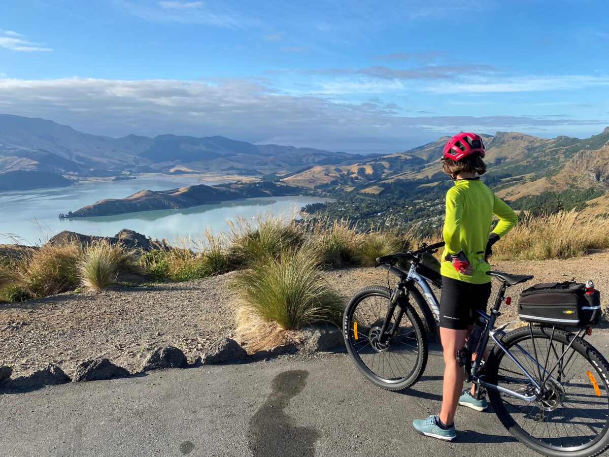
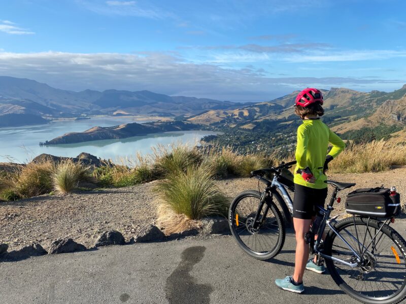
I happened to be nearby on my bike one day, thought ‘why not’, and ended up cycling up St Andrews Hill Road (just over the Ferrymead Bridge) and across to Mount Pleasant. It wasn’t easy and I only went halfway up, but I did it, and I loved the views out over the estuary. So, the next time I went right up to Summit Road and the views were (and still are) fantastic.
It took me another three months to finally get the courage to cycle up Dyers Pass Road. I was very nervous of the traffic so I stuck to the quieter Mount Pleasant route – heading up St Andrews Hill and Major Hornbrook Roads, before continuing up Mount Pleasant Road to the top.
But over the Christmas break, I got up early to beat the traffic and was pleased to find that not only did the ride lead to even better views, it is actually easier than going up Mount Pleasant. The gradient is steep for a start but eases off about halfway up. (Mount Pleasant is steep pretty much the whole way.)
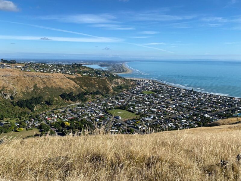
I start my ride with a warm-up cycle across the city (the boring bit) and then it’s about a half-hour climb to the top of Dyers Pass Road (the hard bit). From there, I head east up and along Summit Road to where the best views are. This is the bit that makes it all worthwhile.
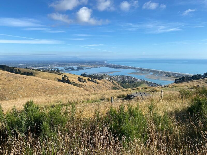
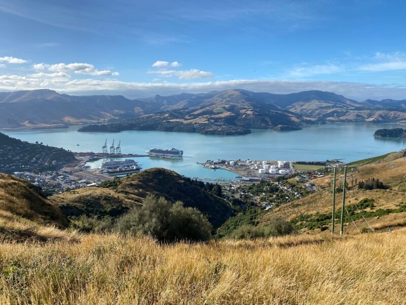
Initially, there are views over the city, across the plains and to the Southern Alps in the distance. As you cycle further around, the eastern suburbs become visible and there are views of the sea and Pegasus Bay. On the other side of the road, there are various points where you can look down into the bays around Lyttelton Harbour. On both sides of the road, there are connections to walking and mountain bike tracks that will take you back to sea level.
Despite the stunning views, there’s little traffic along Summit Road and there’s a section in the middle that is closed to vehicles altogether. It’s well-used by cyclists, walkers and runners. The road is best described as undulating with a few smaller climbs required before gradually winding down again towards Evans Pass Road.
From here, you can head straight back down the hill to Sumner village and cycle back to the city along the estuary. But I prefer to carry on to Godley Head, getting (almost) a bird’s-eye view of Sumner and the surfers at Taylor’s Mistake (and more views of Lyttelton Harbour) before heading back to Evans Pass Road for the downhill. This is the exhilarating bit.
At first, I didn’t enjoy the downhill ride. It’s steep, fast, and shared with other traffic. I used to make heavy use of my brakes and I felt quite tense and wobbly-legged by the time I got back to the flat. But over time, I’ve got a lot more confident (and faster) on the descents. Now, I can honestly say that I love it, and even manage a loud woo-hoo on the way down.
As fun as the downhill can be, I get the most enjoyment out of cycling uphill. The best views – and the best workout – will always come from the hill climbs. And it’s been a real joy to find it’s something I’m good at (with the help of low gears on my bike of course).
I’m still a newbie at cycling on the hills. I’ve got a lot more to learn, and a lot more of the Port Hills to discover. There’s a vast network of mountain bike tracks to explore and plenty of other sealed and gravel hill roads to practice on. And then I’ve got the rest of Banks Peninsula to conquer.
Getting there
- If you’re cycling from the central city, take the Quarryman’s Trail from Rolleston Avenue along Antigua Street, then continue all the way along Strickland Street and continue south on Colombo Street to the bottom of the hill. Take care crossing at the roundabout.
- If you want to avoid the steep climb, you can drive up Dyers Pass Road, turn left on to Summit Road and there’s a small carpark at the top of the hill. From there, you can do a ‘there and back’ road as far as you want to go, and still enjoy all the views.
Other options
- Start at Sumner and do my route in reverse. From the central city, you can cycle along Ferry Road or take the Rapanui-Shag Rock cycleway (from Worcester Street) to Ferrymead. Then connect to Main Road and/or the completed sections of Te Ara Ihutai Christchurch Coastal Pathway. (From north Christchurch, I take the on-road cycle lane on Hills Road to Avonside Drive and then head straight up Linwood Avenue and Humphreys Drive to Ferrymead.)
- Go up Mount Pleasant and then either left at Summit Road to Sumner (and Godley Head) or right to Dyers Pass Road.
- If you’re on a mountain bike, you can take one of several off-road tracks (like the Rapaki Track) to or from Summit Road.
Food, drink and toilet stops
- Godley Head makes a great picnic stop. There are several picnic tables with a view, a small toilet block and walking tracks to explore.
- You can fill up your water bottle at Hornbrook, 575 Summit Road – there’s a tap on the side of the road just past the intersection with Mount Pleasant Road.
- If you need coffee, stop in Sumner on the way back or, as I prefer, at the café at the Mount Pleasant Community Centre. There’s bike parking, friendly service and tasty snacks. (And they don’t seem to be mind if you come in looking like a hot sweaty mess.) Not open on Sundays though.
- You can also get food and drink, and make a toilet stop, at the Sign of the Kiwi when you get to the top of Dyers Pass Road. (You’ll need to cross over to the west side of Summit Road.) I haven’t visited the café, but they claim to have the best date scones in town.
What’s your favourite hill ride?
Thank you Angela, an excellent article. Living in Mount Pleasant I can readily tetify to the steepness of both St Andrews Hill and Mt Pleasant roads (however an e-bike does make it easier if you’re getting on in life like me…). A shorter loop for me entails a stop at the top of the Bridle Path and then a descent down through Mt Vernon Park to Rapaki Road. As you say, lots of other tracks too….
Go Angela, I was 6o years old when I first started riding the Port Hills and 16 years later still can easily ride up Mount Pleasant which is my favorite ride so many alternate routes to the Summit Road on one hill, Dyers Pass and Hackthorne roads I find too stressful with so much traffic and inconsiderate motorists.