There’s no Major Cycle Routes currently being consulted on at the moment, but the City Council does have a number of other project consultations out right now that might be of interest to those who cycle. Here are some details about them:
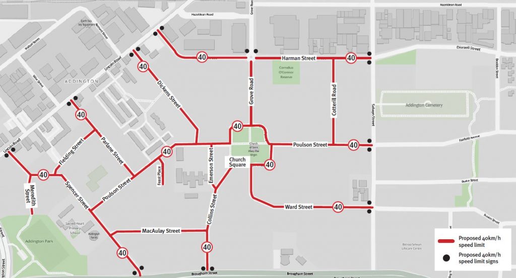
- In Addington, a 40km/h speed zone is proposed for the residential area surrounding St Mary’s Church (aka “Church Square”), roughly bounded by Selwyn St, Brougham St, Lincoln Rd and Hazeldean Rd. Many of you will know that I’m a big fan of lower speed zones around Christchurch, particularly due to the many benefits they bring to people walking and cycling. Areas like Addington are easy to implement because there’s already been a lot of work to traffic calm the neighbourhood. Given that the Little River Link cycleway traverses this area, it also provides an effective way to safely access a lot of surrounding places to and from the cycleway. I might have preferred a 30km/h speed limit instead, but it’s a good start. Consultation closes 5pm on Mon 11th Dec.

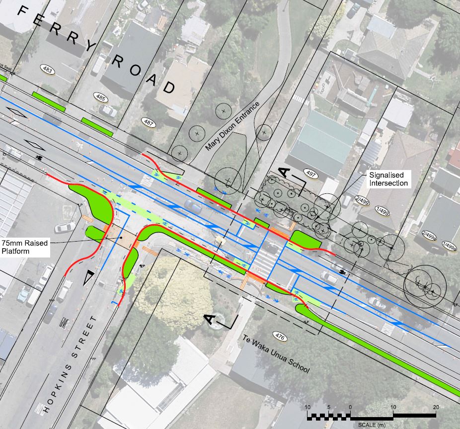
- Meanwhile, over in Woolston some work is planned to improve walking and cycling access near Woolston Park on Ferry Rd. The existing zebra crossing near Te Waka Unua School will be replaced with a signalised crossing, and wider shared path sections will connect Mary Dixon Reserve on the north side (a handy shortcut through to Smith St) with Hopkins St and the school on the south (would be useful if the shared path also extended to the entrance of Woolston Park too). What might not be quite so obvious is that this little project also helps to provide linkages to two forthcoming Major Cycle Routes via the connecting local streets; Rapanui – Shag Rock in the north via Smith St and Heathcote Expressway in the south via Hopkins St. As these cycleways get rolled out, these local connections will be critical to getting safe and convenient access to them from a broader swathe of the neighbourhood. Consultation closes on Wed 13th Dec.

- Finally, in the Port Hills plans are afoot to lower the speed limit on Dyers Pass Rd to 60km/h, from Cashmere (Sign of the Takahe) to Governors Bay. Many of you may recall previous issues with conflicts between motorists and cyclists on this route; we also undertook a survey two years ago on the matter (over 750 responses) that provided some useful feedback for Council. The proposals also introduce yellow no-passing lines along the route, although it is not clear whether that is meant to be for the benefit of slow drivers or cyclists. It should be remembered that drivers are still legally allowed to overtake a cyclist (and cross the centreline to do so) even when a no-passing line is present, although they must still do so in a safe manner. However, not all people are aware of this nuance of the overtaking rules, and may try to squeeze past on the lefthand side of the centreline even when it is safe to cross the centreline – perhaps some information signs for motorists could be useful? Consultation closes on Mon 18th Dec.
These consultations serve to remind us that there are many other projects beyond the flagship Major Cycle Routes that have the potential to help (or indeed hinder…) cycling in the city, so it pays to keep an eye out for them on Council’s “Have Your Say” webpage and submit on them (most of them have easy to fill in online forms these days)
{NB: Waimakariri District and Selwyn District also have webpages for consultation too; for example, Waimak are currently seeking feedback on lower speed limits along part of Tram Rd in Mandeville.}
What do you think about these projects?
