
Summer is fast approaching and, as noted the other day, plenty of construction work has been cranking along around Christchurch that we will soon be able to enjoy with our bikes. While much of that has been happening out in the suburbs, there has also been activity in the central city, and last week saw the long-awaited opening of a new pathway connection…

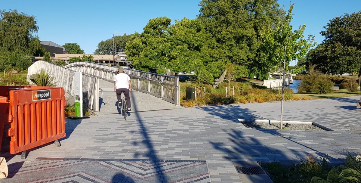
This is Te Rāranga, the new North Frame bridge across the Avon River in the section between Colombo and Manchester Sts, built by Ōtākaro. It’s a handy way to provide a more direct route across town when the river kinks back on itself. Certainly for me, coming from my office in the northeast of the city centre to places across town like City Council, this new connection is very handy. The width is reasonable, the design is quite nice, and I’m glad not to see any pesky bollards at either end of it…
It hasn’t all been plain sailing for this bridge. While being substantially complete for some months, some rust discovered on the balustrades caused the opening to be delayed while repair options were looked at. In the end they’ve decided to open it anyway but will continue to work on options to remediate this.
Have you used the new bridge? What did you think?
Oh that’s cool, I’ll try it out tomorrow! It’s potentially good for my route, but I’ve been ignoring it all this time since it clearly wasn’t ready… it’s funny how you internalise there’s no point going a certain way, and then suddenly… there is!
Honestly? A bridge is a tool, with a function and a purpose. This thing is an “art installation” that you can walk over.
I suppose it helps join Victoria Square with Margaret Mahey Park, in a straighter line than using the two Terraces, but realistically that particular 250 metre distance was served by Cambridge AND Oxford Terraces for walking/riding. Also, Armagh and Kilmore both have painted bike lanes nearby.
Call it what it is – “art” instead of thinking of it as a bridge, transport, or anything intentional.
It makes sense when you’re coming along Kilmore St to jink onto the path on the right hand bank, then trundle along the bank, over this bridge, pop out Armagh, thus bypassing Margaret Mahy playground and the crowds of people. I like it (and not coincidentally, am generally starting from the same place as LennyBoy, heading in the same direction…)
What gets me about the Armagh St “shared path” between Durham and Colombo is how you are supposed to get off it if you are continuing along Armagh St. There’s no curb cut until the intersection and you’re potentially cut off by left-turning cars. The painted bike lane doesn’t start until the next block. And if you ride on the road, cars don’t give you enough space, it’s relatively narrow and the tram tracks give them a strong visual clue to stick left somehow.
I’d agree with you about Armagh Street. Whether it is the tram tracks, inaccessibility due to one way streets or a multitude of other little reasons there needs to be closer attention to street detail from a bike scooter perspective for a much better experience to get around the central city.
Agreed. Given how few buildings there are, NOW is the time to make the roadway wider. Not later when property has been built-on.
Update: I just emailed the council to ask them if this is the final form, if there are further plans, or if I’m just misunderstanding how it’s supposed to work.
UPDATE I just got a nice email from a council engineer, apologising for delay, but basically agreeing and complete with a sketch of improvements they want to make. And it’s a ticket in the maintenance programme for this year now. As we might have suspected, this shared path segment was implemented by the Crown as part of the recovery work and that explains the weird not-joined-up nature of it. Anyway, contacting the council can work! Huzzah.
In my view some of the original designs were interesting, of aesthetic value and would have contributed to the cityscape
To me, the final version is just a bridge and doesn’t appear to contibute much to access or the flow of people beyond that provided by the two adjacent bridges. Maybe people will merely cross it because it’s there.