
 The opportunity and subsequent benefits of Covid lockdowns and travel restrictions over the past 12 months to get out locally and discover our own back yard have in a bitter sweet way been significant. What better way to see your ‘hood than on a bike.
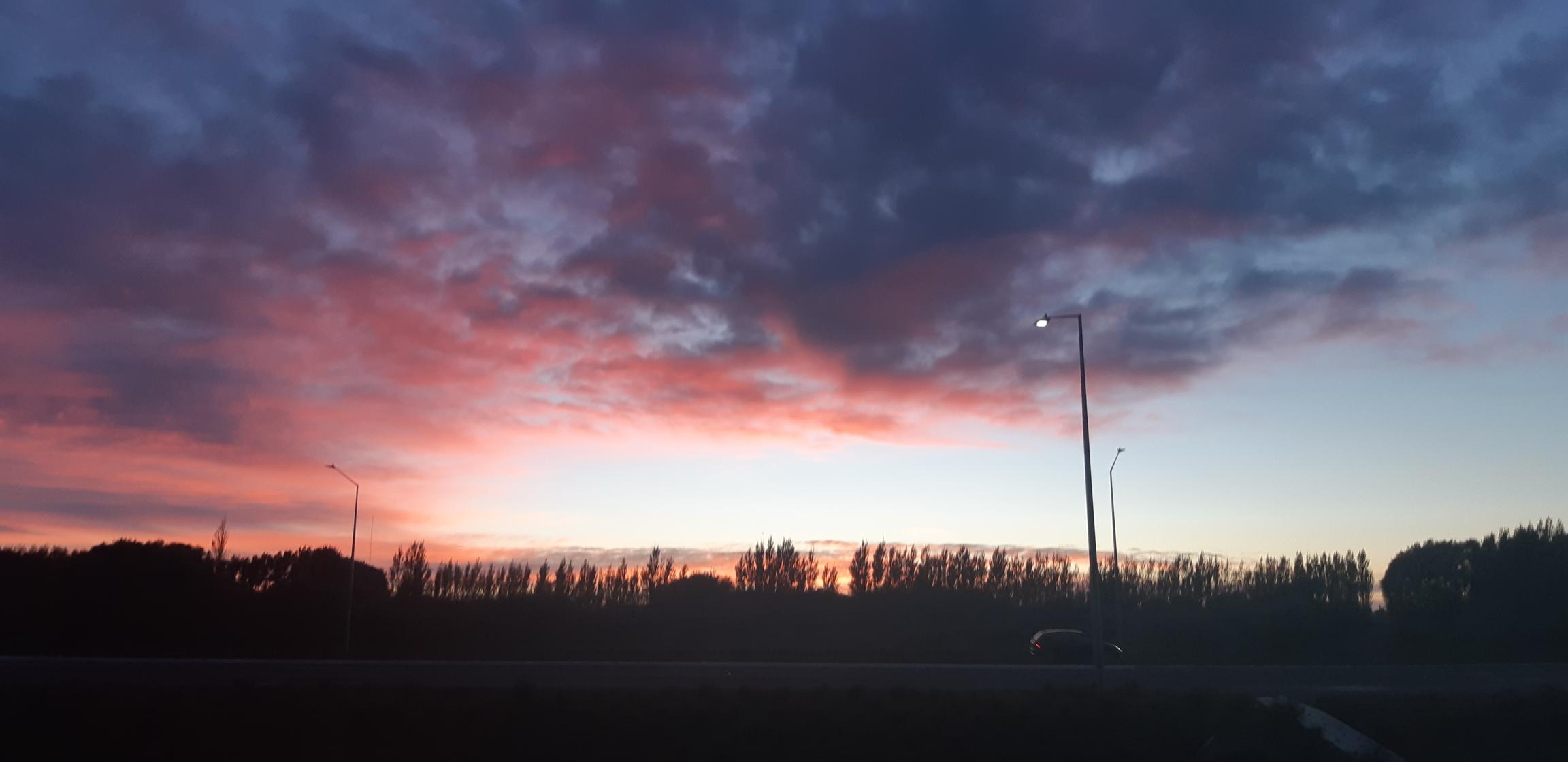
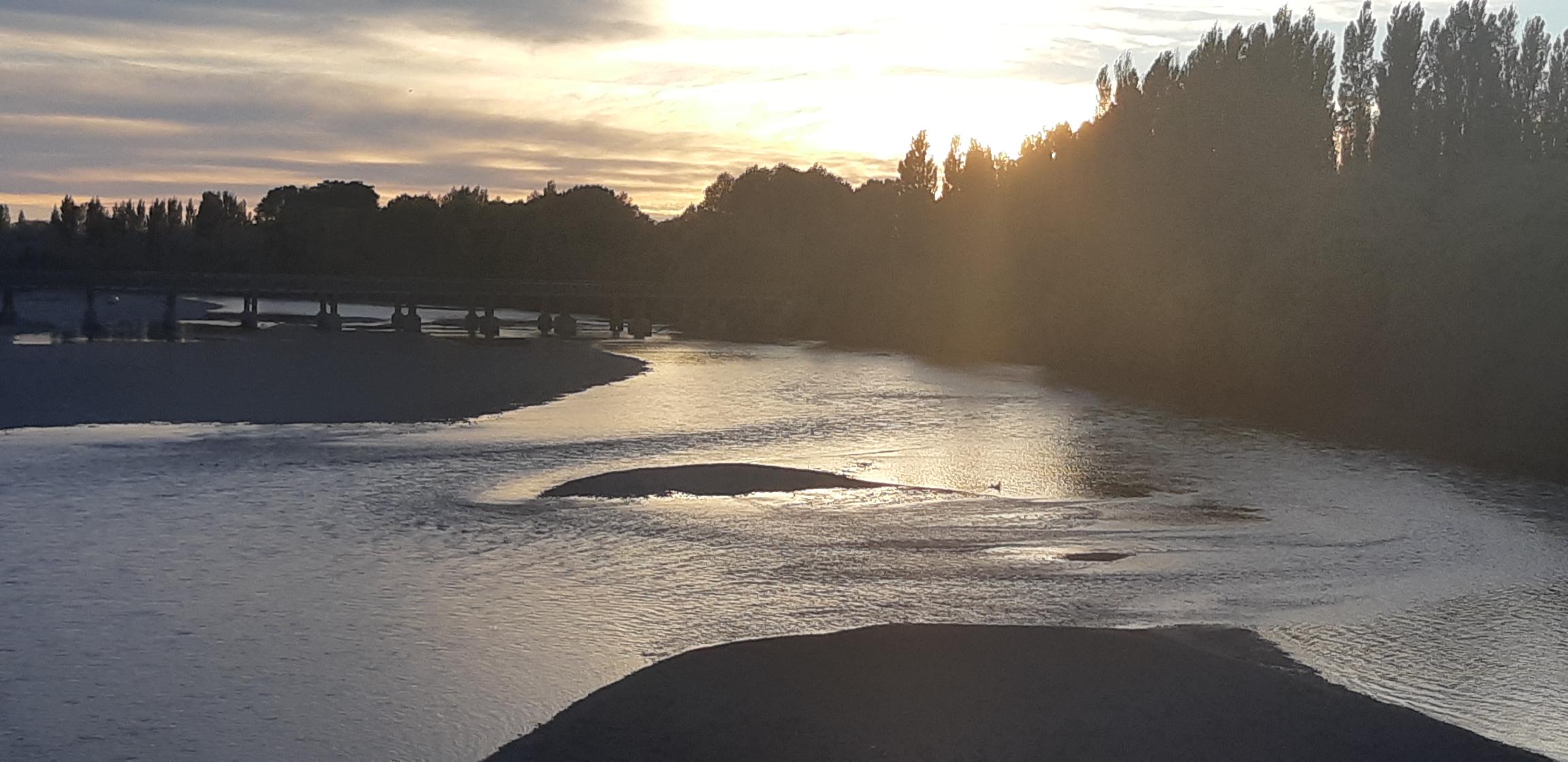
On an exceptionally pleasant Sunday morning at 6.30am I jumped on the bike to see what our brand new Northern Arterial Shared Path through to Kaiapoi could provide in terms of scenic beauty and interest. The early start was easy; better by far than a 5.00am check-in to cross the Tasman. An opportunity to witness yet another spectacular Canterbury autumn sunrise alone in the fresh air; this gift from nature in itself doesn’t disappoint either.
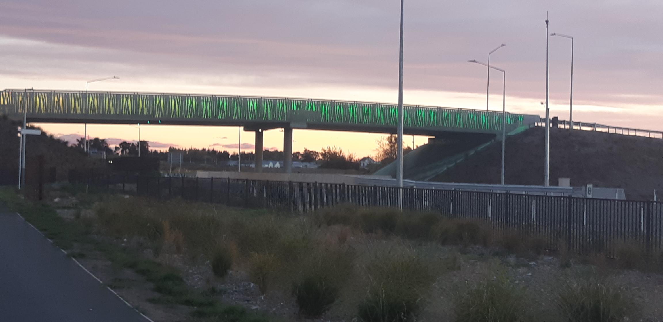
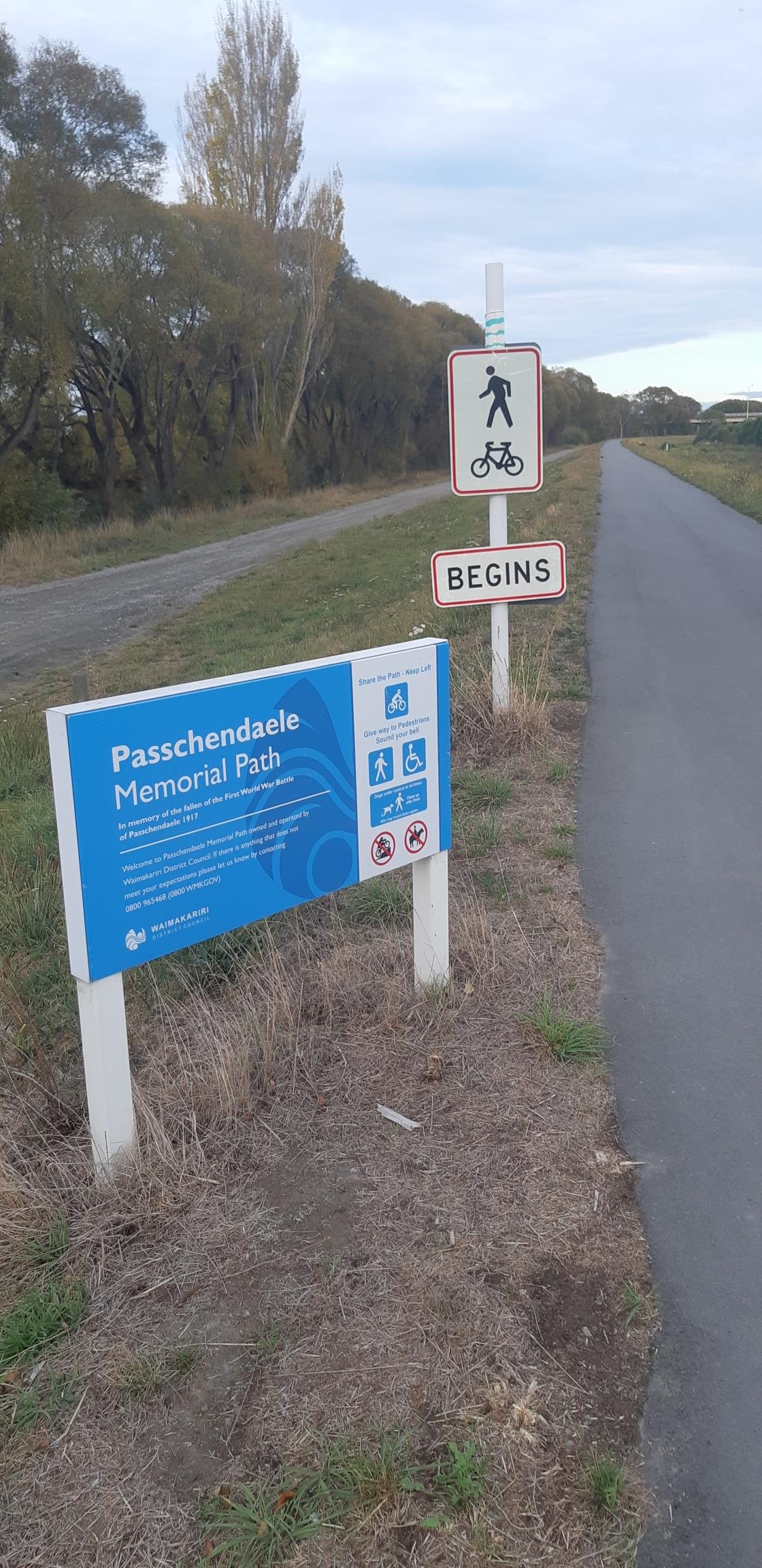
The Southern Motorway path plus Little River Link cycleway ( the worthy older sibling to this one ) enables a visually interesting riding experience in safety all the way from Hagley Park to Prebbleton. The Northern Arterial Path plus Papanui Parallel cycleway does likewise from Bealey Avenue to Kaiapoi (with the option to continue on to Rangiora using the Passchendaele Memorial Path)
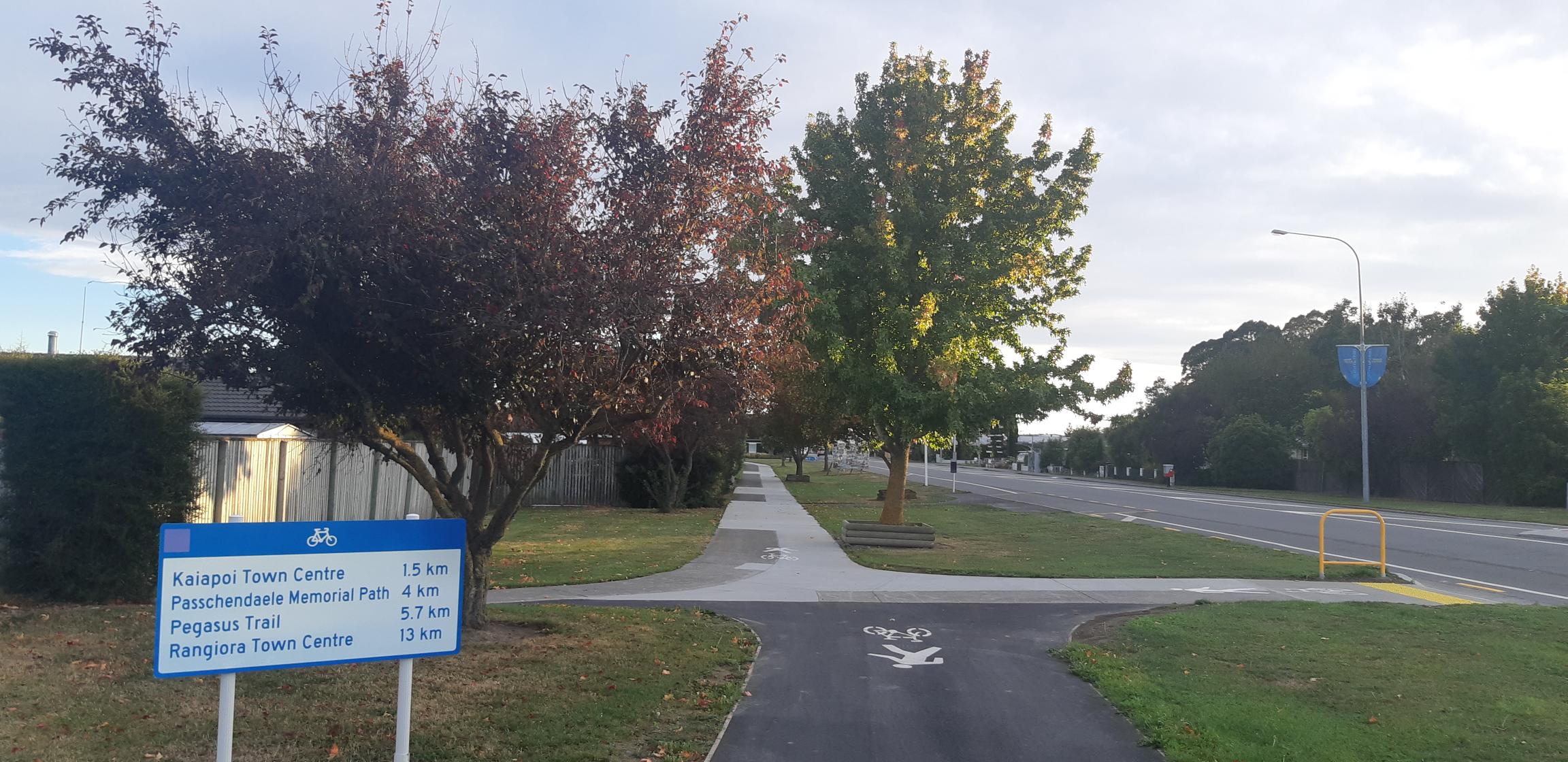
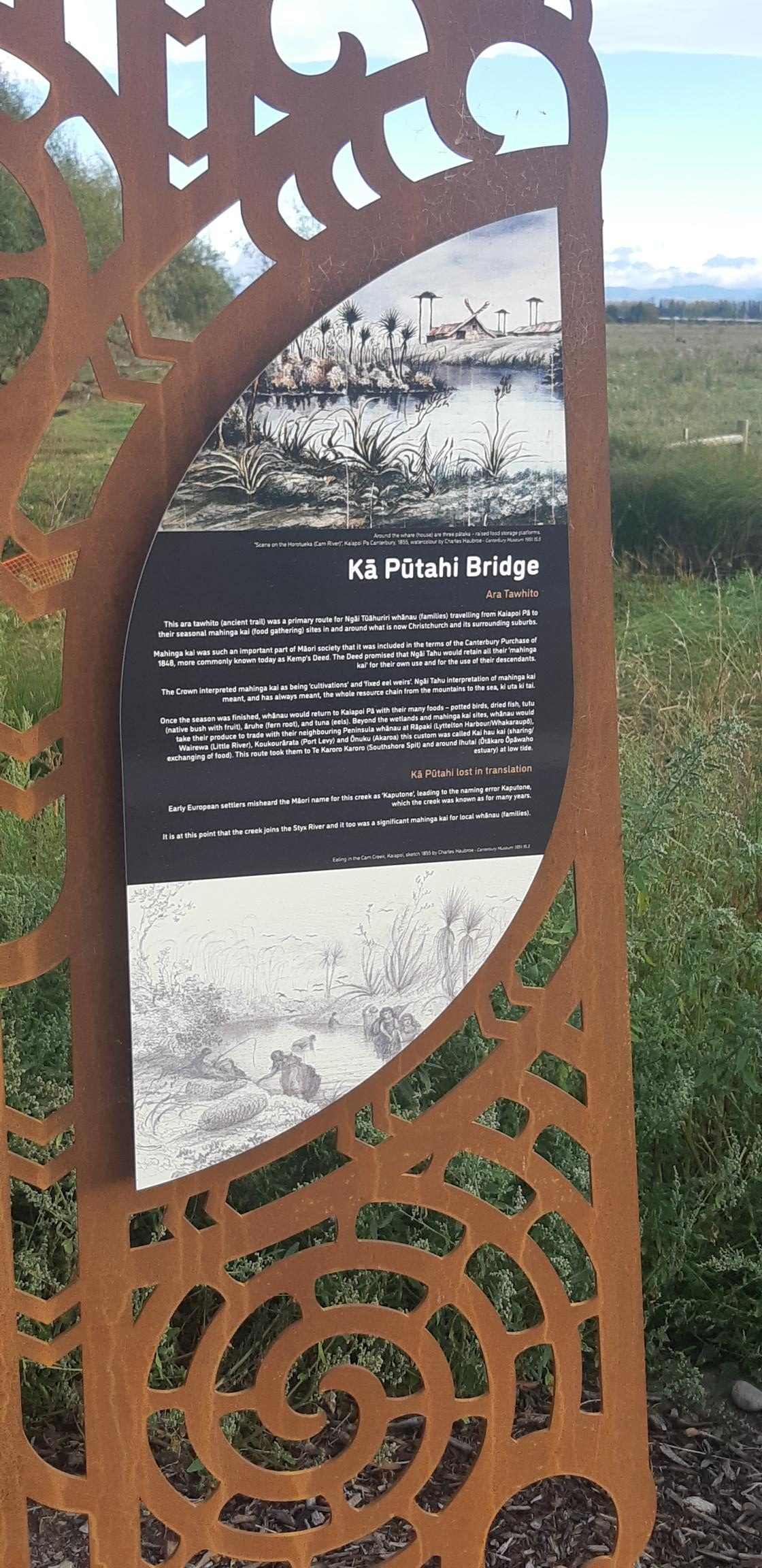
An appreciated touch to the Northern Arterial path is the opportunity to stop along the way and learn about the area you are travelling though.
 |
 |
The path meanders a bit and is often a little further in distance from the motorway lanes than its southern counterpart; from a touring perspective this adds interest and enjoyment, but the motorway noise can be quite audible when closer to the lanes.

The Southern Motorway path lacks the grandeur of the Waimakariri River bridge crossing or the superb access to the Waimakariri Regional Park.
But counter to that there is the Little River Rail Trail to follow on from the southern motorway path. We’re spoilt for easy cycling day trip choices now; from our inner city right through to the very best of Canterbury. Brilliant.
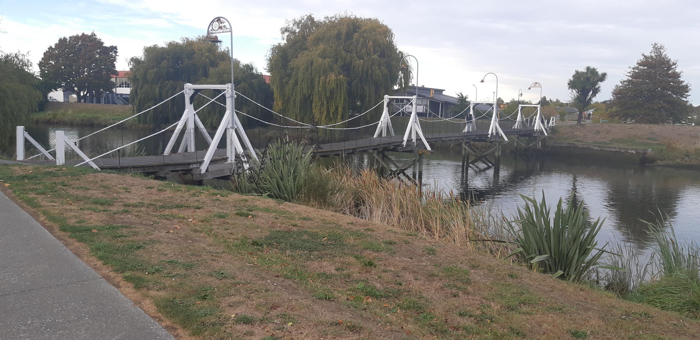
Discovering Kaiapoi by bike is pretty easy; there’s both the Kaiapoi and Cam Rivers to explore, and the Kaiapoi Lakes. The beach settlements of Pines and Kairaki, near the beautiful Waimakariri River mouth are great too. Some off-road tracks to add a bit of excitement.
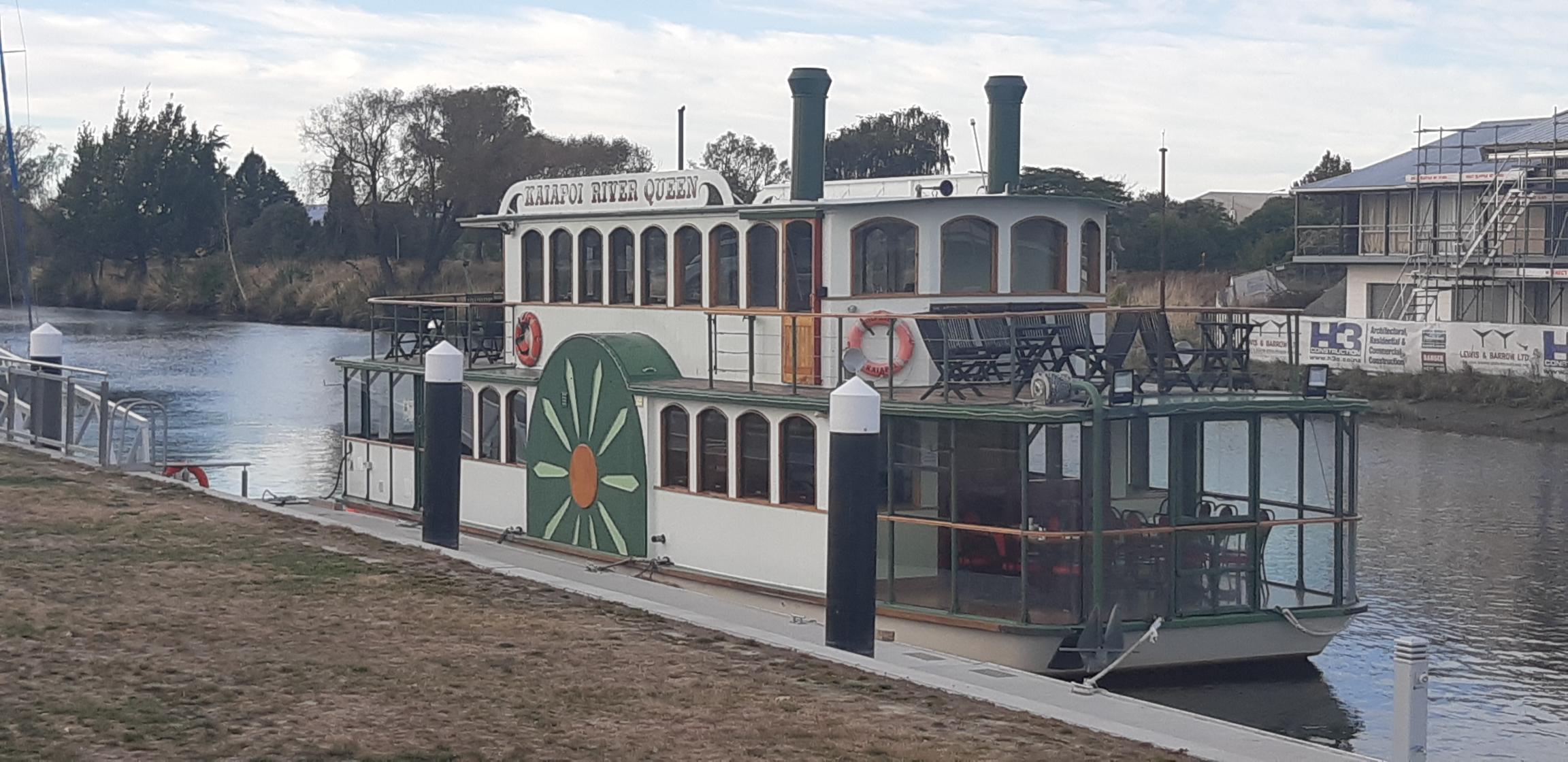
Kaiapoi has quite a pre-European story to tell, a 20th century working class contribution to the Canterbury economy and a more recent unique earthquake experience to share. A pre-ride check for information will provide plenty of interesting places to visit and things to do.
If travel offshore is not an easy option right now, treat yourself to a few hours of pleasure getting to know your now easily accessible neighbouring regions. Don’t forget your bike though.
 |
 |
Thanks for this Robert. It is wonderful to think that (soon) I will be able to bike to Kaiapoi from Ferrymead solely on cycle paths/tracks. If anyone had told me that when I retired 15 years ago I would have laughed out loud. I look forward to the completion of all the major routes and just hope that I will still be fit enough to take advantage of them.
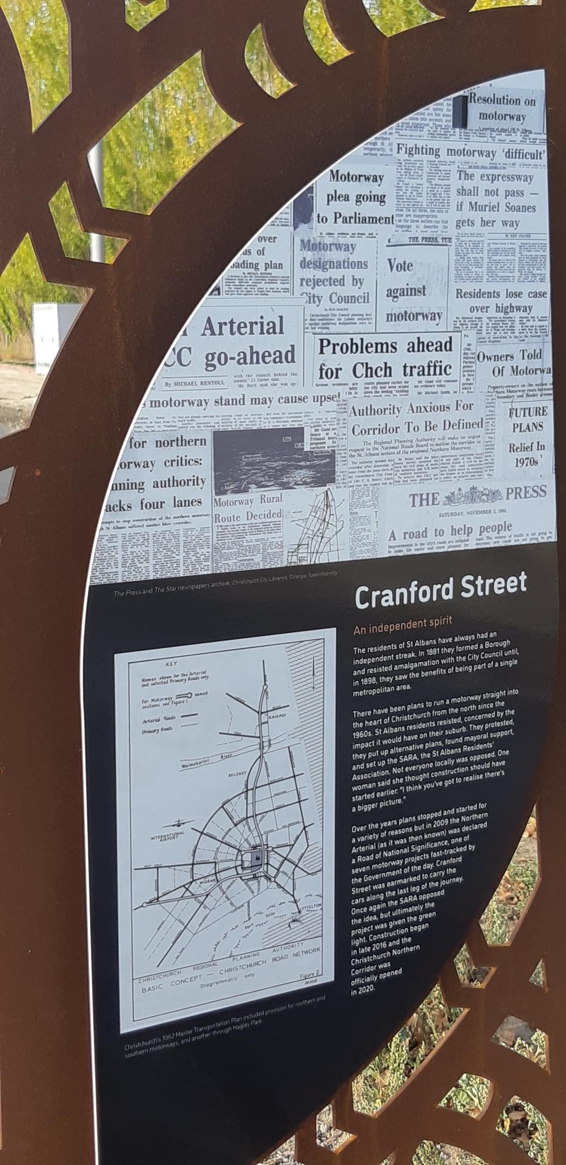
I find it fascinating that you can ride from the edge of Rangiora right through to Cranford Street without riding on a “busy road”
There’s a piece of Passchendale that is on-road but its dead-end farmers access, and there’s a couple of kilometres through the middle of Kaiapoi which are on simple back-roads. The most challenging part is a stop sign.
This is an awesome pathway and comes highly recommended.
Nice one Robert. I rode that same route a couple of weeks ago and throughly enjoyed it. The cafes had a lot of bikes outside them which was great to see.
We live in Spreydon and can now bike in numerous directions on cycleways. It’s so great taking my 5 year old boy riding in relative safety.
Good article. Thanks.
I’ve enjoyed the route from the Papanui Parallel to north of Kaiapoi a number of times. Such an asset.
I understand that the name of the new motorway and, by association, the adjacent shared path is the Christchurch Northern Corridor. Is this incorrect?
Cheers
No you are correct Peter. The project initially was referred to as the Northern Arterial, and at some point became the CNC – Christchurch Northern Corridor. It would be interesting to know exactly when. The Northern Arterial name has stuck with me ; living not far off Cranford Street we’ve lived and breathed the controversy in the area for 9 years now.
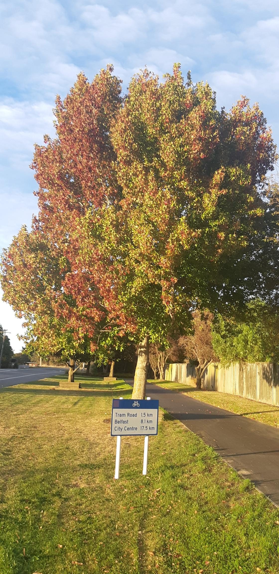
On another point of accuracy it is intriguing to note in the top photo sign the advises the distance to Kaiapoi is 14.0km. At Grimseys Road 1.2km further north the sign reads 13.0km. Head back 1.05km to the Rutland Reserve, at the junction with the Papanui Parallel cycleway the sign reads 13.8km. Mysterious.
Thanks for the explanation Robert.
Yes, mysterious. Perhaps some sort of space/time warp.
Once in Kaiapoi with one’s cycle there’s an interesting and enjoyable loop, mainly using paths, to Kairaki – Waikuku – Rangiora – and back to Kaiapoi.
Starting in Rangiora there’s the Hurunui Heartland Trail all the way to Kaikoura. Unlike the Little River Cycleway which mainly uses dedicated paths, the Trail uses back roads.
I’m grateful to all those people who created all of Christchurch’s wonderful cycling infrastructure, and for the paths beyond.
The peaceful and beautiful town. I want to spend sometime there.