
There has been an interesting conversation going around Spokes Canterbury lately about the potential for extra cycle counters across Christchurch in new locations. There is of course a cost to installing (and maintaining) any new permanent cycle counters; fortunately there is also a programme of other short-term counts to help build up a picture of cycle use. But it calls to mind a previous discussion about this, back in Oct 2018 – when there were quite a few suggestions for additional count sites…
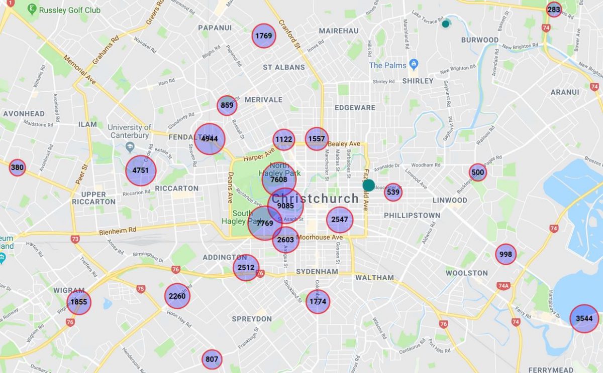
We’re now starting to develop a comprehensive set of automated cycle counters around the city, and you can check out the weekly count data live at SmartView, the City Council’s very useful information website. Of course, these counters don’t even come close to capturing all of the cycle trips around the city; on my typical 6 km commute to work I don’t trigger any of the 20-odd current counters.

So it begs the question: where else might it make sense to capture count numbers? Here’s a few thoughts:
- Many of the new sites are being installed on the new Major Cycle Routes as they are constructed, e.g. new counters were recently installed on the Quarrymans Trail and Rapanui Stage 2. However, there are some potential gaps in the existing cycleways, including:
- The Northern Line, somewhere near Papanui
- Quarrymans Trail on Strickland St, south of Milton
- Uni-Cycle on Matai St West
- Rapanui – Shag Rock, in Linwood Park
- There’s not a lot of information within the central city about cycle patterns, especially towards the northeast. Granted, there is still some construction going on, but a few more sites could be useful, such as:
- Tuam St near Durham St
- Kilmore St near Barbadoes St
- Armagh St near Victoria Sq
- Cambridge Tce pathway near Gloucester St
- Colombo St near the Bus Interchange
- Plenty of cycling still happens on other routes around the city. To get a better idea of whether people are switching to new cycleways or new trips are being generated, it is useful to have some “control” sites (some of the existing count sites already perform that function). A few more possible sites include:
- Barrington St near Spreydon
- Kotare St near Clyde Rd
- Harewood Rd underpass at Russley Rd
- Wilsons Rd near St Martins
- North Parade near Shirley
- Centaurus Rd near Cashmere
- Ferry Rd near Woolston
Obviously any list of potential sites is still going to miss a whole lot of other cycling locations; all you can do is try to get a good representative sample to help monitor ongoing trends across the city. Unfortunately there is a cost associated with installing (and monitoring/maintaining) each site, so that will always be a constraint on the available number of installations.
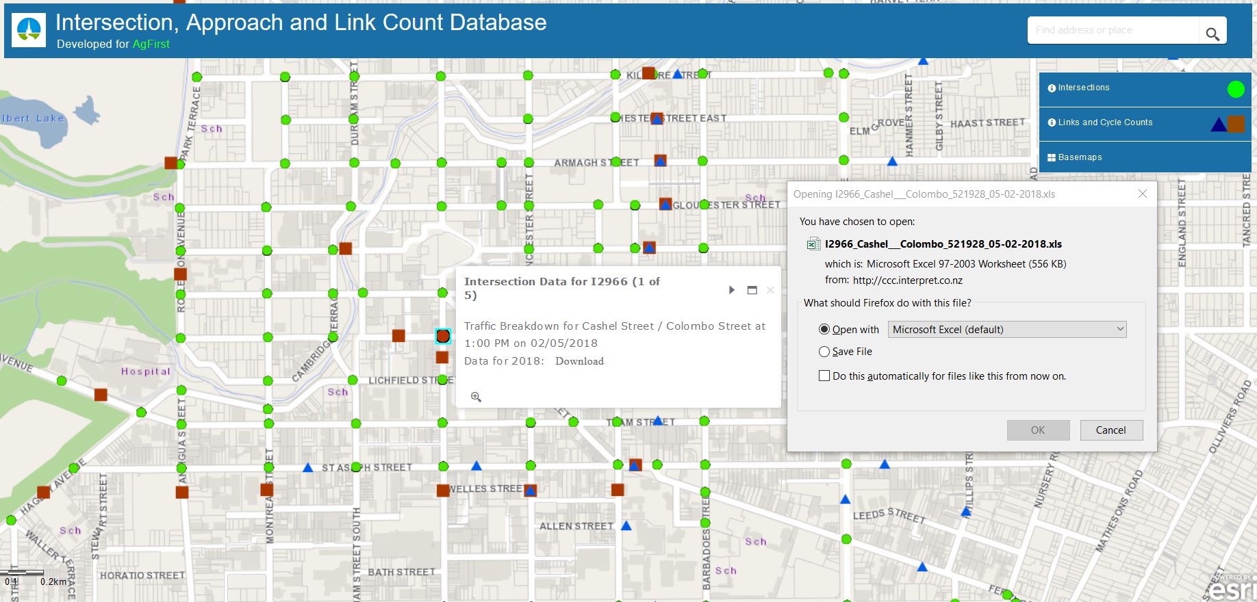
{By the way, another useful source of cycle counts, albeit more sporadic, is the multimodal count data from CCC’s graphical traffic count website. Typically, sites are counted every two years and intersection counts can provide you with five AM/interpeak/PM hours of detailed counts for all movements and travel modes.}
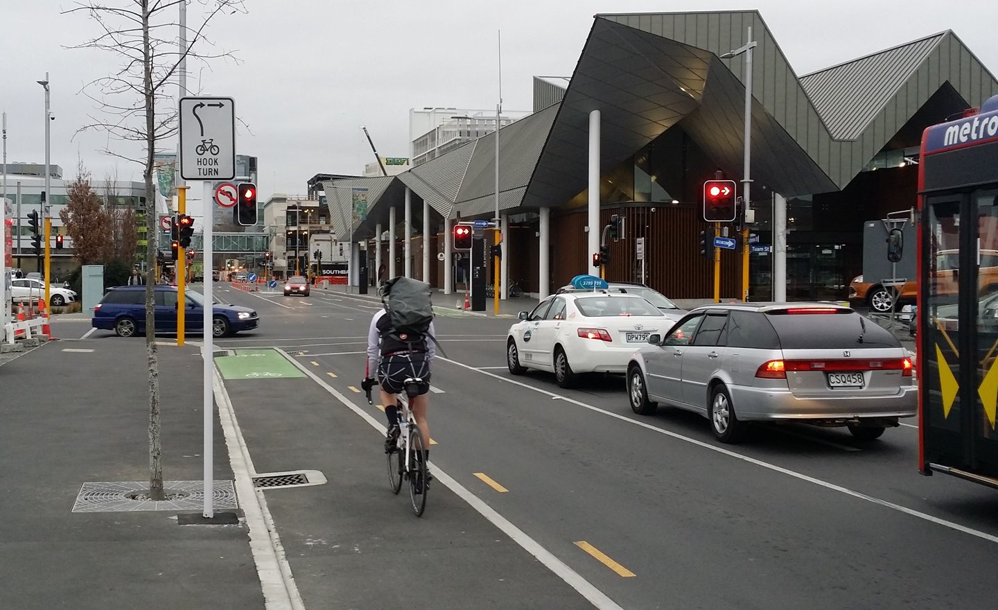
The other thing that’s a little annoying is the fact that many of the on-street counters are only one-way – in SmartView, click on individual counters to find out whether they pick up movements in one or two directions. Ideally it would be useful to know the two-way flows; it would make the numbers look even more impressive for a start and would save us having to manually double the numbers shown. {Fortunately now at least the one-way counts are displayed using a different colour to the two-way sites, for easier identification}
Where do you think some cycle counters should be located?
Tennyson st or Strickland st.