
Riding into town last weekend, I took the route through the southern part of High St to head towards the city centre. For the past few months that has been a bit of a construction zone as the final part of the redevelopment of this street has progressed. But all that has now finished, and I got to check out what the final street looks like…
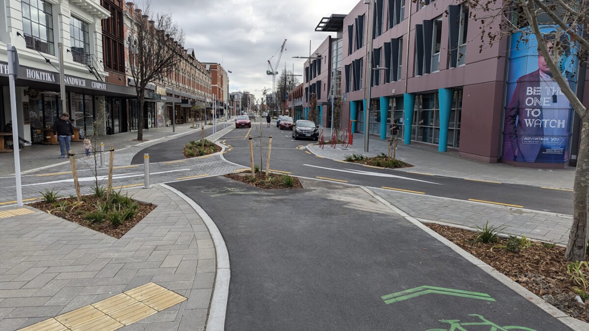
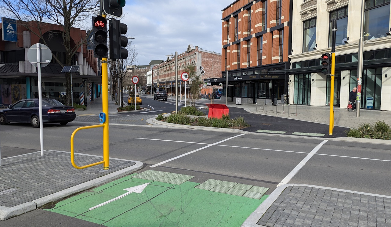
As you might recall, from the original consultation, the section of High St between Tuam and St Asaph Sts has been made a one-way slow route south (with a 10km/h limit) coupled with a “contra-flow” cycleway for people riding to the north.
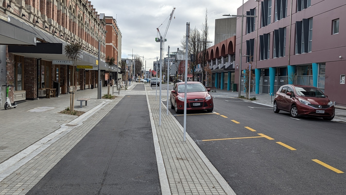
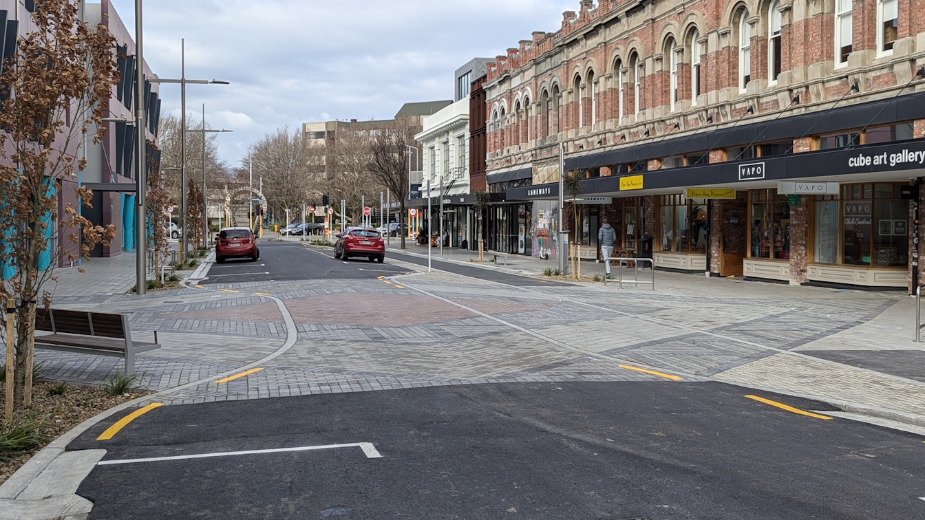
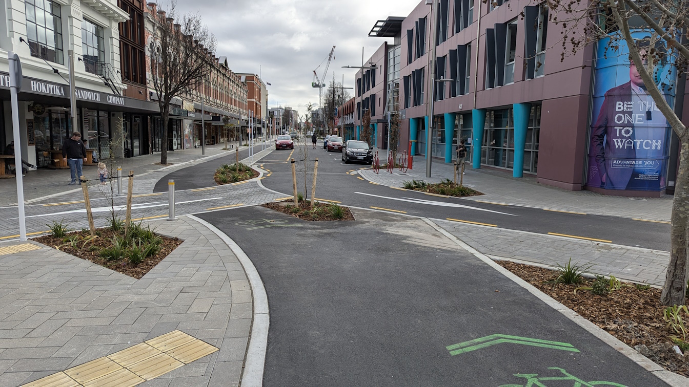
On-street car-parking has largely been retained as before, with nice flush pavers separating the parked vehicles from the adjacent footpaths and cycleway (also nice use of trees and planting).
At each end, cyclists can easily connect between the street and the cycleway crossing.
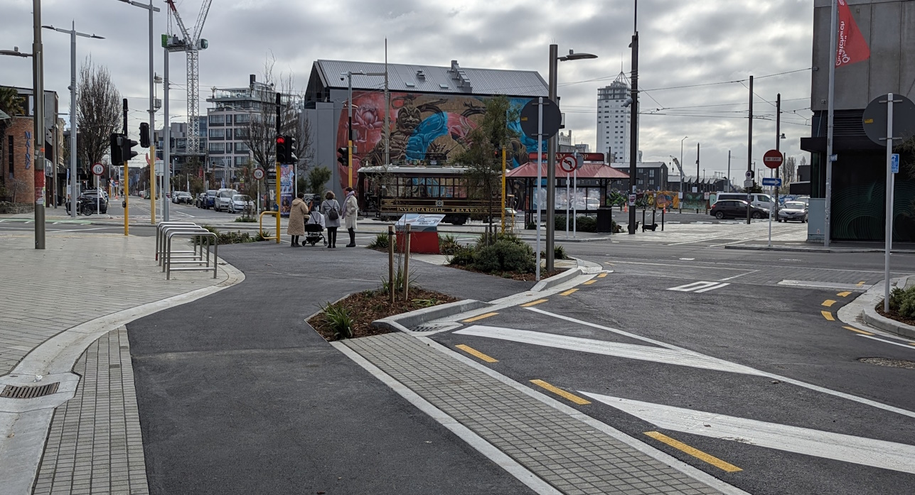
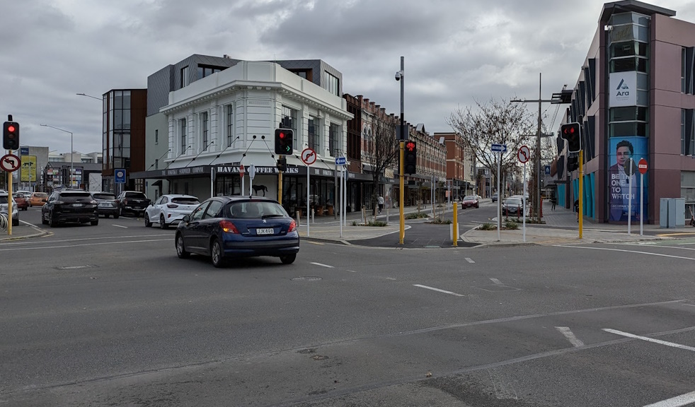
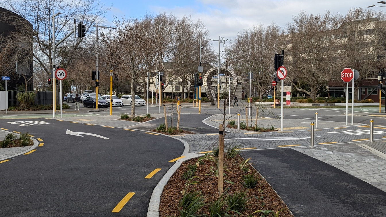
The final design chose to keep an exit option for southbound traffic to turn right into St Asaph St, which is a little bit annoying but in reality probably not going to cause a lot of grief for passing cyclists.
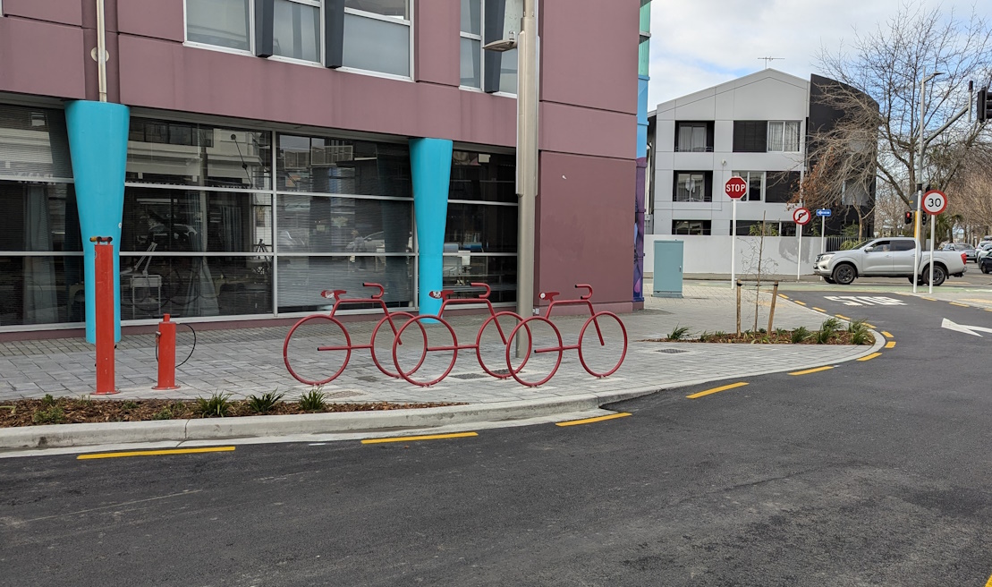
As well as other street furniture along the block, the stylish bicycle-shaped racks and repair stand that used to grace the southwest corner have now been relocated to the other side of the street.
Judging by a few of the temporary paint markings, I presume that we’re still waiting on a few final cycleway markings to go down in places to steer people the right ways.
All up, I think that the council have done a pretty good job of reconstructing this street. And providing two-way access for bikes while restricting motor traffic to one way is another little tool to encourage more use of sustainable transport modes.
Have you travelled along lower High St yet? What do you think?
Looks pretty good. Would have been better with less on street parking and without the right turn slip lane but the treatment of that looks good for ensuring vehicles go slow at least.
Interesting choice of trees with small lancewood /horeka by the look of it so as to not block the buildings from view. Would have preferred a bit more tree canopy.
Did this stretch for the first time since it was finished last night.
My gripe is, imagine that you are wanting to go right on to St Asaph. You pull up in what looks like the obvious place, and there is this tiny gap in the St Asaph cycle lane protection next to a parked car which you have to get through.
As I was doing this, I realised that I could have pulled up at the corner, where the bike lane continues on to the Ferry Road cycle lane, and then turned right and entered the St Asaph bike lane from its entrance.
But this doesn’t seem like the obvious direction to go when you’re approaching the end of High St because the orientation of the cycle lane there is diagonally across the intersection, which cues you to think it’s not the right direction.
It’s a great connecty bit for the cycle network. Would be ace to see some new green paint going from southern High Street into the Ferry Road cycleway, to slow traffic a touch (I hope) and emphasise the area is for more than cars. More green paint from the Ferry Road cycleway into the St Asaph cycleway would also be welcome. And at the northern, painting the crossing green in the area for cyclists would also be beneficial.
It’s a shame that the lights no longer automatically trigger (like they did during construction)
Hopefully the lead in cycle trigger will be put in soon.