If you’ve been following the news, you might have heard about the rather odd last-minute notice of motion by Cr James Gough to have a section of the planned Nor’West Arc Major Cycleway (literally about to start construction) reviewed to save some carparks (being a street that clearly suffers from not enough parking…). Now that the motion has squeaked through, there will be some extra work required to relitigate the merits of the option that would see pedestrians and cycles sharing a path while also wiping out virtually every tree along there. For those of you struggling to remember the details of this project, let me take you back two years ago when the project design (and its various options) was first consulted on, as summarised in this blog post from Oct 2021…
As mentioned earlier, the final section of the Te Ara O-Rakipaoa Nor’west Arc Cycleway (Section 3 from Ilam – Papanui) is now out for consultation, with submissions closing this Tuesday 12th Oct. This length will complete a route right around the western periphery from Cashmere up to Papanui, picking up Spreydon, Hillmorton, Middleton, Upper Riccarton, Ilam and Bryndwr along the way.

As is often the case, there is a lot to take in along this nearly-4km length of cycleway route. You can either review the details via the online GIS map or download the (rather large) PDF files from the consultation page (really not sure why they have to be so huge…). Along the route, two slightly different design options are presented for your feedback:
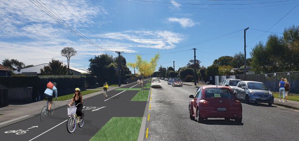
- For the first section from the University to Jellie Park, there is the option of either one-way cycleways on each side of the road or a two-way cycleway on just the northwestern side.

- For the next section of Aorangi Rd through to Brookside Tce, there is the option of a two-way cycleway or a shared walk/cycle pathway.

- The remainder of the route to Harewood Rd retains a two-way cycleway separate from the footpath.

Not surprisingly, the key implications of the different options above involve car parking; one-way cycleways are typically safer than two-way ones (where crossing drivers don’t always think to check both ways) and separated cycleways are preferred over ones shared with pedestrians. However, those options would mean removal of more car parks along the route – about 90 extra spaces. Personally, for a route that is rarely parked out to any great degree, I think I’d rather have the better design, especially for the northern section.
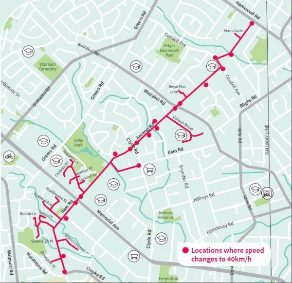
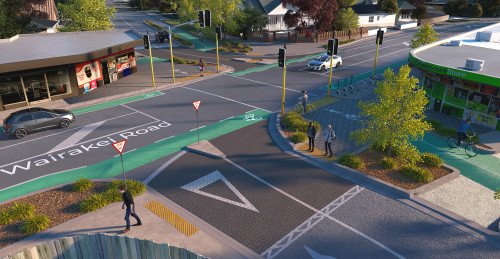
Support for getting across the busiest roads is in the form of new signalised cycle crossings, upgrading the existing signals at Maidstone/Creyke and Memorial Ave and adding a new one at Wairakei Rd. Another new signalised crossing is also provided at Jellie Park, providing a useful link across to Brunside Primary and Cobham Intermediate Schools. Another nice feature will be the introduction of a 40km/h speed limit all along the route.

Make sure that you get your submissions in for this project. As was seen with Harewood Rd, it’s important that support for a project is seen as much as the inevitable naysayers…
Which Nor’West Arc design options would you pick?
