
These days, using your smart device for wayfinding seems almost second-nature to many, even when on a bike. But seven years ago, it was pretty cool when the traditionally car-centric Google Maps first provided directions for biking around Christchurch (albeit with a few directional glitches). This post (originally from Sep 2012) provided an overview of what was possible; fortunately the routing seems a lot better these days:
{Speaking of maps, this probably a good time to remind people that the latest Chch Cycle Map is now available, both online/downloadable and hard copies at your local Council Library or Recreation/Service Centre…}
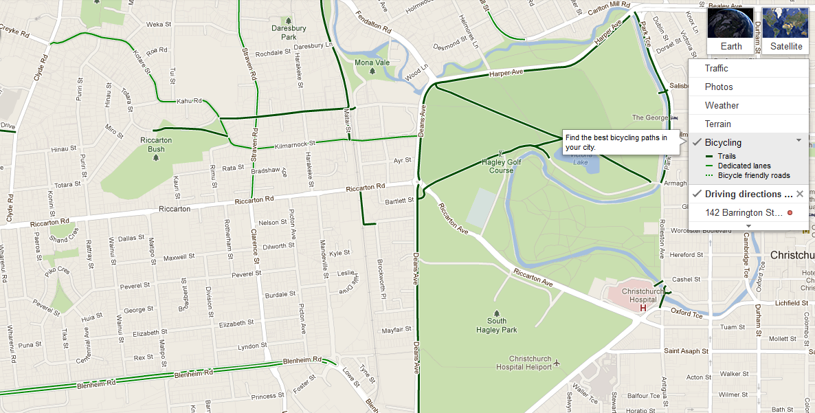
An interesting development was added to everybody’s favourite mapping service Google Maps in the past month. NZers can now experience getting directions for cycling, which will make use of any handy cycling shortcuts such as off-road paths. Viewers can also see the location of any bike lanes, off-road paths (“trails”) or cycle-friendly streets.
It’s easy to use: when you enter addresses to get directions in Google Maps, you can now select a bike icon to get it to determine the best route by bike. It will also give you an approximate time to cover the distance, although I have to say that it’s probably a bit brisk for the average “non-racer” commuter.

Obviously Google Maps is only as good as the information it has and at present there are plenty of things not quite right in Christchurch. For example, I tried the route from my old place in Spreydon through to work in Ilam; I used to go up Selwyn St, through Hagley Park and then along Kilmarnock St to do this. However Google Maps suggested first up that I might like to head along SH73 (Brougham St) to get to my destination! The second option provided (technically the shortest) was only slightly better in sending me along Blenheim Rd (at least it has bike lanes…). Option 3 finally sent me up Deans Ave (and then Riccarton Rd!), although presumably on the road because it doesn’t seem to have all the paths in Hagley Park registered yet. You can tick an option to “avoid highways” but evidently that doesn’t affect the routes proposed in this case – perhaps they need to lower the bar on what constitutes a “highway” for a cycling trip?

Fortunately there is a new way to help improve the maps that has also been released. Google Map Maker allows anyone to contribute to the pool of knowledge about what’s in their neighbourhood, including bike facilities {NB: Now incorporated directly into Google Maps – Ed}. The editing interface is a little hard to get used to (I was struggling to try to correct some bikeways that were a bit off), although it wasn’t too hard to add a new link or (more often than not) tell Google that a marked “road” was in fact a ped-bike trail. Pay attention to some of the attributes recorded (e.g. is the route “preferred” for cycling?), and also don’t get confused about divided roadways that are actually two separate one-way links.
Proposed edits have to be reviewed by others before they get approved, which seems to provide a sufficient level of protection from map vandalism or inadvertent mistakes. Already in a few days I’ve had a go at correcting or adding some things around Christchurch and now they are part of the GoogleMaps world for all to see. I can see that Hagley Park is going to be a work in progress though…
Here is some local feedback in The Press about these initiatives (although why do they always have to go and slot in some cycle crash statistics? It’s about mapping, not safety!)
What do you think about GoogleMaps bike route features?