Guest contributor Ian provides some thoughts about the Hospital Corner cycling saga (remember you are welcome to contribute your own guest posts for consideration):
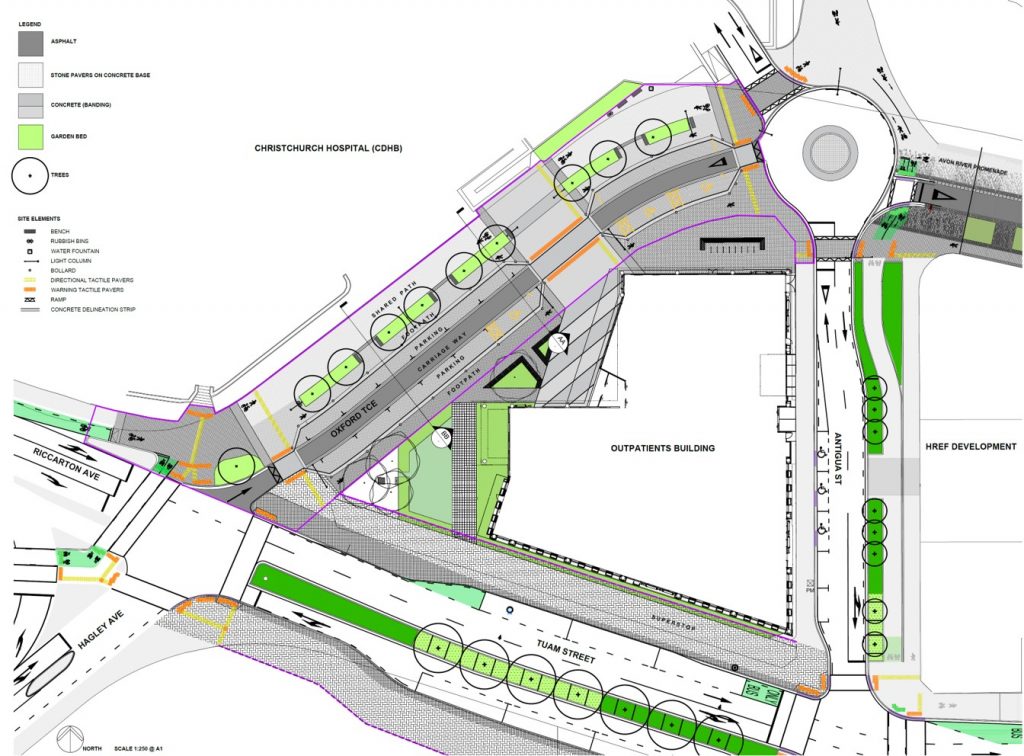
The problems with the new design for Hospital Corner are set out in this earlier post. Simon Barnard is right when he says that it is “an unworkable plan sure to displease drivers, pedestrians, people on bikes, anyone who needs to access the hospital and new outpatient services building.”
However, Council traffic engineer Steve Dejong is quoted on Stuff saying, “We don’t believe there will be a problem. We believe this is the best design you will get.” Really? Is there no alternative to having a footpath and a shared path on the same side of the road?

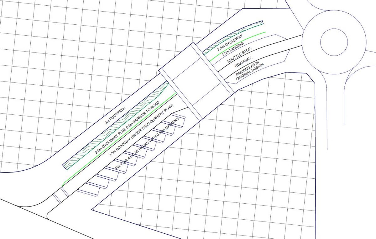
I tried to sketch something better. I have not attempted to deal with the biggest question over this whole design (why aren’t West-East cyclists being directed down Tuam St?), just looked at why, if cyclists have to go along Oxford Terrace, they don’t have a separated cycleway.
It seemed to me that the biggest obstacle to a separated cycleway is the parking on the North side of the road (as that means conflict between people getting out of cars and cyclists), so I have moved all the parking to the South side. Angled parking is not often favoured (it was discounted on Ferry Road, thankfully) but this is not an arterial road and speeds can be kept down. Two parking spaces are lost (I reckon you could get at least one back with a bit of shifting over – Ed.) but the parking spaces are wide and passengers entering or exiting cars do not have to contend with cars passing on one side or pedestrians passing on the other. Having the cycleway alongside the road clears up most of the potential problems at the large crossing between the hospitals, as cars and bikes will be in the same part of the crossing and will be treated the same by pedestrians, and it frees the path nearest the hospital for pedestrian use only.

Northeast of the large mid-block crossing I have kept the road layout as in the original design. The shuttle stop unfortunately has to be on the North side as most bus doors are on the left. But by shrinking the planter size down there is space for a landing for shuttle passengers so they are not in conflict with cyclists.
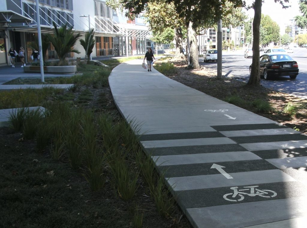
{Ed. note: some work will be needed to make sure that the cycleway doesn’t look like another footpath, tempting pedestrians to use it instead. Auckland learnt that lesson along Beach Road…}

What do you think? Are the City Council right, that Otakaro’s design is the best design you will get?
Does this solve the perceived problems at Hospital Corner?


I fail to understand the point of having the garden bed there at all. It looks like it takes up near on 2 metres of space, plus overhang from leaf producing trees. Add that to the shared path gives you 6 metres , ample room for pedestrian path and two way cycle path. A flush path with demarcation provided using paving colours and signage, just as you would expect in European cities. If a barrier with pedestrian set down area is required, a simple camelia hedge could be done for under a metre. This is a utility area, not dissimilar to pick-up, set-down area at the airport and I do not see intrusive landscaping there. Possibly the busiest piece of cycleway in the whole network and Otakaro are obsessed with greenery. Has it not been noticed that Hagley Park is across the road ?
Thanks and keep the ideas coming. The parking would help to encourage pedestrians to use the crossing points.
However, a 2.5m wide bidirectional path is too narrow for the number of cyclists. 4.5m deep parking is not deep enough for many SUV’s, vans and full size cars. Also needed is to keep the hospital driveway to exit only to minimize conflicts with pedestrians and bikes.
I imagine many confident cyclists will find it easier to deal with the buses and use Tuam Street. Fine, until someone dies.
The bi-directional cycleway width is marginal but the footpath width could be 2.5m and the cycleway width 3m, instead of the other way round- or as Robert mentions above, reduce the planter width. The 4.5m parking is measured on the short side of the bay- the long side measures 6.2m which is 0.8m longer than required in this guide for accessible parking (see p14)
http://nzrf.co.nz/techdocs/Accessible-Parking-Guide.pdf
At 3.5m the roadway is significantly wider than required so could cope with overhangs.
Thank you for the clarification on length. It is a better plan than what is on offer and makes clear what a bad job has been done.
The 3m wide bidirectional path is not great, the Cycle Design Guidelines would call for at least 4m in a far less congested setting.
The 2.5m wide footpath would be challenging for those on crutches, in wheelchairs, etc. Given how frequently we are told to slow down, this width would achieve that for pedestrians.
CERA/Otakaro were aware that the Accessible City Plan had designed a massive pinch point here and failed to respond in a timely fashion.
Providing a separated east bound cycle path on the south side of Tuam would also go a long ways to relieving congestion from Oxford Tce.
Yes, confident cyclists will no doubt risk the wrath of the general public and bus users by attempting to share Tuam Street with our bus system and one way traffic. Sadly this will do little to get more people on bikes , more often. This whole project sends out completely the wrong message; namely that cycling is not seen as a valid transport option , that on occasion it DOES require some priority in order to be attractive and safe. Also to enable high capacity and efficient movement of people in a small amount of space. It also tells pedestrians , however old or infirm they may be , that in the scheme of things that they do not matter too much either.
I agree – 4.5m won’t do, need absolute 5m min (city plan) and preferably 5.4m. Some big vehicles are round 5.4m. See https://districtplan.ccc.govt.nz/pages/plan/book.aspx?exhibit=DistrictPlan for some examples. Angled parking is good- 30 degrees is usually a good balance