
It’s almost the end of the lovely summer weather and it might feel like there’s less excuse to jump on the bike and check out the city’s great cycleways. But maybe it’s useful to appreciate a time not that long ago when a ride around town didn’t involve all of the cycle connections we are now starting to see everywhere. This post (originally from Dec 2013) highlights a riding trip that these days can take in three of the new Major Cycle Routes – and that’s a pretty good thing…
So last weekend, my youngest boy was keen to go on a big ride somewhere. OK, I said, how about out to Sumner? It’s been a long time since I biked out there and a lot has happened in southeast Christchurch lately (and a lot is planned to happen).
We started off following the lower reaches of the Heathcote River (see this Spokes Ride map for details of what you will find). Mostly a pleasant quiet ride, although some of the main road crossings need a little care. It could also do with a bit more route signage to highlight it (the historic interpretation panels along the way are good though); for example, the lack of formed paths east of Radley Park may deter some people (although it’s actually pretty easy to ride here). But all of this is planned to be improved as part of one of the Major Cycleway Routes (slated for about 2016-18).

It’s also tricky at the moment to get across the Ferrymead Bridge from the Settlers Reserve track while all the bridge construction works are going on (probably well into 2015 before it’s all done). We ended up having to backtrack to the Ferry/Humphreys signalised intersection to get across the road.

Heading east once more and we were able to try out the upgraded McCormacks Bay Causeway. As well as reinstating the cycle lanes on the road, they’ve also taken the opportunity to construct a 4m wide shared path that will form part of the Chch Coastal Pathway. With plenty of traffic whizzing past, I can see that this will attract plenty of “interested but concerned” punters in the future.
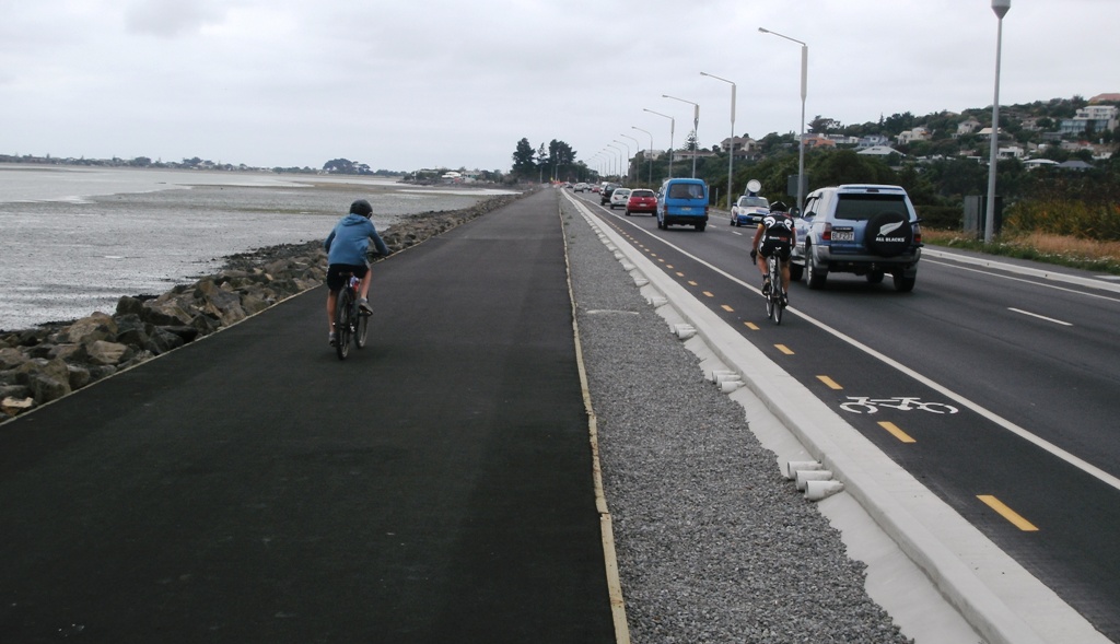
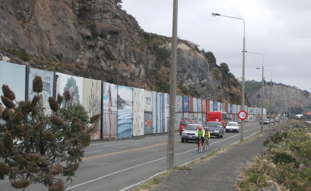
As we made our way to Sumner, there was still evidence of some of the devastating rockfalls that had plagued this area during the quakes. Container walls protect travellers from further debris either side of Redcliffs; unfortunately you also have to hold your breath while you share the lane with traffic for short lengths of road around some of the corners. Fortunately they have applied 30km/h speed restrictions in these places and traffic (for the most part) is good at letting you get through first. But let’s hope that they can eliminate these pinchpoints as a priority along this route.
On to Sumner at last, and here you can start envisage what the finished Coastal Pathway might look like. The existing Esplanade along Scarborough beach is a fantastic facility for all; its width invariably means there is little conflict between users either.

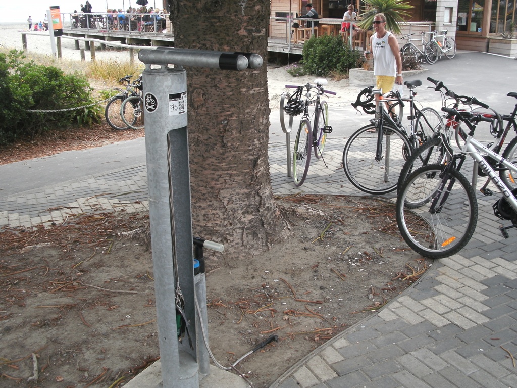
We stopped at Sumner Beach on our way back for some lunch and a wander around the sand. Here we also noticed the very cool cycle repair facility provided right by the beachfront bike parking. You can prop up your bike, pump up the tyres, and fix all manner of problems with the set of tools provided. Very cool – how about a few more of these around the city?
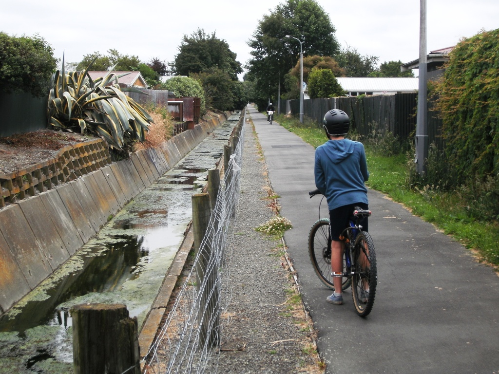
On our way home we decided to take a different route via the Charlesworth Reserve and the Linwood Drain. It’s a bit hard to work out how to get into the Reserve from Humphreys Drive; access from behind Mitre 10 Mega is not at all well indicated. After that though, there is a reasonably good route along the Charlesworth paths, the service lane alongside Linwood Ave, and the Linwood Drain pathway (although some path width and crossing improvements would go a long way). Work is still needed to eliminate the “gap” between Dyers Rd and St Johns St, but this should form part of the “Sumner to City” Major Cycleway Route (scheduled for 2014-16).
All up, it was a great day for riding (not too hot, not too cold), and my boy was very proud to clock up 30km on the journey. Fast forward a few years, and most parts of it may be even more pleasant and accessible to many more people on their bikes.
It’s incredible to see how far some of these routes have come in just a few years. Has that Linwood drain path changed at all? It looks like a great candidate for partial renaturalisation.
No – its still pretty much exactly as pictured. Still a pleasant straight cruise, but it duplicates the Linwood Ave one so probably won’t be high on priorities.
A great wee trip back down Memory Lane. It just makes me realise how fabulous the Coastal Pathway and other MCRs are now – I have biked over the Waimakariri Bridge four times already (2 return trips).
I would really like to see ChristchurchNZ and other PR organisations work hard to promote what we have here for cycle tourism just as the regions do for their National Cycle Trail rides. So easy and interesting to be able to see the city ( every nook and cranny pretty much ) in a week on two wheels. All interests, abilities and codes well catered for. It’s time to get the sizzle onto the sausage; in particular there is a silver demographic who is itching to see the country on bikes as the cruise, the islands, the trip to see family in Aus are all currently off the menu.