
The second part of this post focuses on the benefits to those who ride a bike, as part of DEMP – Downstream Effects Management Plan. A plan developed for CCC to facilitate the smooth passage into the city of up to 30% more vehicles than currently, restrict rat running and to make residential streets safer for walking and biking in the midst of the traffic onslaught.
To recap with a picture …
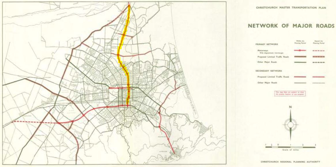
In 1962, grand plans were announced for a new motorway to facilitate faster access to Christchurch from the North Canterbury inland farming communities and service towns of Rangiora and Kaiapoi. Initially intended to join the also-planned southern motorway at Waltham, the first stage from North Kaiapoi to Belfast was completed 5 years later.
Over the next few decades considerable growth for the Waimakariri District resulted as farmlands were divided into lifestyle blocks and small towns grew into much larger ones. City folk moved out, taking advantage of better and cheaper land and housing options plus cheaper cars and petrol, to become the commuters from the north. In 1975 the decision was made to terminate the motorway at Bealey Avenue rather than linking through to Brougham Street.
Also in the 1960s, a plan to slice up the neighbourhoods of New York City to build a freeway network on a scale not unlike what we now see in Los Angeles was successfully opposed by the people of those neighbourhoods led by Jane Jacobs. More recent changes to make New York a more people-friendly city as opposed to one of roads and cars are slowly paying dividends.

So it was not surprising that the people of St Albans rose up during the 1980s and early 1990s to oppose the planned motorway development from Belfast through to Madras Street by the Ministry of Works; a plan that was dropped in 1995. The plan (of sorts) was resurrected post-earthquake and fast-tracked using powers enabled by earthquake legislation. The Christchurch Northern Corridor was deemed necessary to prevent severe congestion on the Main North, Papanui, and Marshland Roads as thousands of earthquake displaced folk resettled in North Canterbury towns and districts.
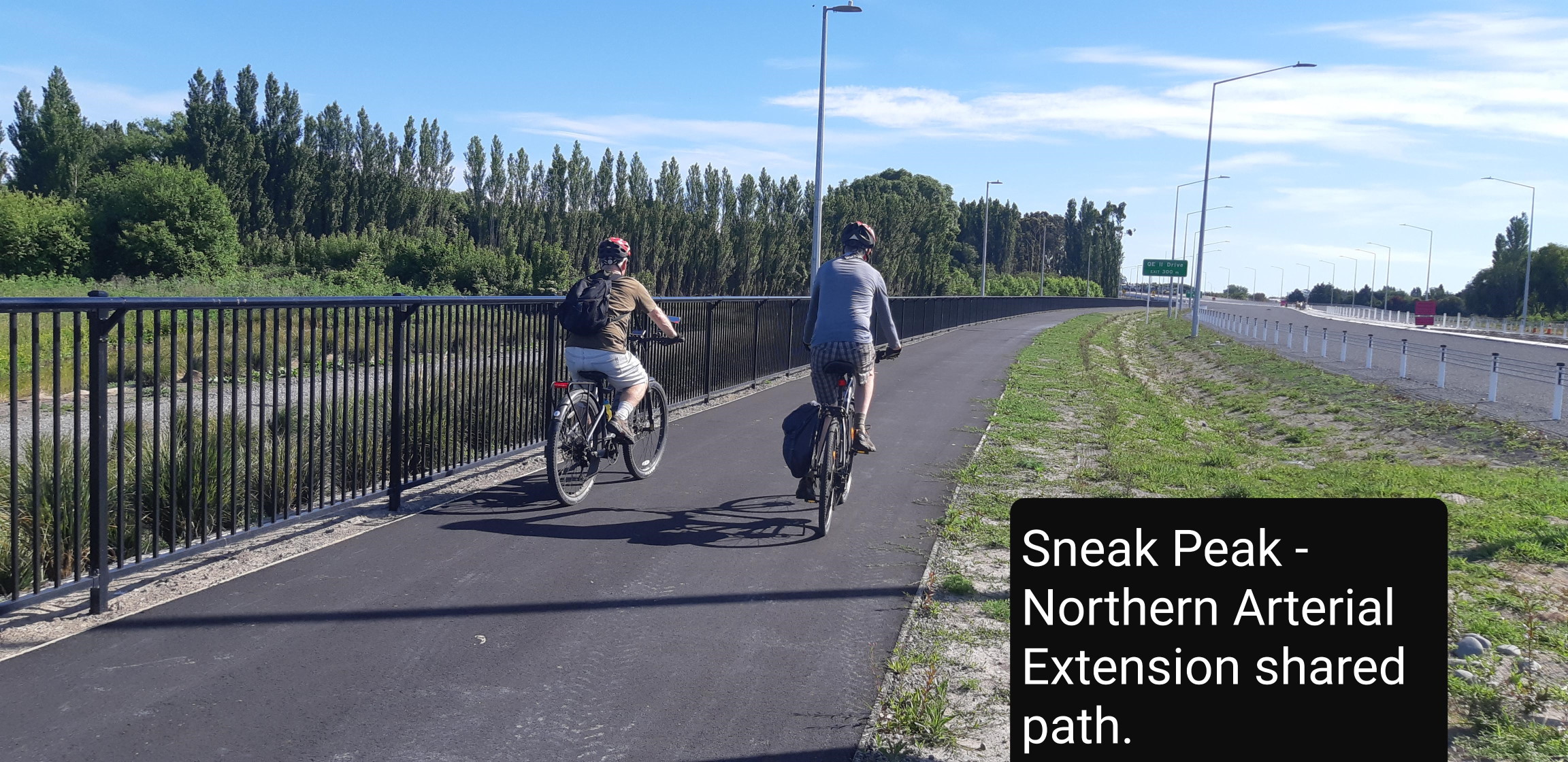
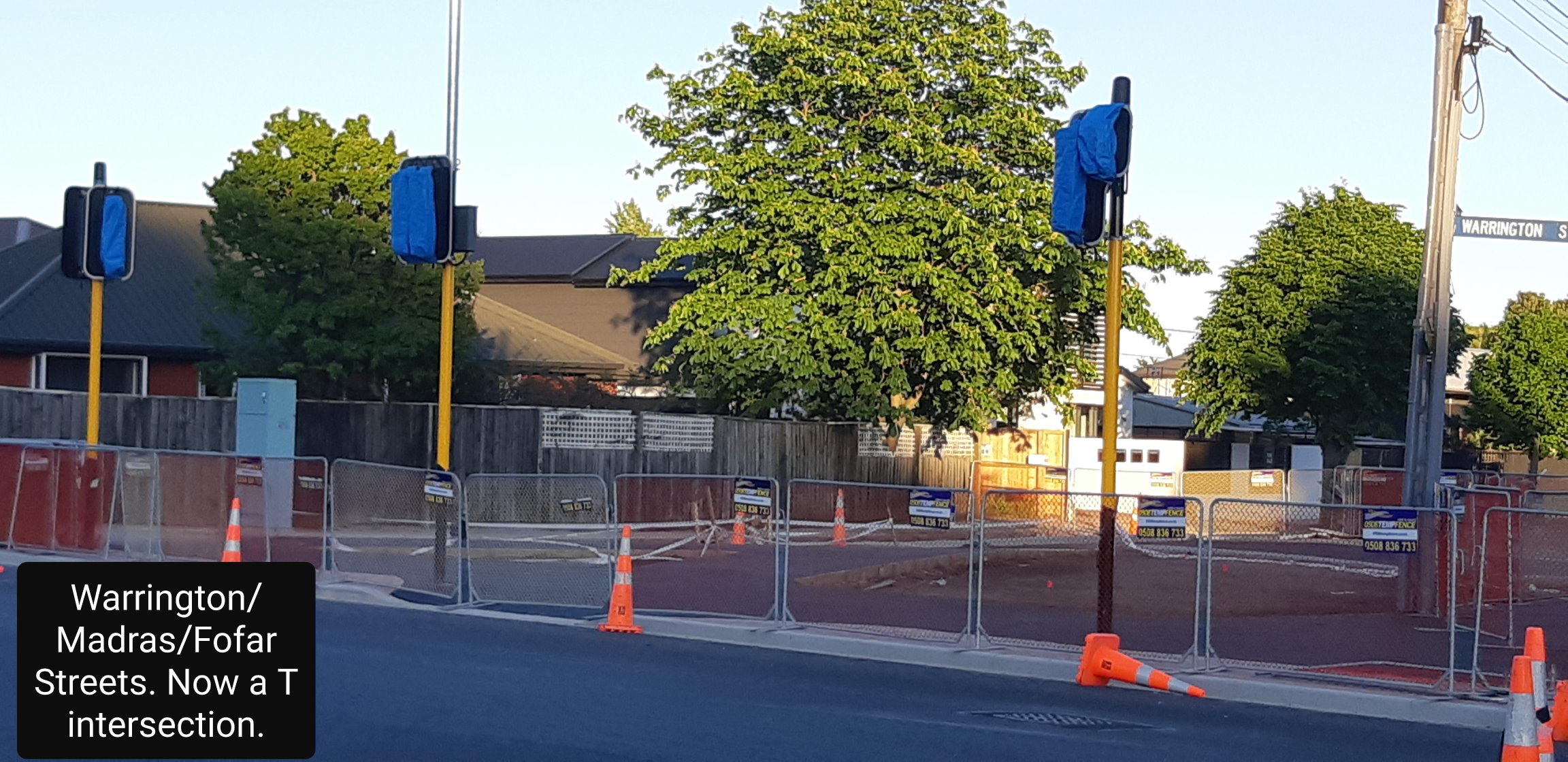
Rather than dissect St Albans and Mairehau with a four lane new road to Bealey Avenue, Cranford Street was chosen for the route south to Bealey Avenue. A connection from QE II Drive onto a widened Cranford Street, plus intersection upgrades to funnel traffic via Madras, Barbadoes and Sherborne Streets was deemed the best option. The corridor opening is just a few short weeks away.
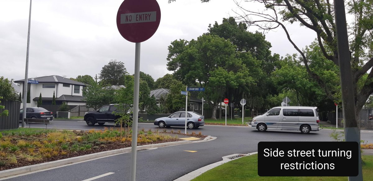
Increased rat running and unsafe streets for those who walk, bike, or scooter particularly near schools has always been the concern of the St Albans residents. The hard pill to swallow has been the fact that any reduced access to local streets to curtail rat-running will also restrict movement for locals, particularly those who regularly have to get from one side of Cranford Street to the other.
It appears that the cost of the project, whichever way you look at it, makes our cycleway network quite a bargain by comparison, particularly if the cost of loss of amenity for St Albans residents is factored in.
The DEMP project has been actioned over the last 12 months, understandably creating difficulties for those who move through and around St Albans; a bittersweet price to pay for the promised rosy travel future north from early 2021. A delayed decision (now due to be made on Nov 26th) by CCC will decide whether or not the widened section of Cranford Street between Innes Road south to Berwick will provide bus lanes, a high occupancy vehicles lane (or both together) or peak time clearway lanes.
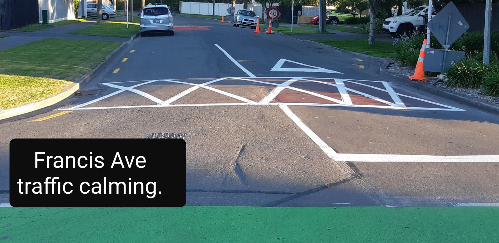
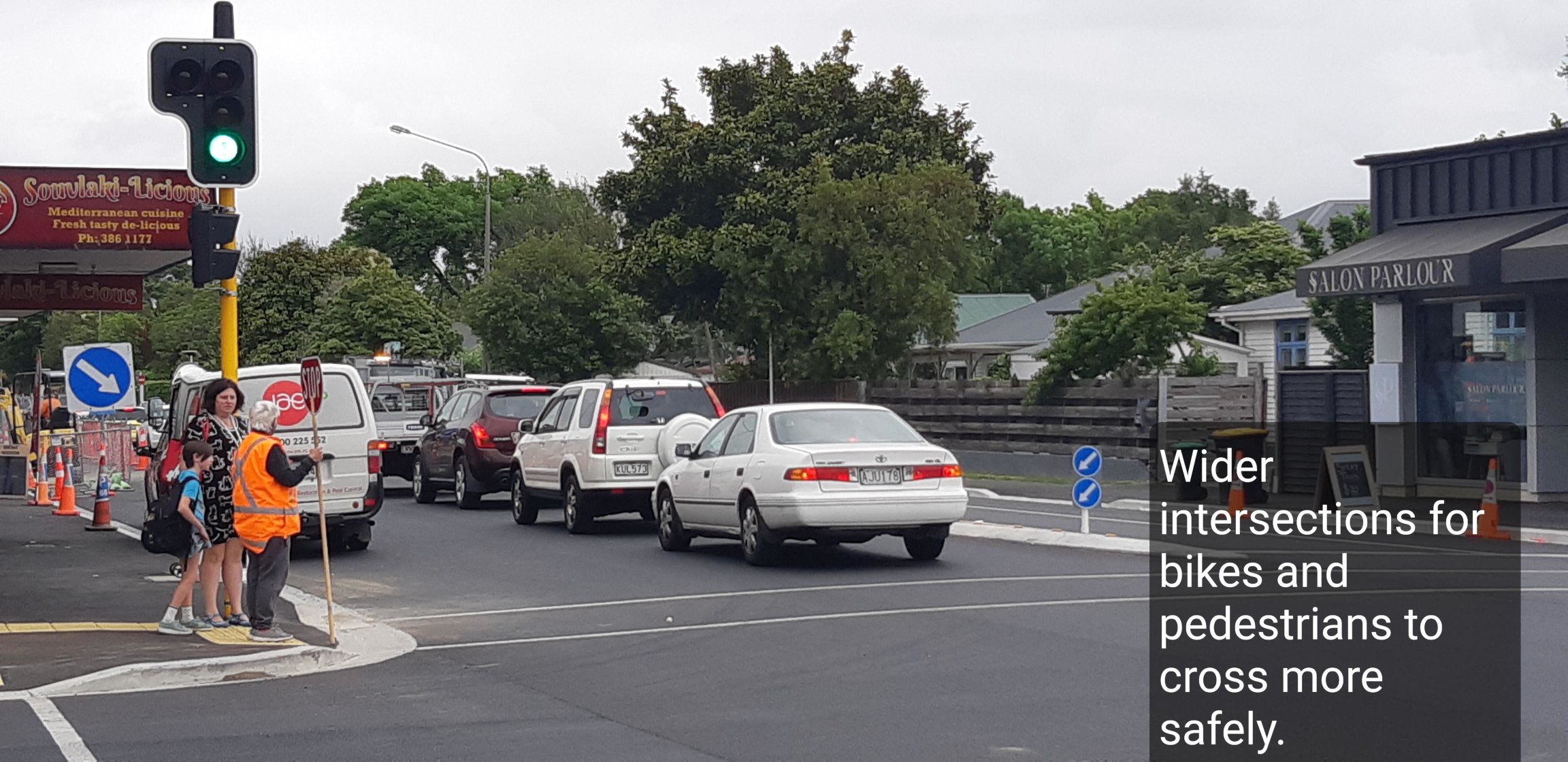
Lowering the speed on all but major roads to 40km/h, safer intersections for pedestrians and cyclists, street traffic calming measures (yet to be implemented) and restricted turning allowance both onto and off Cranford Street are all in the mix to reduce the level of rat-running and improve street safety for residents.
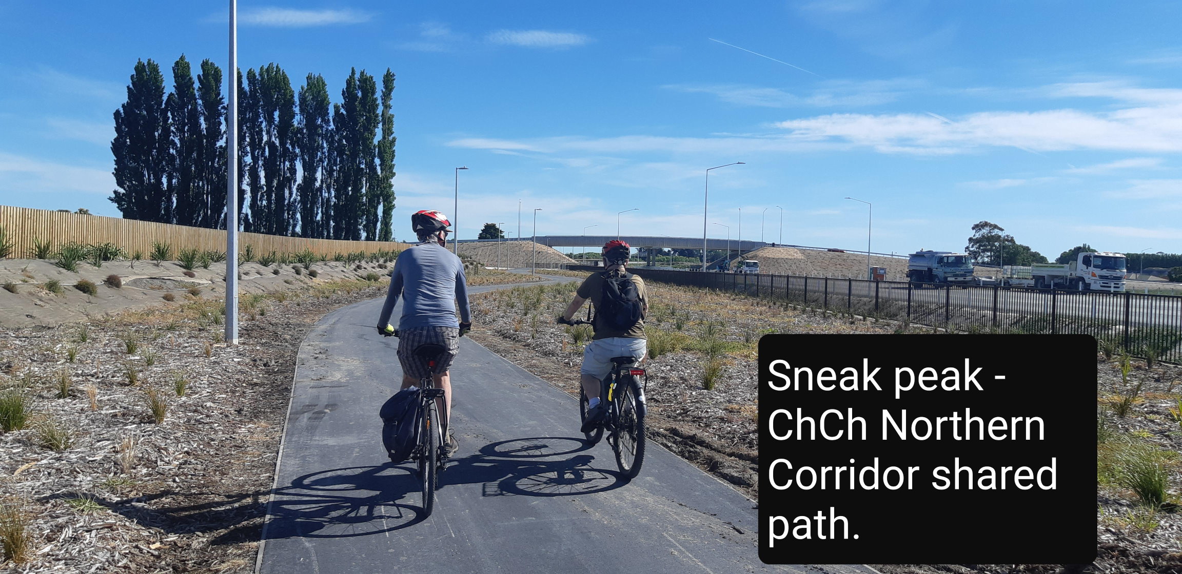
What do you think of the new cycleway works around the Northern Corridor?
I have ridden parts of this and found it really great. Looking forward to going further north.