
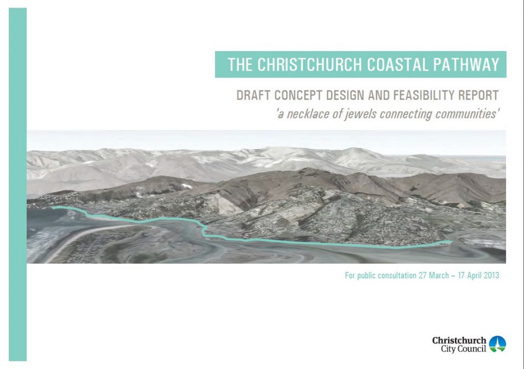
Many of you will have enjoyed riding on various parts of the Coastal Pathway over the past few years, almost providing a continuous off-road route from Ferrymead to Sumner. It’s interesting to think that it was only seven years ago that the whole concept was still just a community dream looking for some funding. This post, originally published in Apr 2013, outlines the original plan consulted on by the City Council.
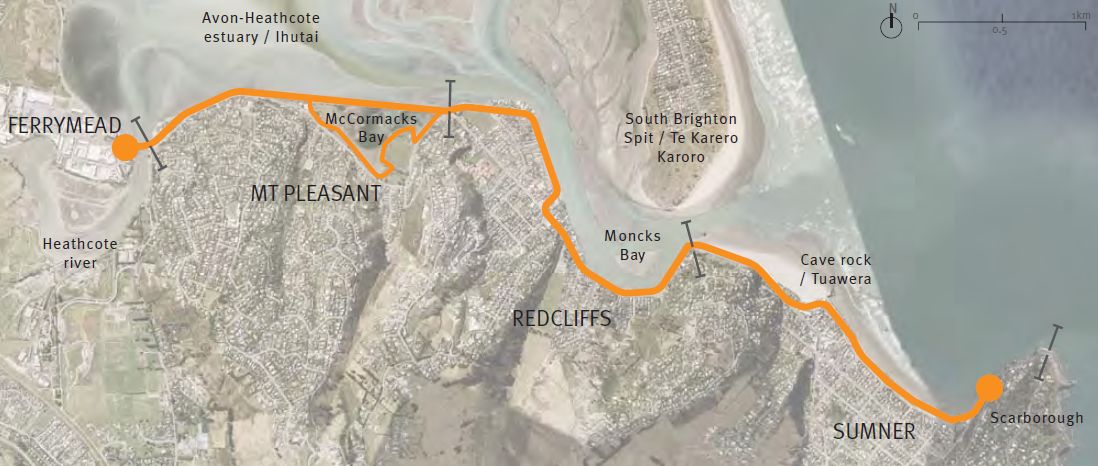
A few months ago we told you about a few exciting initiatives happening on the east side of Christchurch. One of them was the Coastal Pathway, a 6.5km shared corridor for walking and cycling along the water-side between Ferrymead and Sumner. After some initial consultation and investigation work, a draft Concept Plan has now been released by City Council for public consultation until Wed 17th April.
The Coastal Pathway has been a triumph for grassroots community planning, with the locally created Coastal Pathway Group being the prime instigators to get both local resident and Council support for this project. It has modelled its vision on a number of similar “waterfront promenade” facilities around the world, including local examples in New Plymouth and Wellington.
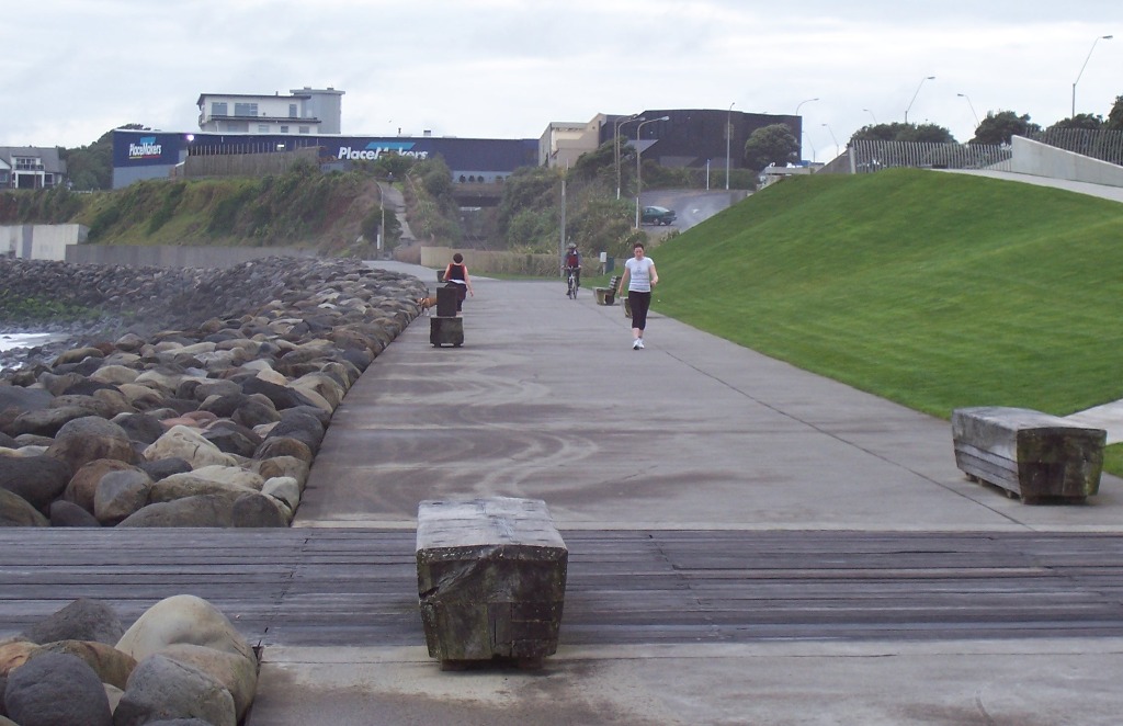
Unlike much of the New Plymouth pathway, the Christchurch one will be running very closely alongside the main road to Sumner for most of its way. Although there are/were on-road cycle lanes all the way along, these have been somewhat diminished thanks to post-quake temporary works (with the “rockfall protection containers” not feeling very protective to many people), and many would-be riders probably wouldn’t have considered them friendly enough anyway with all that adjacent motor traffic.
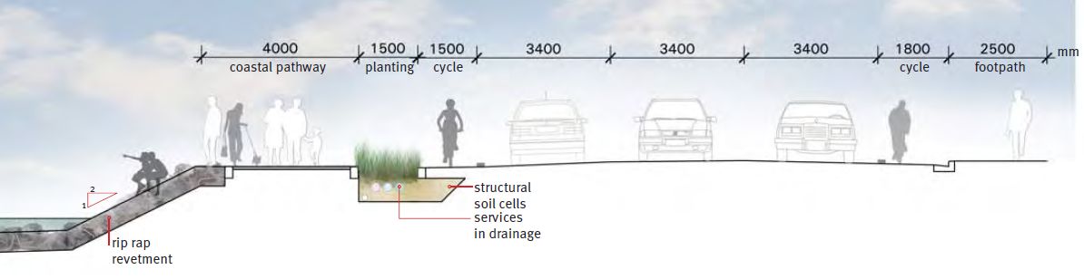
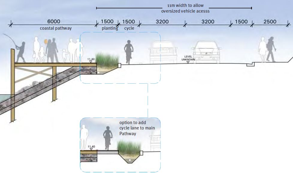
The Concept Plan has generally aimed at providing a reasonably wide shared pathway for its length, with separate cycle lanes as well. Sometimes this is using the existing waterfront, sometimes additional reclamation will be needed, and sometimes a separate structure such as an overhanging boardwalk has been considered.
Probably the most contentious part of the Plan was the proposed route along the waterfront through Redcliffs. Some of the residents with properties fronting the estuary weren’t too keen to see a pathway between them and the water. So, for now now at least, the proposed route heads in past the Redcliffs shops on the main road – avoids a major battle for now, but I suspect that this will be revisited in the future.

From a cycling perspective, the other thing not strongly promoted in the draft Plan is the use of separated cycleways rather than on-road cycle lanes. There is clearly a desire to separate recreational riders (who may be happy to dawdle along with other path users on foot) from faster utility riders such as commuters. However the utility riders may be keen for a bit of traffic separation too, so more use of kerb separators between traffic and cycle lanes wouldn’t go amiss.
So what’s the price-tag for this concept? The draft Plan costs the entire proposal from Ferrymead to Sumner at $17.8 million, with the section between Shag Rock and Cave Rock the costliest at $5.7m alone. Interestingly, an earlier report suggested that the whole route would cost $26m; perhaps some concepts got pared back a bit? In the context of various other infrastructure projects out there right now, <$20m is not an outrageously expensive investment. It should be noted that the Coastal Pathway group envisage sourcing funding from a variety of sources, including donations and community trusts, so the hit to the ratepayers pocket will probably be a lot less.
Council are now seeking public feedback on the overall Concept Plan; there are also some drop-in sessions being held at various community centres where you can find out more about the project and provide feedback directly. Written submissions can be submitted up until 5pm Wed 17th April.
What do you think about the Coastal Pathway Concept Plan?