
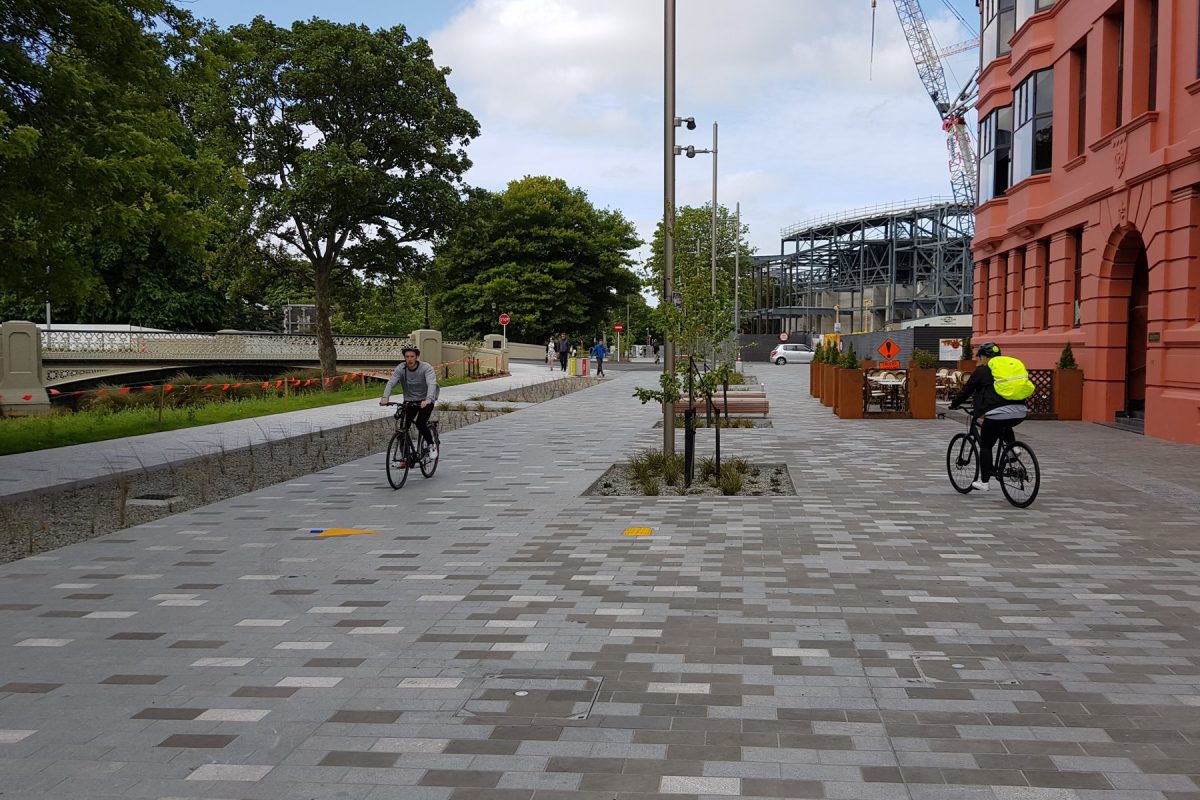
I’m slowly appreciating a new route through town as a great place for biking – the Oxford Tce “City Promenade”. Since its opening in late November, this new corridor along the Avon River is providing a relatively traffic-free link to many central city destinations and beyond.
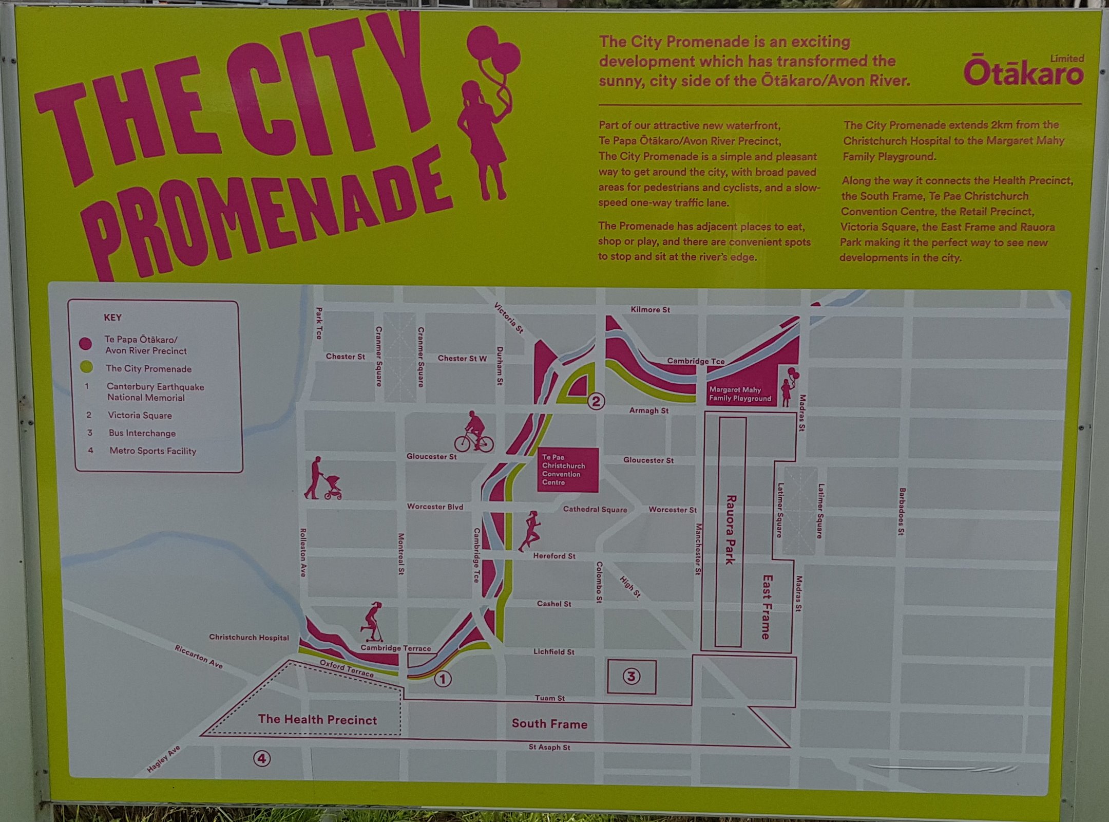
Let’s have a look at the route in more detail. Robert has already given you an overview of the westernmost “Oxford Gap” section past the hospital; this connects to the Little River Link towards the southwest. On reaching the mini-roundabout at Antigua St, you are also connected now to the Quarrymans Trail to the south, and across the Boatshed Bridge north towards the Uni-Cycle.
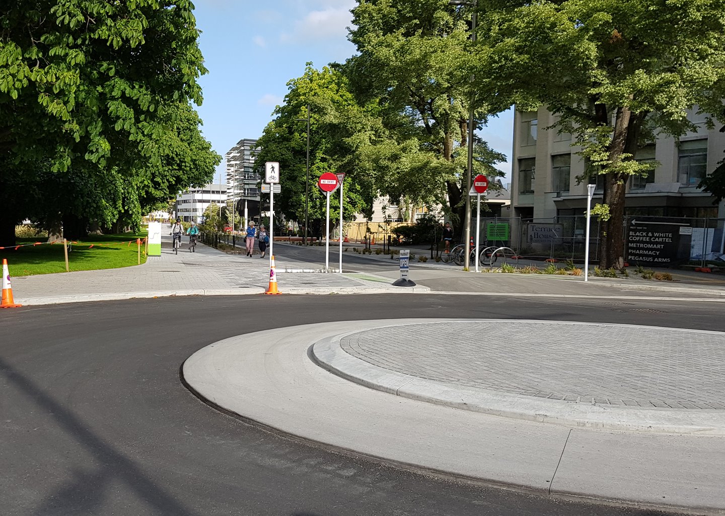
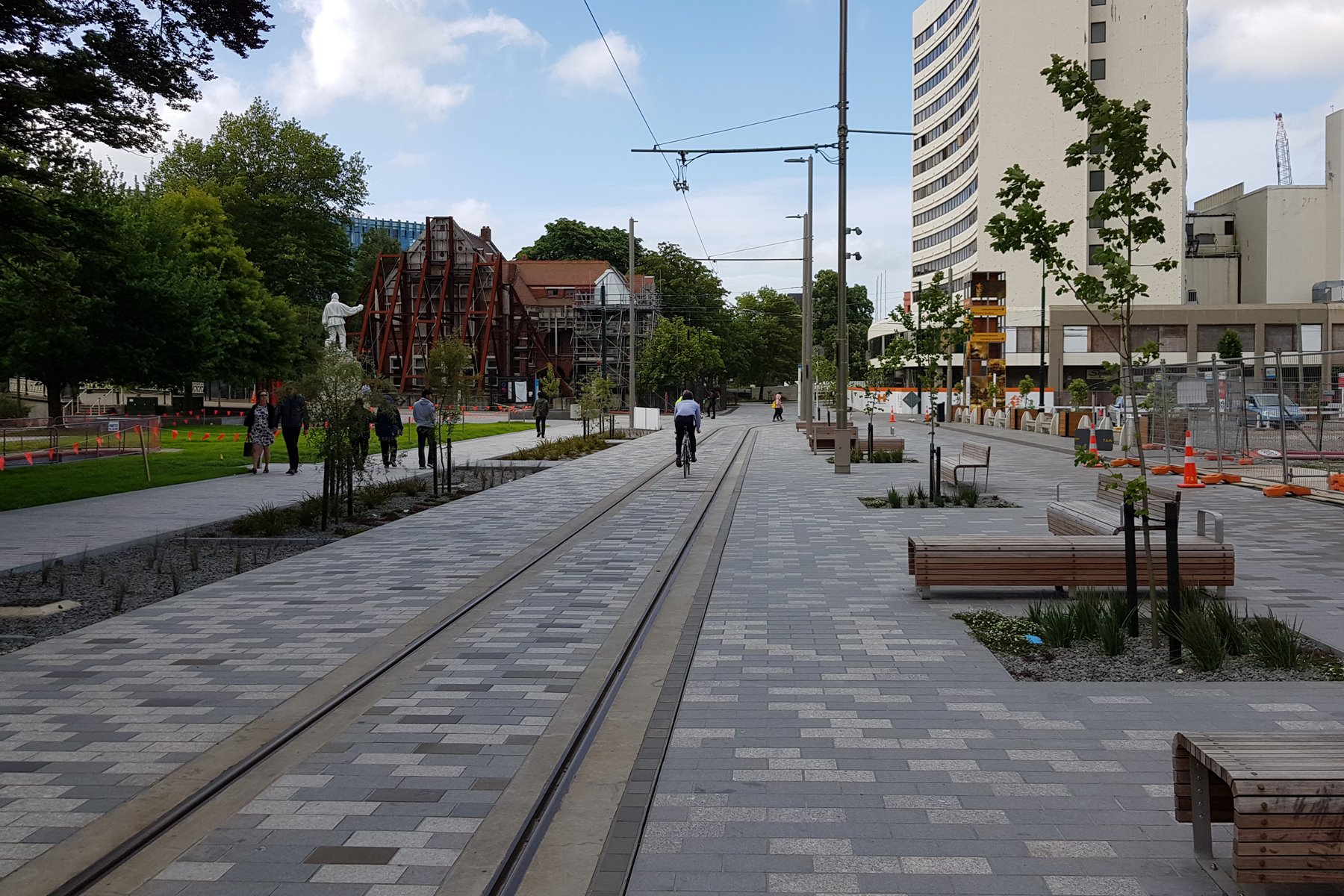
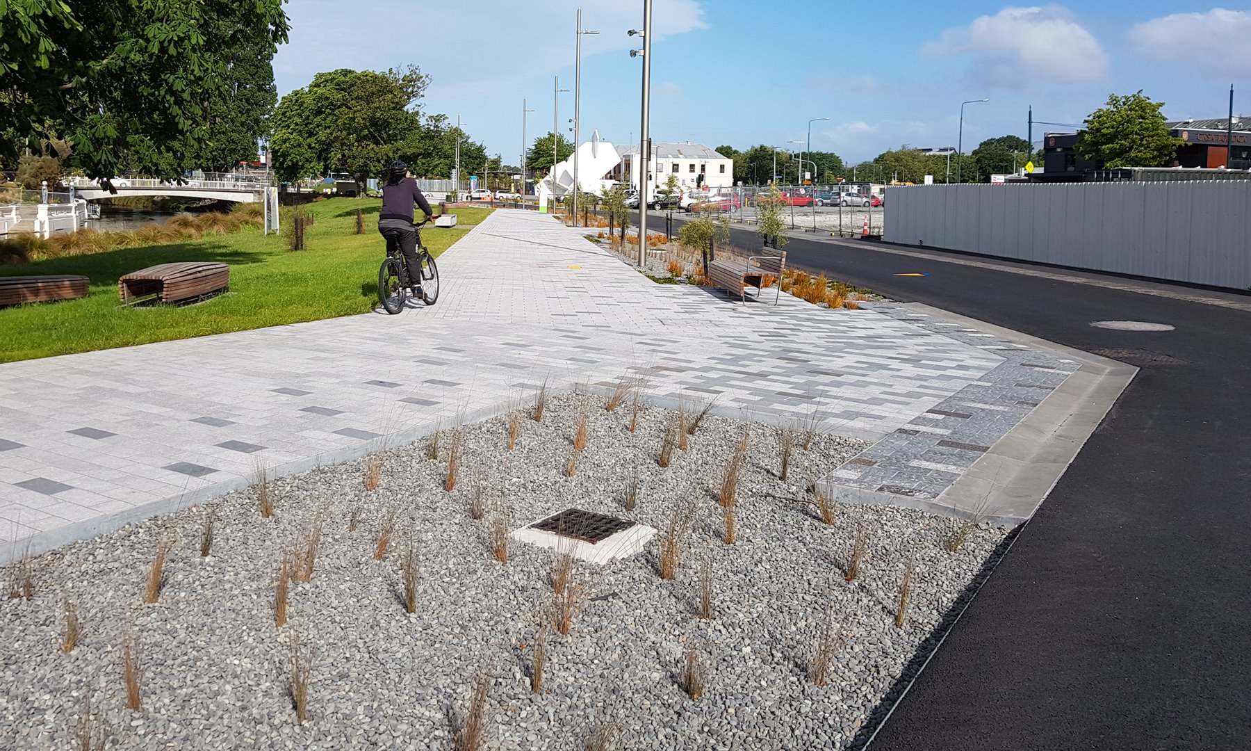
The Oxford Promenade is a shared zone and each section is one-way only for motor traffic; however, cycles are allowed to ride in both directions, so don’t be put off by the NO ENTRY signs.
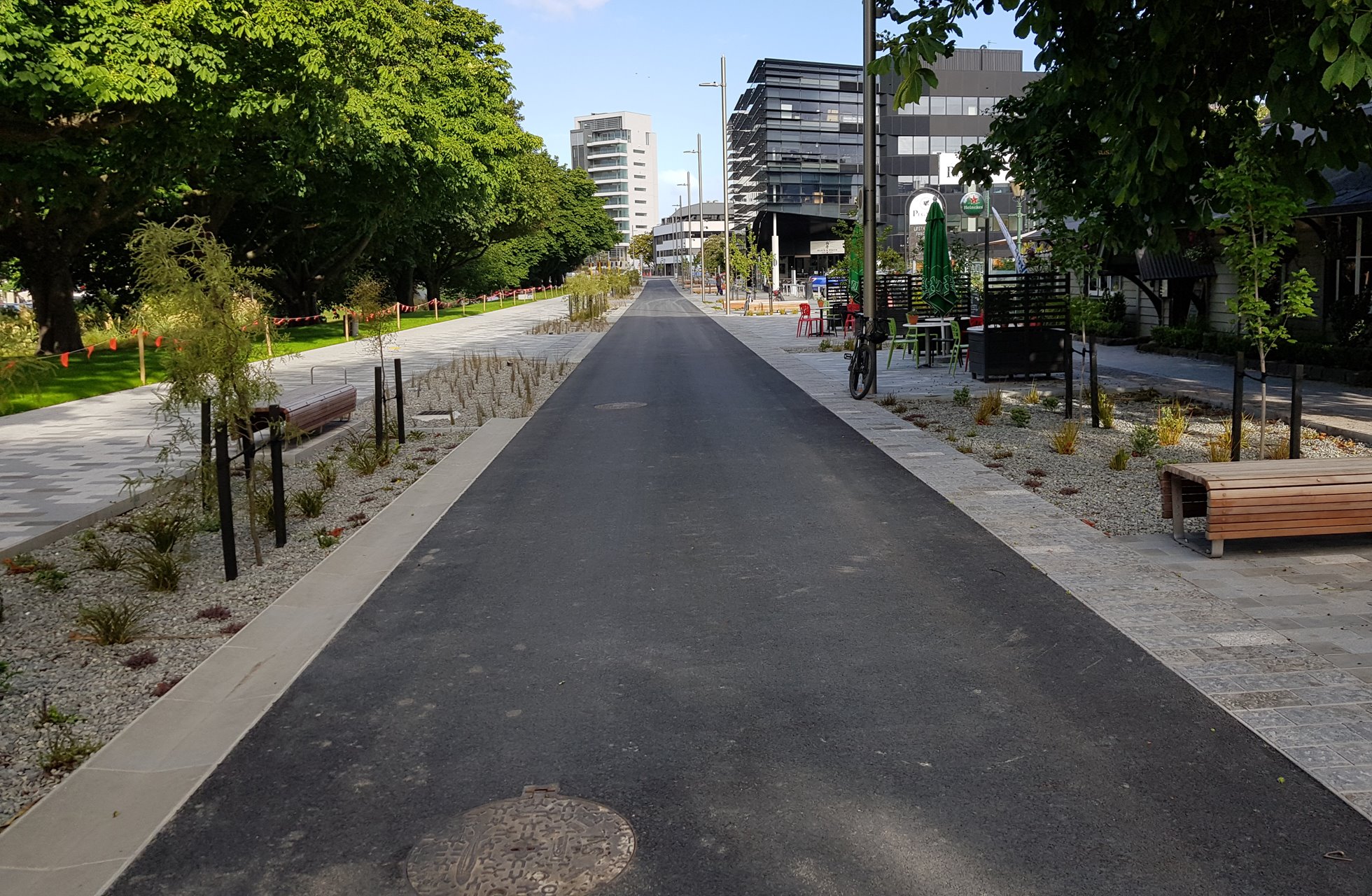
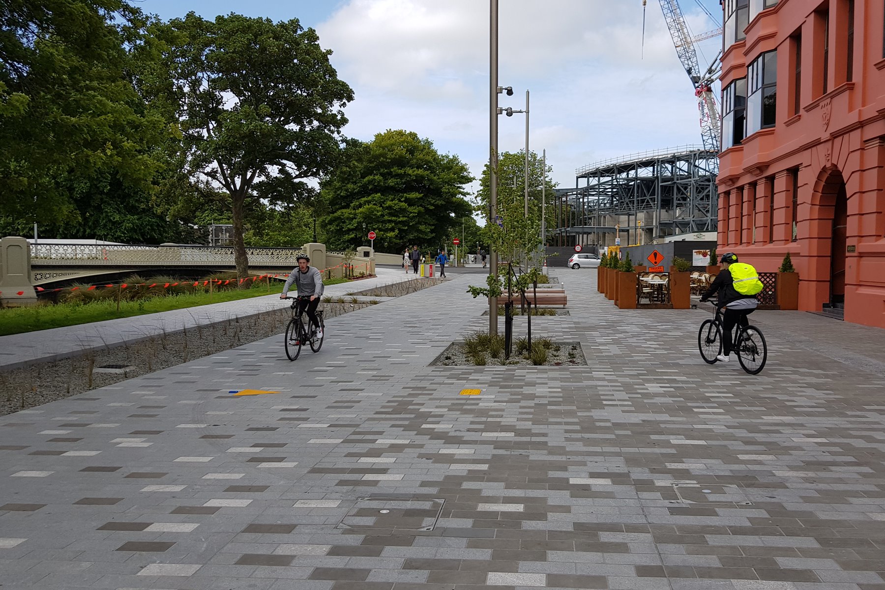
For much of the route, there is both a tiled pathway area and a (typically asphalt) driving area. It’s up to you as to where you prefer to ride; it may depend on what road users and other people are about.

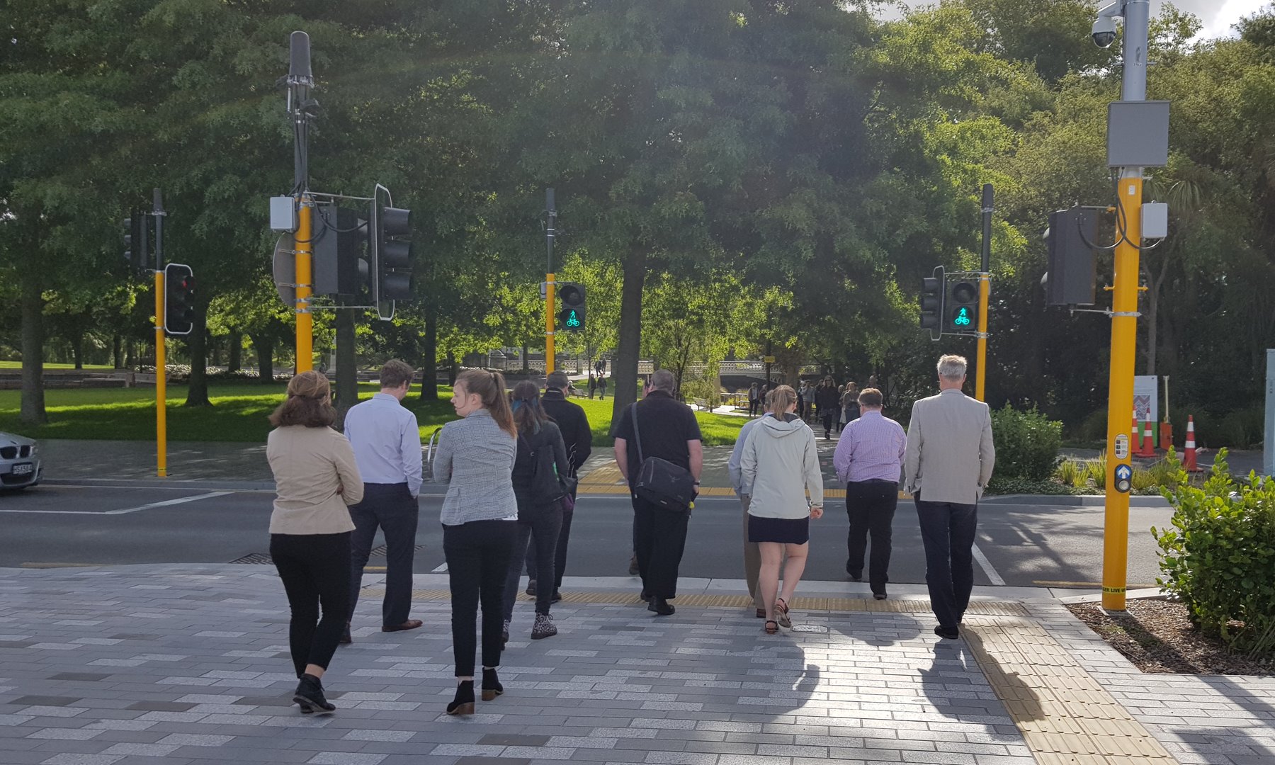
When you get to the main roads crossing the corridor, signalised crossings help you to get across. They can be a bit slow at times though to let you cross, so a lot of “civil disobedience” is definitely evident when not much traffic is about.

The Promenade uses some very nice urban design features throughout the route, including seating and bike parking (never seems to be enough of the latter!). One word of warning: watch out for the drop into some of the adjacent rain-gardens, especially when vegetation starts to conceal it.

At Durham St, the route follows Oxford Tce to a crossing by Lichfield St. But there is also a more direct footpath crossing by the bridge if you prefer (although again, the signalised crossing is painfully slow…).
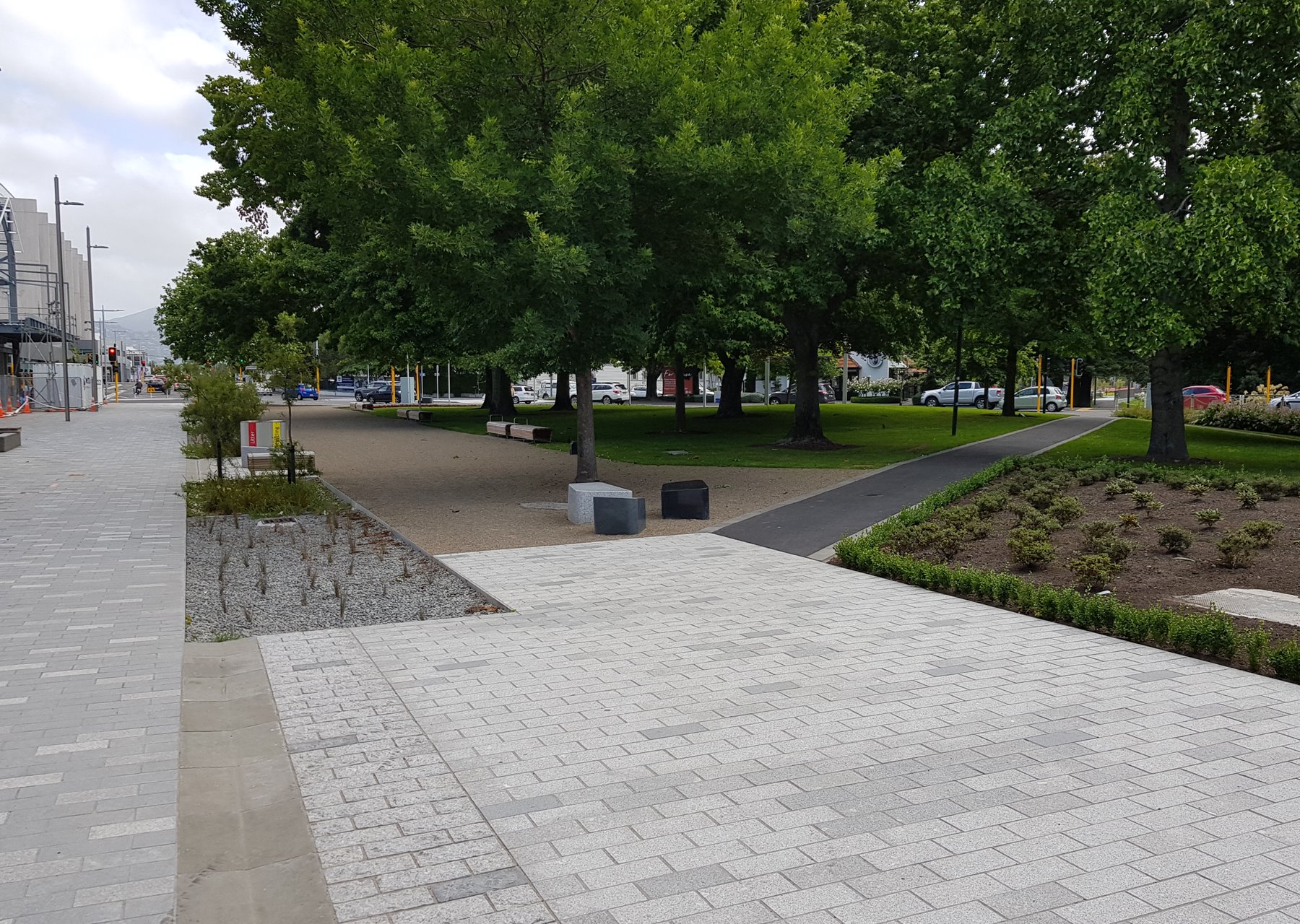
The area around The Terraces bars and restaurants has been open the longest and has already been a great success. What’s needed now is similar “activation” of some of the newer sections.

One little thing to watch out for now is when crossing Hereford St (still to be reconstructed). Signals control this intersection, but at present there are no signals facing north; if you’re coming from The Terraces you’ll just have to keep an eye out for the side signals to know when you can go.

Between Cashel St and Worcester St the tram route follows the Promenade, so just be careful when riding over the tram tracks – always do it at a square angle if you can.
Construction of the convention centre is busy taking place as you head further north. In due course, you will be able to connect to Cathedral Square from the Gloucester St Bridge via a new public space.
The Promenade continues through Victoria Square following the traditional curving paths. You can also connect from here northwest towards Victoria St; likely to be a more useful cycle route in the future. From Colombo St, heading north takes you to the Papanui Parallel route too.

An interesting feature along this route is the trialling of combined signals featuring pedestrian and cycle symbols (also being trialled elsewhere on Christchurch’s cycleways). Given the shared nature of this route (and short crossing distance, making visibility easy), they make a lot of sense.
The final section of the Promenade leads from Colombo St to Manchester St and the Margaret Mahy Playground. There is a new signalised crossing just north of the Manchester St bridge that will connect to Cambridge Tce, and the signalised intersection at Armagh/Manchester immediately south. What is a bit odd though is the pedestrian refuge island at Manchester St, directly on the route but with no kerb ramps; I’ve yet to hear a convincing argument for their omission…
I gather that a cycling route along the north/west (Cambridge Tce) side of the Avon River is still (slowly) in progress (and there will be a bridge connecting the two sides east of Colombo St). There is also further work planned to connect the Promenade to the Avon River red zone further east. For now though, the Oxford Promenade already provides a very handy new connection through town.
What do you think of the Oxford Promenade?
I rode along it last week and it’s great
I think it’s fabulous – Christchurch is very lucky with all these wide, shared spaces. Just a lovely route along the river. Terrific vibe with people walking/cycling/e-scooting about.
In the second photo of Oxford Tce entry from the Antigua roundabout there are give way signs for the cycle/pedestrian traffic heading north/south on Antigua. Why is this?
Oxford Tce is not an arterial or major route of any kind for car traffic, yet cars are given priority over people using a major cycle/pedestrian route. Is this a fault of our outdated traffic laws or just the typical incompetence of Otakaro planners?
Could it be Dirk for the same legal reason that the cycle path along Collins Street requires cyclists to give way to traffic turning in and out of both Macaulay and Emerson Streets ? If so, I think the law needs looking at. A little niggle at the roundabout going north along the shared path on the east side of Antigua is that the line of sight to the Antigua Street Bridge is to shoot onto the roundabout, avoiding that crossing and all of the pedestrians up until the bridge approach. Until you get to the kerb, that is and either have to dismount, or return back to the shared path. I know the reasoning behind this, but it is an irritation all the same.
My experience of riding on Christchurch cycleways is that you are actually safer to have to give way to cars as you can never be quite sure if the cars are going to give way even when they are meant to. When I first started riding my bike on the cycleways all the lovely green paint gave me a false sense of security. After having had numerous near misses with cars racing across cycleways without even looking for cyclists I now have a strict policy that I treat every motor vehicle as if it is out to kill me. I figure that legally being not at fault is of no use to me if dead.
The bike parking issue seems to be getting rectified – last week about 5-6 bike stands were installed next to the Earthquake Memorial, by the water fountain at the intersection with Montreal. I’ve had good experiences using the covered bike parking offered at the Bus Interchange and Lichfield St parking building.
It’s fabulous. At Manchester St, just turn north – just over the bridge on Cambridge Tce side is the safe crossing point for cycles, lights there and you can continue on either side of the river to Kilmore, but riding through the poplars on Cambridge Tce (north side) there is less pedestrians than beside Margaret Mahy. Enjoy !
Not so great in the wet winter on either side though; still waiting for them to produce an all-weather riding surface here…
Hi All – info (from last week) on cycle parking provision for the promenade… “I am advised that to determine potential cycle parking requirements as part of the “Cycling accessibility” project, staff from the Transport Unit are going to walk the Promenade on Wednesday of this week with the project manager from Ōtākaro. They intend to identify where Ōtākaro are putting cycle parking and to create a list of potential sites for more cycle parking. This information will be put forward as one of a range of proposed projects for discussion with ITE and then subsequently submitted for formal approval.”
Should have been done early with he original design work -but at least it is happening 🙂
Hi,
I am curious about the cycle exemption regarding the one-way traffic on the road. Both Transport for Christchurch as well as Ōtākaro Ltd claim that the road itself is one-directional for *all* vehicles, but if that is the case, it is my understanding there would need to be a bylaw/resolution that abolished the cycle exemption after it was introduced in 2014/15 (I have set out my understanding here ). So are they simply wrong, or am I missing something? Also, if I am not wrong, are there any plans to make it clear to cyclists that they are allowed to use the road in both directions? I find that the tiled section can become quite crowded, so I prefer using the asphalted section, but I am not keen on getting into an argument with a motorized road user without any signage to back me up.
Cheers,
Jan Jakob
Aargh, a goblin (me, putting the URL in angle brackets) has removed all links from my comment. Anyways, the most important one is the last one to my discussion with the Transport in Christchurch people: https://www.facebook.com/TransportChCh/posts/2329003927331163?comment_id=2329189663979256&reply_comment_id=2329298860635003
Trpt for Chch are certainly confused, and I got the original advice directly from Ōtākaro staff. As you note, the bylaws also make clear the exemption, although I could happily leave out the two-way on-road provision for the last section towards Hagley/Riccarton Ave.
Ōtākaro didn’t originally want to add extra sign “clutter” to the Promenade, only adding it later if need be. Personally I don’t think a few small contra-flow cycling signs at the start/end of each block are very jarring to the layout, but certainly would add a lot of clarity…