

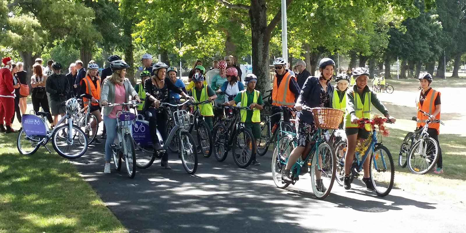
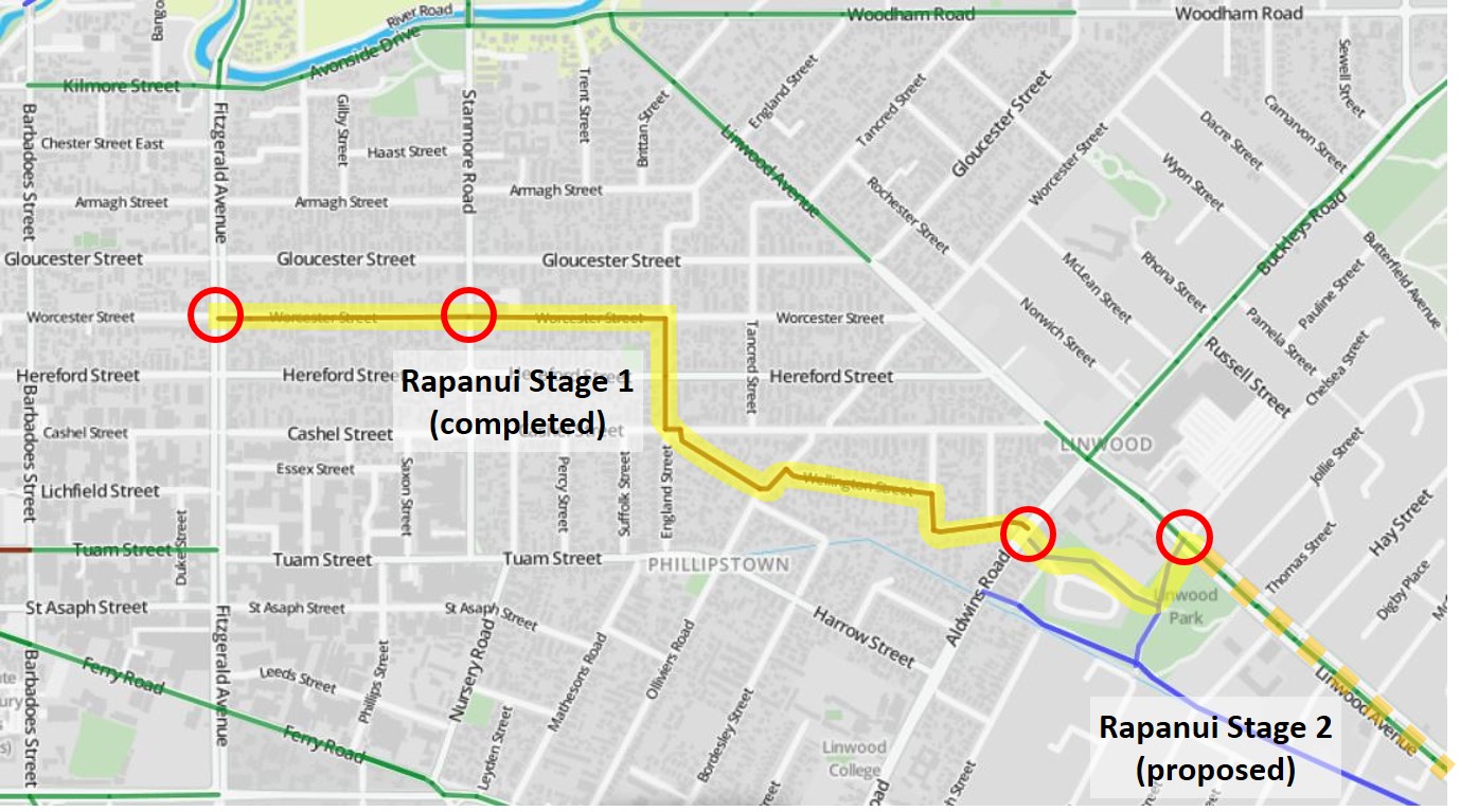
Last Wednesday morning was a happy affair for many, with the official opening of Stage 1 of the Rapanui (Shag Rock) Major Cycle Route. This is the first part of what will eventually be a cycle route all the way from town out to Ferrymead via Linwood, connecting at the end with the Coastal Pathway.
The Rapanui cycleway is significantly different to many of cycleway predecessors in being wholly a neighbourhood greenway for its length between Fitzgerald Ave and Aldwins Rd. We’ve talked before about how these kinds of “bicycle streets” are an important part of overseas cycling networks like the US and the Netherlands, but they are still a relatively unknown concept in New Zealand. Perhaps not surprising then that The Press saw an easy target to poke fun at (and to bait the predictable online comments…), without actually bothering to find out what they were about…
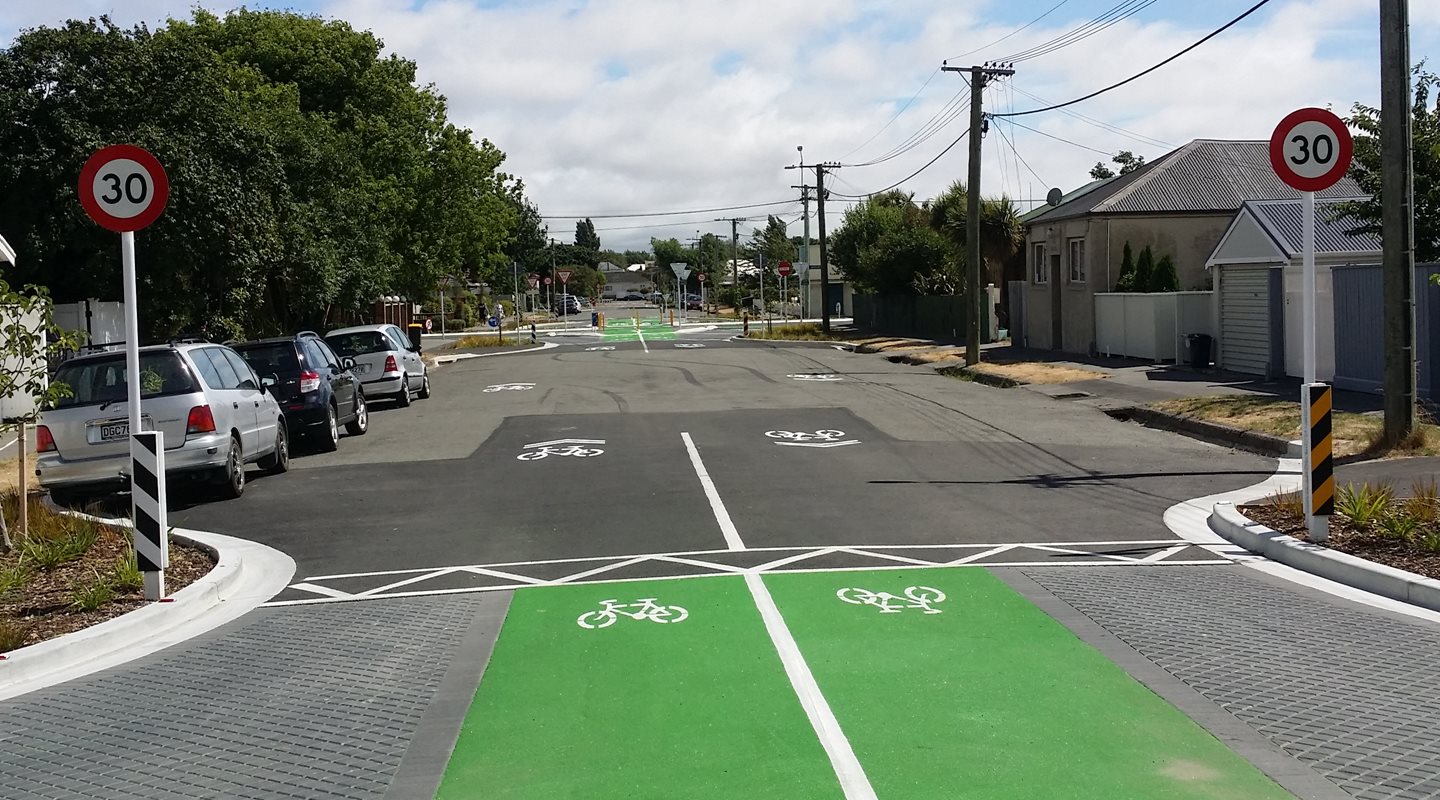
The key concept is that when you have a route along less busy local streets, it is not sensible to install costly separated cycleways like we’re seeing on many busier roads. Instead, if we can get the traffic volumes and speeds down to comfortable levels (typically <2000 vehs/day and 30km/h) then riders can simply share the existing quiet street. Some streets may already be like that, but others may need help in terms of traffic calming and street restrictions to discourage unnecessary traffic.
In the case of Worcester St, a major part of this cycleway route, there are two “collector roads” running parallel 100m to the north and south, so it makes sense to steer through-traffic there instead. Hence the work at Fitzgerald Ave to block east-west through-movements by motor traffic while still allowing bikes to go straight across. As per usual, there have been all sorts of grumbles that this is the end of the world for nearby businesses, which seems daft given that it’s a grid network – 99% of drivers can just use the other two “sides of the rectangle” to get to their destination, requiring no further travel distance.
Another important piece of the puzzle is to also introduce a lower speed limit along the route. So you will notice that the whole greenway section is now posted at 30km/h.
Let’s have a look at the route, starting from the east and working our way into town. Our journey (for now) starts at Eastgate mall, where the existing signalised crossing of Linwood Ave leads you to the cycleway entrance into Linwood Park.
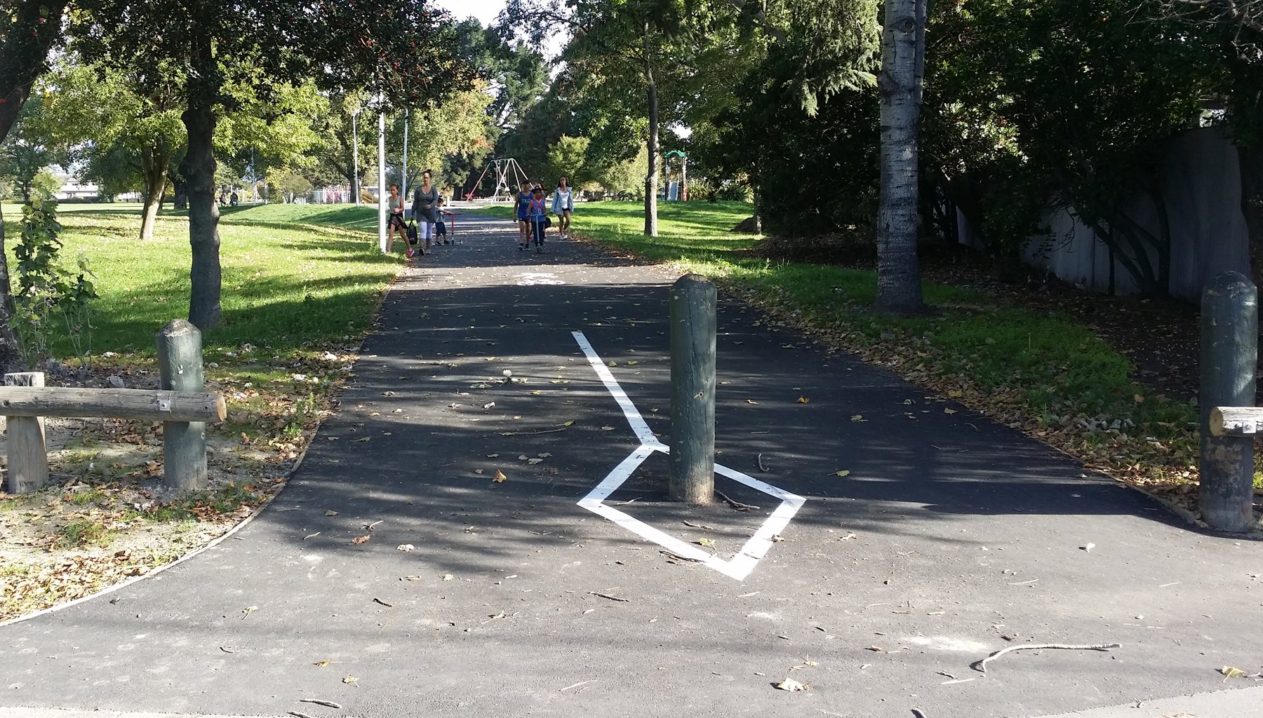
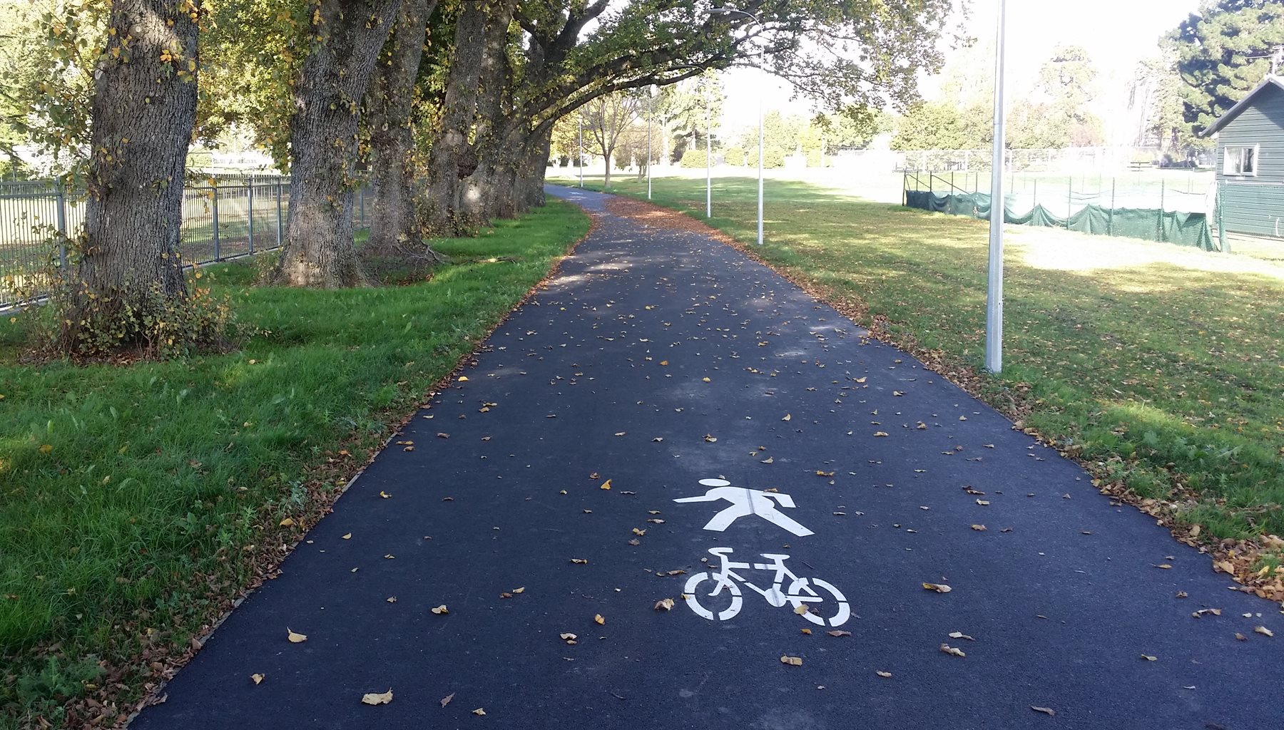
The shared pathway through the park is a good width and winds it way around to Aldwins Rd (you can also connect to other existing pathways like the Linwood Drain route).
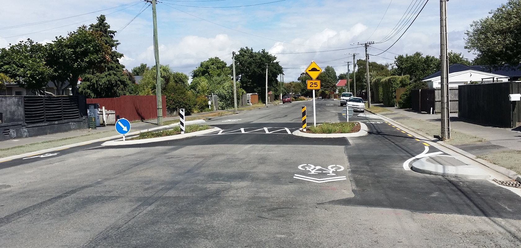
At Aldwins Rd, a new pedestrian and cycle signalised crossing gets you across four lanes of traffic and into the start of Marlborough St on the other side.

Now we’re into the neighbourhood greenway section; Marlborough St winds around to Clive St and then onto Wellington St. I expect that some cycleway signage will appear along the route soon (like we’re starting to see on the other new cycleways) but generally it’s actually pretty easy to follow your way through simply by seeing which way the new kerbing steers you around corners and following the “sharrow” markings.
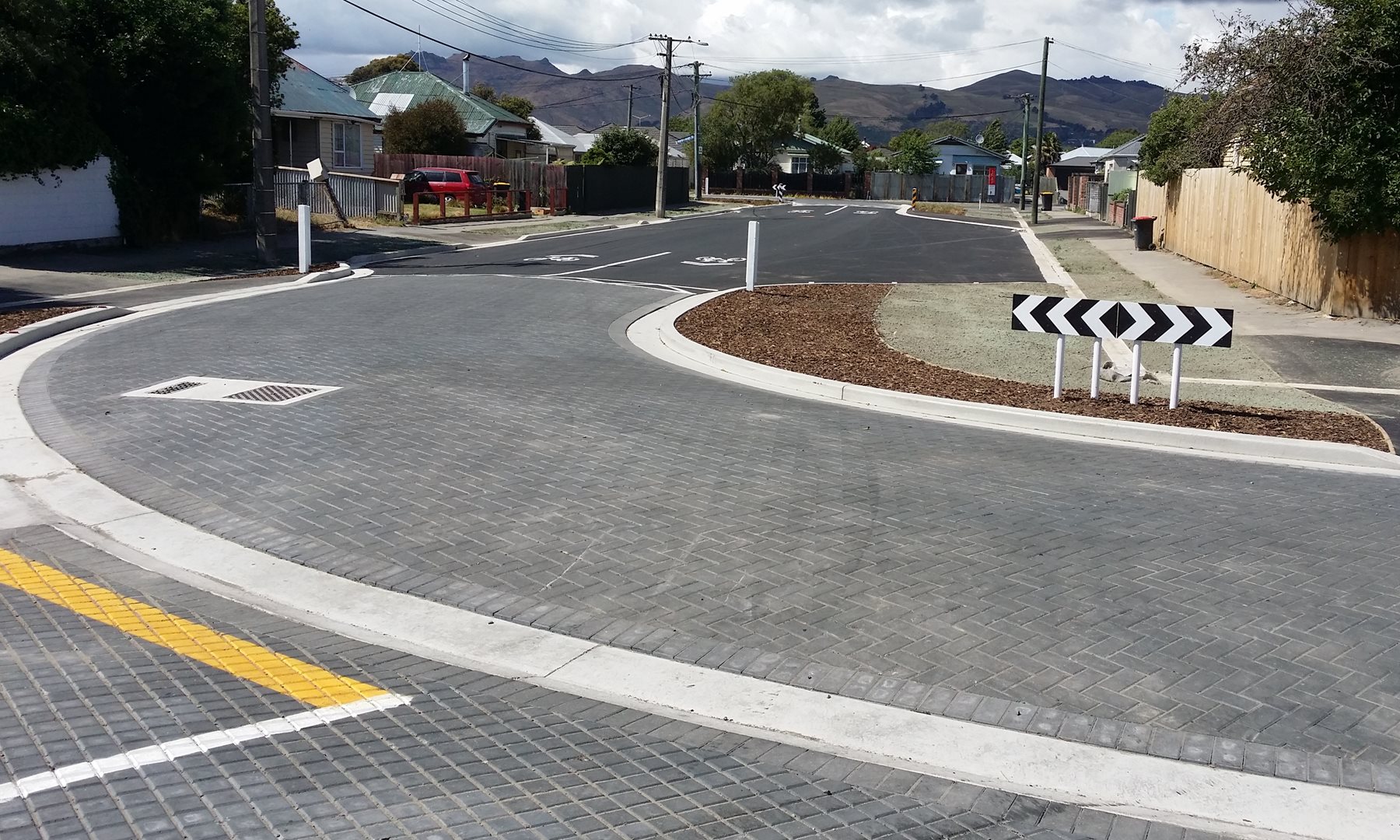
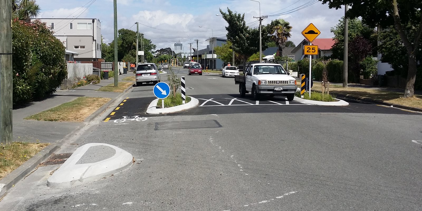
Along the greenway route, there are numerous street humps and narrowings to help slow down traffic. When cycling, it’s up to you where you go here. More confident riders can just “claim the lane” and go through the middle, but less confident riders can elect to use the bypasses around the sides instead. To ensure that cars don’t park too close and block the bypasses, small kerb islands were also constructed; again, much to the bemusement of the media and a few locals…
From Wellington St the greenway route wiggles across Olliviers Rd and Buccleugh St before heading towards England St via a short path link.
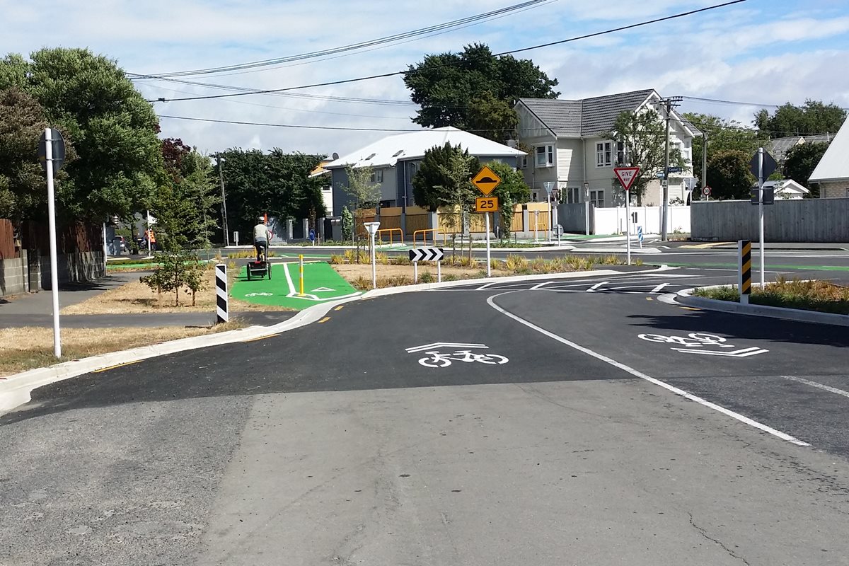
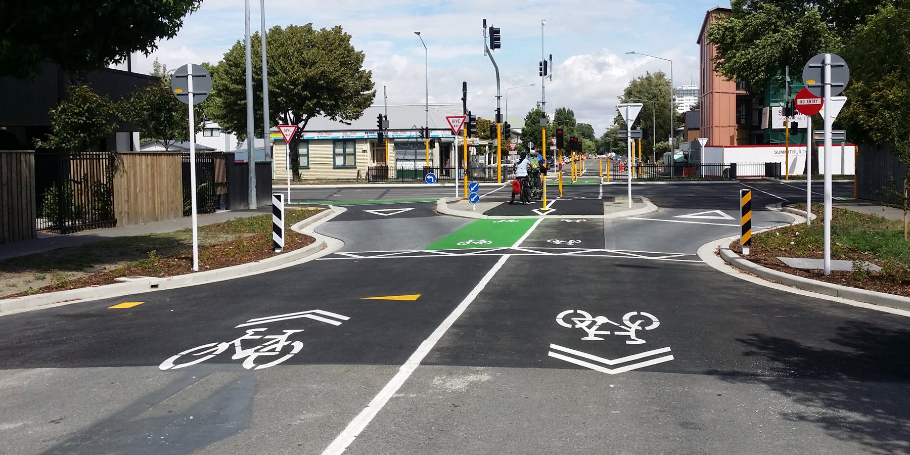
At the England St crossing of Cashel St comes another new cycleway design; a crossing that allows riders to continue along England St while requiring motorists to turn left in or out only. It looks a little complicated at first glance, but really just requires you to follow the green path route (give way to any main road traffic passing first!).
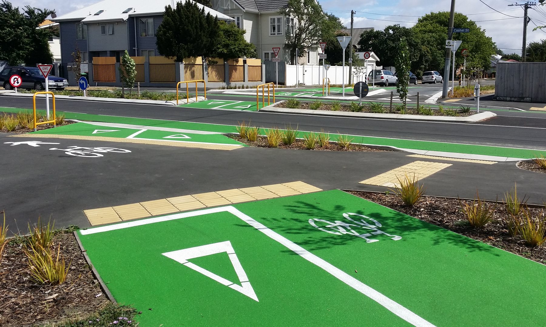
The England St crossing of Hereford St is a similar design in preventing motorists from going straight across. In this way, traffic volumes are reduced along the cycle route, by removing unnecessary rat-runners.
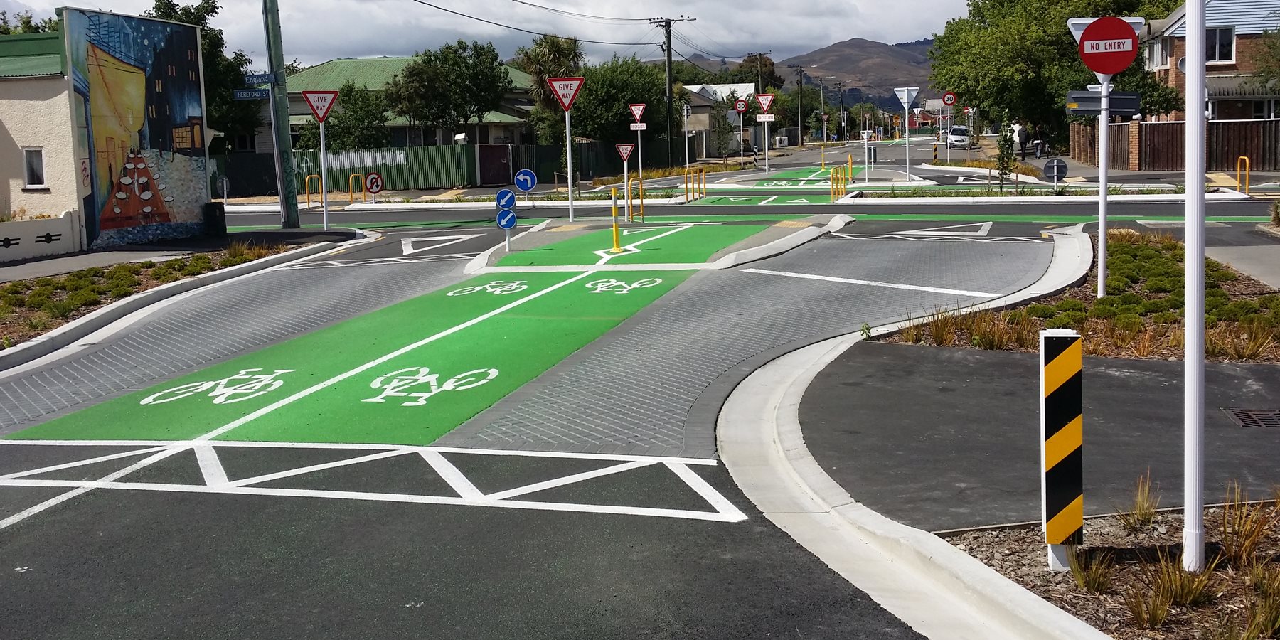
At Worcester St, the route turns left to head towards the central city. Originally the plan was to convert this cross-roads into two curved segments with a diagonal splitter in between (thus eliminating through-traffic along Worcester St) but complaints by locals saw an entrance along Worcester St retained.
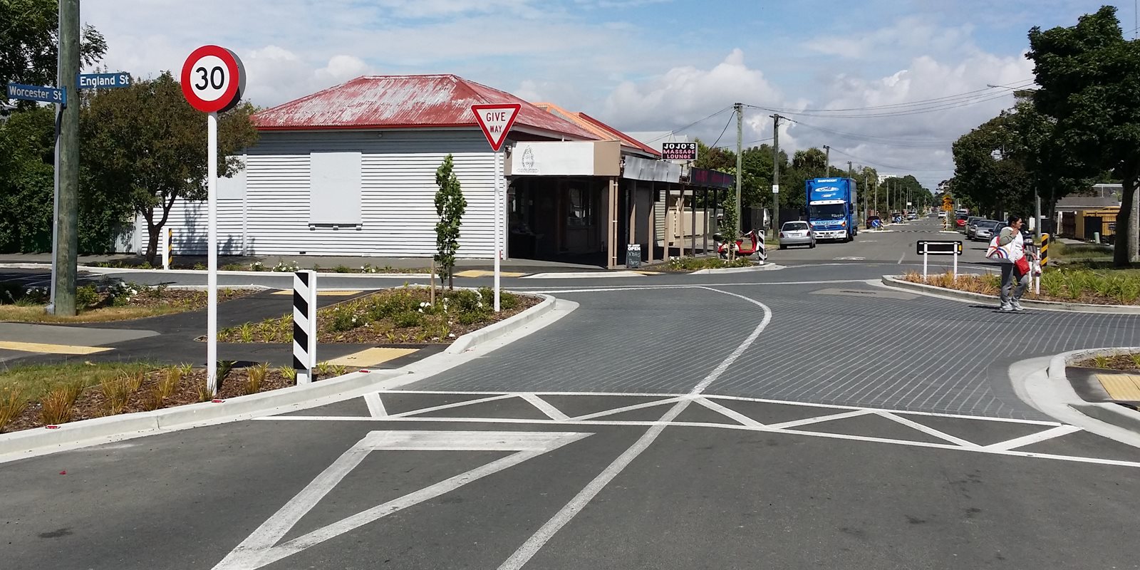
More traffic calming narrowings continue along Worcester St. At Stanmore Rd, the existing traffic signals have been tweaked a little in layout; as riders, you just “take the lane” on approach.
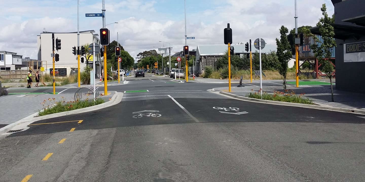
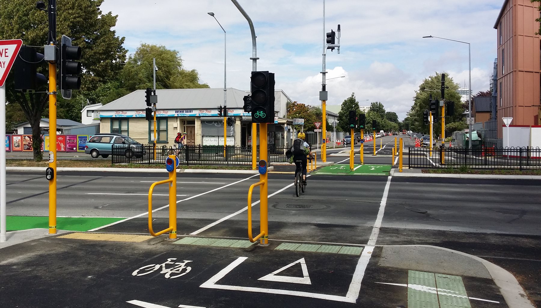
Finally as Worcester St gets to Fitzgerald Ave, the reconfigured signalised crossing lets cyclists and pedestrians get across this busy road. From here into town, Worcester St is still relatively quiet but with no special treatment for cycling (yet) until you get to Latimer Square.
Look out in the New Year for the next part of the Rapanui cycleway to kick off works, following a route along Linwood Ave out towards the estuary, including an exciting pathway down the middle of the tree-lined median…
Have you tried the new Rapanui cycleway? What do you think?
I have been using this cycleway for a while. Great to see the progress over the last 3 months and even though some locals grumble I have spoken to many who seem more than happy to have some money spent on their, up to now, neglected suburb. I can ( almost..) ride from the Ferrymead Bridge to the city centre either off-road or on cycleways now which is wonderful. The cycleway itself has been well designed in the main and I’m looking forward to the next stage down Linwood Ave. Being a 65 year old who has rediscovered the joy of cycling after years of driving I can only applaud the foresight of all who have contributed to these cycleways.
Why have the council put cobblestones on the Linwood Av section
Minimises the tree root damage. They have done similarly on Matai St, Linwood Park, etc.