Hidden beneath all the hoopla about the City Council’s Major Cycleways programme, there is another small but potentially very useful line item in the Council budget. $250,000 was allocated for each of the next two years for “cycleways targeted improvements” (page 304 of the Three-Year Plan for those playing at home). In a nutshell, the aim of this programme is to identify some low-cost “quick wins” that might improve the lot of people cycling on some existing routes relatively easily. A similar programme was introduced in Auckland a couple of years ago, with reasonable success so far.
So what might fall under these “targeted improvements”? Some has already been allocated to a few other little cycling projects (e.g. recreational cycle route signage around the foot of the Port Hills), but there is still scope to implement various other bits’n’pieces. Some possibles examples were suggested in my earlier “1000-day challenge” proposal, including:
- Improved route/destination signage
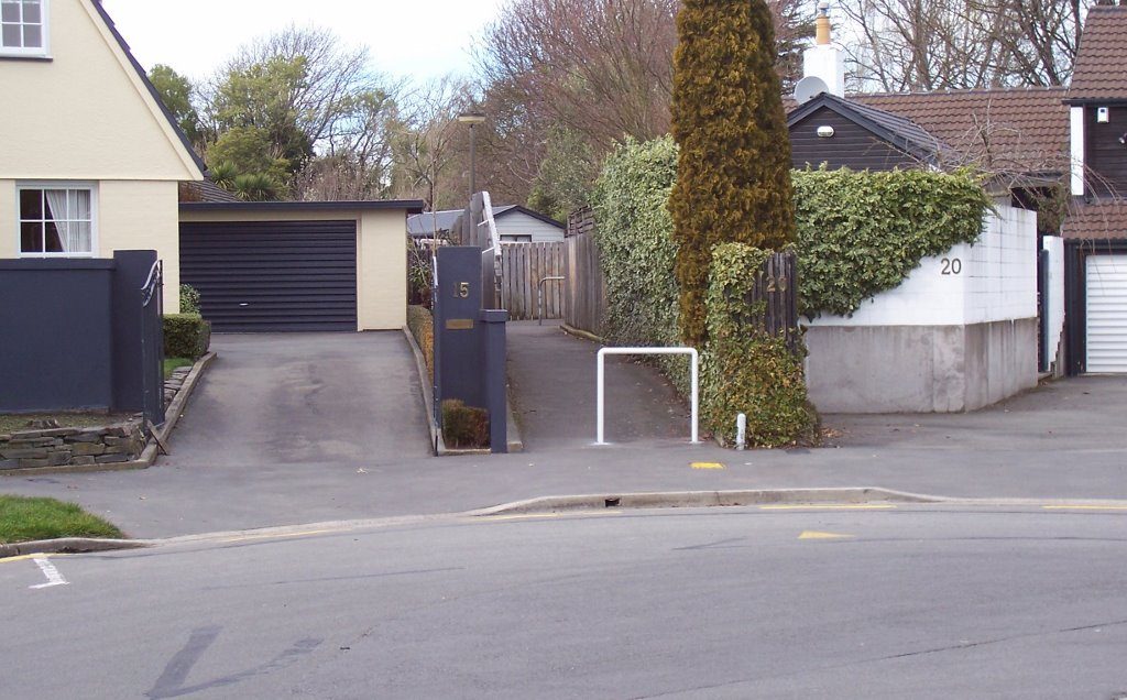
- Removal of barriers on some pathways (esp. at the end of alleyways)
- Addition of some cycle lane separators at curves and intersections (we’ll cover potential locations for these further in a future post)
- Kerb ramps at the ends of well-used pathway links
- Removal of poorly located car parking spaces
- Addition of hook turn boxes for tricky right turns

A good way to think of potential improvements is to simply consider your regular cycle routes, to work, shops, school, etc. For example, from my own trip to work I can think of a few things that would be nice to fix up:
- Removal of car parking on one side of the narrow winding section of Centaurus Rd east of St Martins Rd (no house frontages on one side anyway).
- Smoothing the kerb transitions onto the separated cycleway along Tennyson St.
- Some cycle lane separators at the Strickland/Milton intersection to keep the left-turners out.
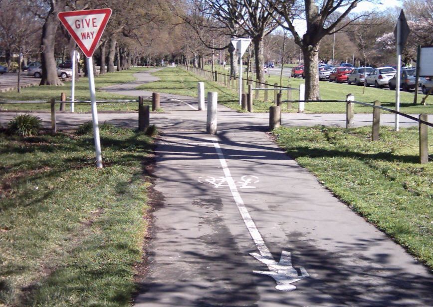
- Changing the priority of the pathways in Hagley Park so that they have right of way over the access roads.

- Adding a short path link where everyone clearly wants to access the Deans Roundabout crossing point from.

- Putting bypasses around the horrible speed humps on the Riccarton Bush driveway (with vertical posts to prevent motorists doing likewise).
No doubt you have a similar short-list of simple fixes on your regular rides. It might not be possible to deal to everyone’s wishlists in one go. But hopefully if the success of this minor fixes programme is demonstrated, it might become a regular line item in Council’s budgets.
What would be your top five “quick wins” on your regular cycle routes?


Hook turn box on Lake Terrace Rd @ Marshland Rd
Hook Turn box on Londons St @ Bealey Ave
Revised central median crossing point at Fitzgerald Ave/Cambridge Tce giving better access from both Alexandra St and Heywood Tce
Seperators on corner of Briggs Rd near Clearbrook St (although I have requested this previously, only to be told its not a cycle route)
Extension of No Stopping on East side of Kerrs Road adjacent pedestrian crossing near Dunarnan St)
one more for good measure!
Kerb ramp from Latimer Sq (in-line with Madras St) on Gloucester St
Kerb ramp for north bound riders leaving Cranmer Sq to head up Montreal Street
Review of markings heading West on Warrington Street from ( dangerous ) roadside car parking area at Dairy/Shops through until passed Barbadoes St T Intersection . Traffic turning right ( scampering) off Flockton St onto Warrington St then a quick left into Barbadoes St makes this so-called cycle route a treacherous experience.
A lot of painted cycle & pedestrian symbols on paths in Hagley Park
Yes and keep left signs.
A few more green painted cycleways on the sides of roads specifically across motorist conflict zones e.g.
* through the 2 Curletts Rd roundabouts Nth bound under the motorway upto the rail overbridge (especially the sth roundabout)
*from the Main Sth Rd rail overbridge West bound from Sockburn roundabout, past Symes Rd to about 50m past Springs rd intersection (where the pinch point bend is)
About time there were warning signs with regard to the hazard that exists with tram rails especially when wet get very slippery. i saw a young woman a couple of days ago who had wiped out and a motorist had stopped to offer assistance. Signage such as approaches to the Taramakau Bridge (West Coast) would be appropriate.
I would like to see an improvement on the shared Cycle/Walkway between Annex road and Hansons Lane along the South side of Blenheim Road. They have put some green painted sections there to indicate you can use the path to access the right hand turn light further down, but they have also put in a sign on the edge of the grassed verge beside the narrowest part of the path (There is also the control box for the signals and a lamp post in the middle of the path just past that point). This sign is on the inside of a curve so it makes the path even narrower as you need to pull wide of it so you don’t clip it. It would be nice to just seal over the grass outside Millars to get rid of this bottle neck, it is not a very big area. Oh and some sweeping maintenance would be nice there too, there have been a couple of smashed bottles there for the last three months!
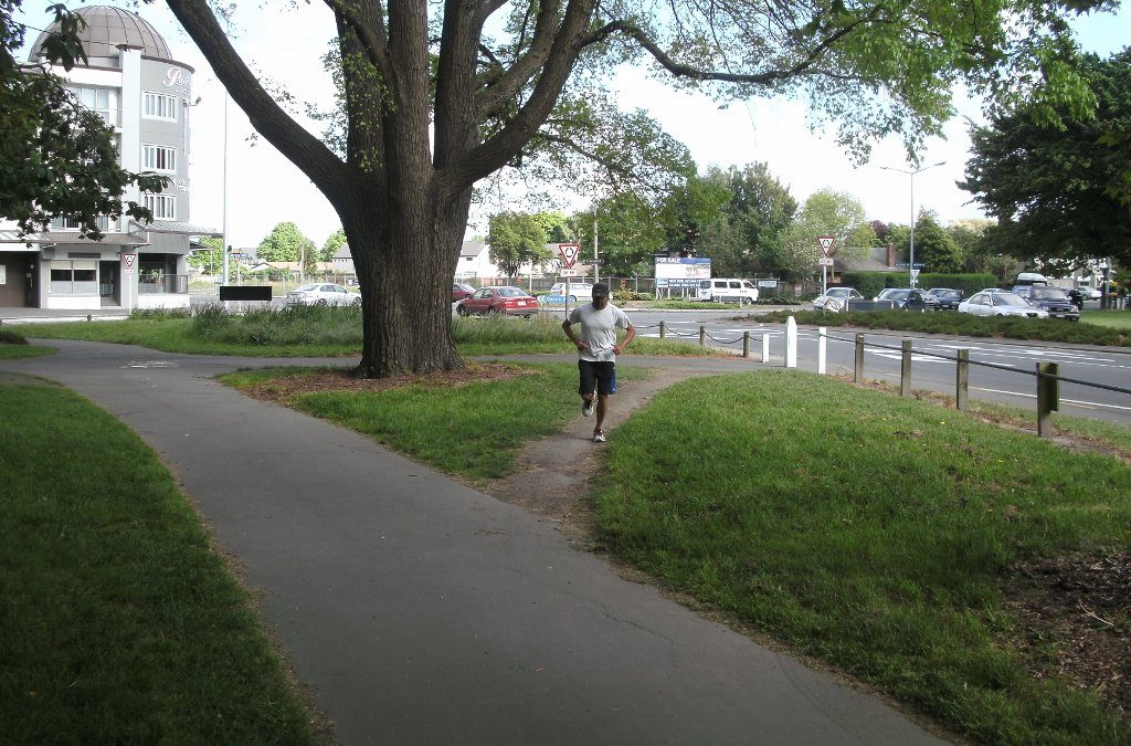
While I am at it, I recently went down the cycle path along the side of Riccarton Ave (pictured above) and there was huge competition for the narrow path, with walkers, Joggers and cyclists all competing for the same 2m (approx) wide strip. I would be nice to have some lane indication with cycle and pedestrian symbols painted at regular intervals.
I like your ideas above – I commute daily along the cycleway from Barrington St to Annex Rd but the section from Annex Rd – Blenheim Rd needs some work to make it feel safer. A traffic island would be helpful for crossing when heading south from the Millers corner towards the railway line. The road seal could also be repaired at the Annex Rd railway crossing and there are large chunks gone which are a killer for bike forks! The right turn at the Annex Rd/Birmingham drive corner is also very dangerous as a cyclist when heading south to join up with the motoway cycleway as cars tend to cross the centre-line on the corner.
Beth, I know what you mean about crossing from one side of Annex road to the other heading south, it is a bit of a “running of the gauntlet”. I generally try and get across at the main Millers entrance as there is a reasonable gap between parked cars to see both directions, if there isn’t a break then I go up to the bus stop outside the storage place which also provides a decent view and there is a painted median there to sit in if needed, it does confuse the drivers if you go for the median as your intention is not always obvious and occasionally you will get somebody waiting to turn right into one of the nearby businesses sitting in the median, or aiming for it when you are in there. As you say a decent sized island with those hand rails would be useful.
About half the people riding from Blenheim road to Annex road stay on the road as sometimes it is the easiest way to get from Hansons lane, if you take the cycle path along Hansons lane heading south it puts you in between the right and left turning lanes and there is one of those stupid painted waiting areas in front of the left lane you should be able to use to turn left. These things generally don’t work because there is normally a car parked in them or the traffic is flowing and you can’t get into that area because you will get run over. That is normally why I go straight on and cross Annex road.
The rail crossing isn’t as bad as it has been, I use to use it to get air a few years back :). The problem is the sleepers need re-laying as some of them move as the trains go across which pushes up the road surface. What they need to do is what they have done at the crossing on Carmen road with the plastic inserts either side of the track. I generally don’t slow down for them as I have a fully suspended cross country bike but I passed a guy on a carbon road bike crossing the railway lines some time ago and it sounded like it was about to break!
The Annex road/Birmingham drive intersection will be changed quite considerably when they put the “Magdala Link” in. There will be a straight though cycle lane to take you on to the cycle path along the motorway. Of course there is no provision for all of us that work down Birmingham drive to actually turn left, I am not quite sure how I will handle that as there is no foot path there either, quite an oversight. For the moment you can use the path that cuts up onto the verge and there is a place to cross onto an island in the middle of Birmingham drive if you don’t feel comfortable sitting in the middle of the road. I turn left there every morning and most cars and trucks fully cut across the cycle lane, right up to the kerb. The other week I was cut off around there, once by a small truck who passed me then cut in and slowed right down to make the turn, I had to dive on the brakes to avoid running into him and then a couple of days later a car came up beside me and pinched me between it and the kerb. They need to put some flexible bollards there or the plastic mountable kerbs like they have on Kotare street. The flexible bollards may not last that long there as the lager trucks need to cut across the cycle lane so they don’t hit the pedestrian refuge I mentioned earlier on the exit of the bend. I suspect that the lower plastic ones will last a while, at least until they start the road works.
So they have done some more work on the Blenheim road/Hansons lane intersection. There is now a sign for traffic heading south and turning right from Hansons lane into Blenheim road saying that all turning traffic to give way. There is another one when you are heading north warning about on coming turning traffic. I thought yeah right that’s going to work, coming through that intersection tonight I had just missed the 6 seconds of dedicated cycle light phase but the normal green light was on and there was a gap in the traffic so I proceeded through the intersection… and had two cars pull across in front of me as expected. They seemed to be surprised that some body would dare to take their right of way and travel straight though an intersection on a green light… This is not an unusual event for this intersection as I have seen people trying to turn in front of trucks coming out of steel and tube through the same intersection! Anyway so those signs work really well… I would have thought that they could have swept up the glass from the broken bottles that have been there all year while they were there putting the signs up. OK I feel better for that wee rant, carry on…
Brougham Street westbound between Opawa Road and Opawa Road again, by the Z and ice rink, especially the turn off onto Ensors Road if you’re going straight on can be pretty scary. Lots of big trucks and drivers turning left onto Ensors. Could do with a painted cycle lane. Even in its just at the Ensors junction for riders going straight.
Correction: eastbound.
-In the inner corner on Annex Road at the intersection with Magdala Pl: vertical bollards (http://goo.gl/maps/z4IOG).
-On int Wrights Rd – Hillmorton St (http://goo.gl/maps/MBXk1) an on road cycle lane instead of this uncomfortable off road shared path to go onto the Marylands Cycleway and this two side pinch point islands. Create another ramp to enter Maryland cycleway just on the west side north of the bridge and south east of the bridge over the dish channel.. Now you have to do a strange swirl to get onto the cycle path.
– a better position for the cyclists to wait for the traffic lights if it is coming from the cyclepath (http://binged.it/1e8cRIc) on the south west side of the intersection.
-marked cyclelanes on Brougham St the whole length!!!!! Not only at the intersection.
I especially like how the cycle lane heading south down Annex road suddenly stops with the back of the first parked car once you have turned into Birmingham drive… It also coincides with the island in the middle of the road creating an interesting pinch point. I thought the island had a pedestrian refuge but is doesn’t, it’s just an obstacle in the middle of the road. It would’ve better if it was a) removed and bollards put in its place or b) turned into a padestrian/cycle refuge.
Agree with all those, what a disaster the wrights road crossing is. BTW, we looked at Brougham Street about 5 years ago, NZTA then backtracked due to an agreement they have with the port company about minimum lane widths.
Port company can’t really comment on safety ! Their recent record is tragic
if you want to keep this poorly designed cyclelane….from Annex Rd onto Blenheim Rd.
continu the cyclelane in Blenheim Rd for the left turn (http://goo.gl/maps/2VivJ)
Require the developer to reconstruct the main spine road (the Jarnac Boulevard continuation called McKenzie Ave) and loop road continuations (Rannoch Drive) in Living G Yaldhurst with cycle lanes as are required by the 2006 Environment Court decision, the City Plan, the Councils Infrastructure Design Standards, NZ Safety Standards, etc. etc.
There is no point to these standards when Council Staff refuse to implement them and if our Elected Council don’t insist that Council staff do.
The bottlenecks, pinch points, and cyclists sharing busy 3.2m lanes with buses, trucks and cars is a guaranteed recipe for death and serious injury as forecast by the safety audit of Dr Shane Turner. One of the three developers (Noble) and his engineer have made grave mistakes and the Council for four years have turned a blind eye to them.
Just want to reiterate the comments on the issues cycling from Hansens Lane to the Annex Road underpass and vice versa:
There is no obvious safe way for a cyclist to get onto the left side of Annex Road from Hansens Lane.
The “level” crossing (four sets of tracks) desperately needs attention.
A traffic island with wait space is needed for at the intersection of Annex Rd/Magdala Pl/Birmingham turning across Annex Road to get to the underpass. Failing that, green paint in the middle of the road might help.
Heading north, the Annex Road/Magdala Place intersection is, what shall we say, treacherous?
Also, the right hand turning light onto Blenheim Rd off Annex Road is not activated by a cyclist. A push button (a la pedestrian crossing) would be welcome.
Remove parking from Brougham Street shoulders, not that many people park there anyway.
The cycle lane heading north along Waltham Rd disappears either side of Brougham St. There is plenty of room on the road it just seems someone forgot to paint the lines? Travelling in the opposite direction (south) is fine and the reserved space for cyclists at the front of the left lane works well. Something similar heading north would do the job nicely and I imagine would be a really easy fix. I’ve been tempted to buy some paint and do the job myself!
Travelling along Wilsons Rd north approaching the roundabout with St Martins Rd cars regularly park in the bike lane because the parking area narrows but there aren’t any yellow dotted lines to prohibit parking. This forces cyclists into the traffic lane and hence causes congestion and conflict. The extension of yellow dotted lines further south till the parking area is wide enough to accommodate a car would prevent this happening. This is a common problem to many intersections around the city.
I also agree with Nic about removing the parking from Brougham St. This could be done for many major routes around the city where on street parking isn’t really needed or appropriate. It would free up room for extra traffic lanes as well as allowing separate bike lanes.