
So it’s been a little while now since the City Council signed off on the $69 million plan for major cycleways, and you might be wondering what has happened to it. Actually quite a lot in the background, but it is only now that the first bits of information are coming out publicly about the next steps.
Spending nearly $70 million on a comprehensive cycleway network around the city is not something that you want to do once-over-lightly, so it is no surprise that a lot of effort is going into (hopefully) getting the finished product pretty good. This takes a fair bit of coordination of the various different parts of Council (design teams, capital works, marketing & promotion, etc; not to mention the elected members) as well as linking with external stakeholders like CERA, NZTA, Spokes, and so on.
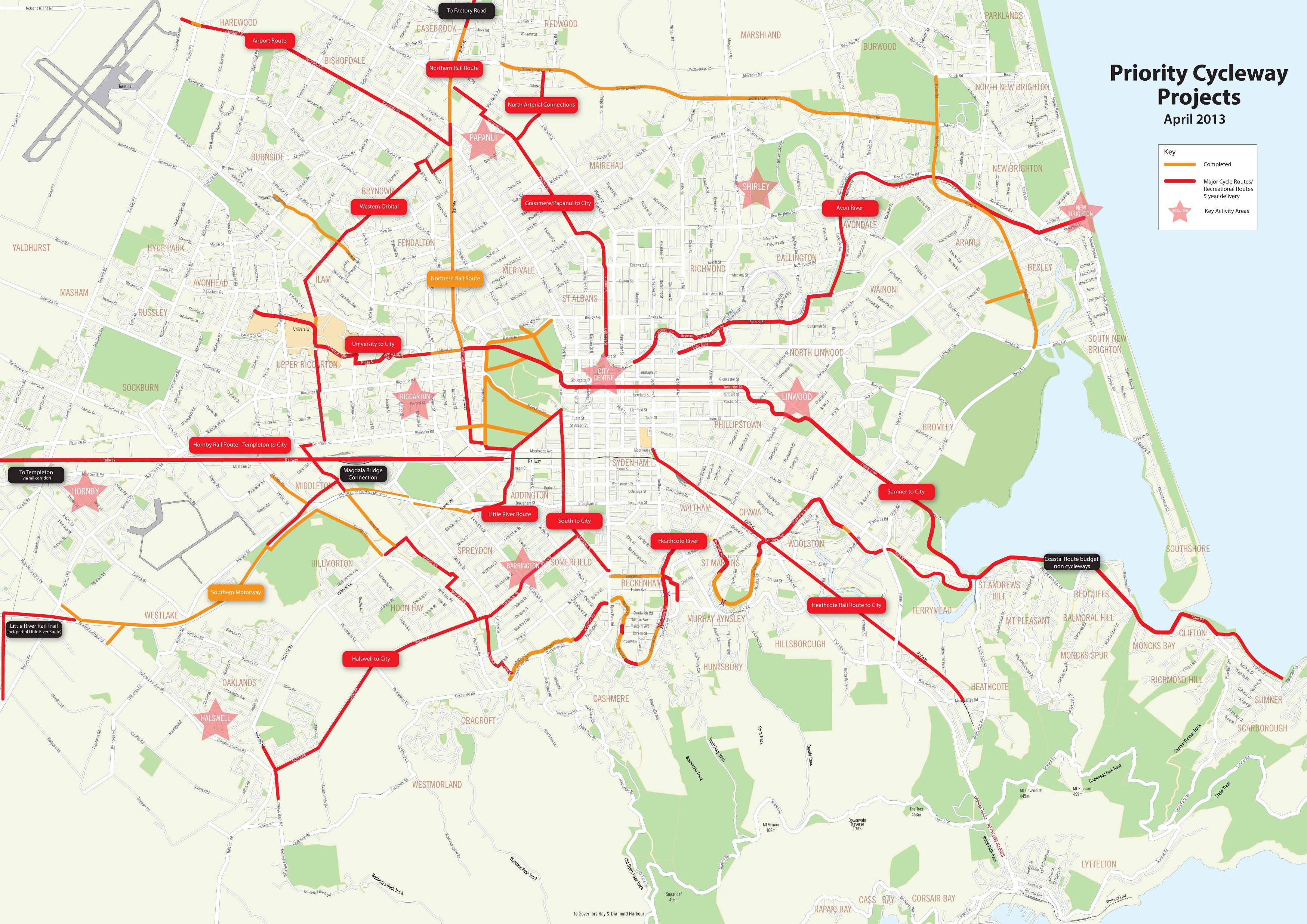
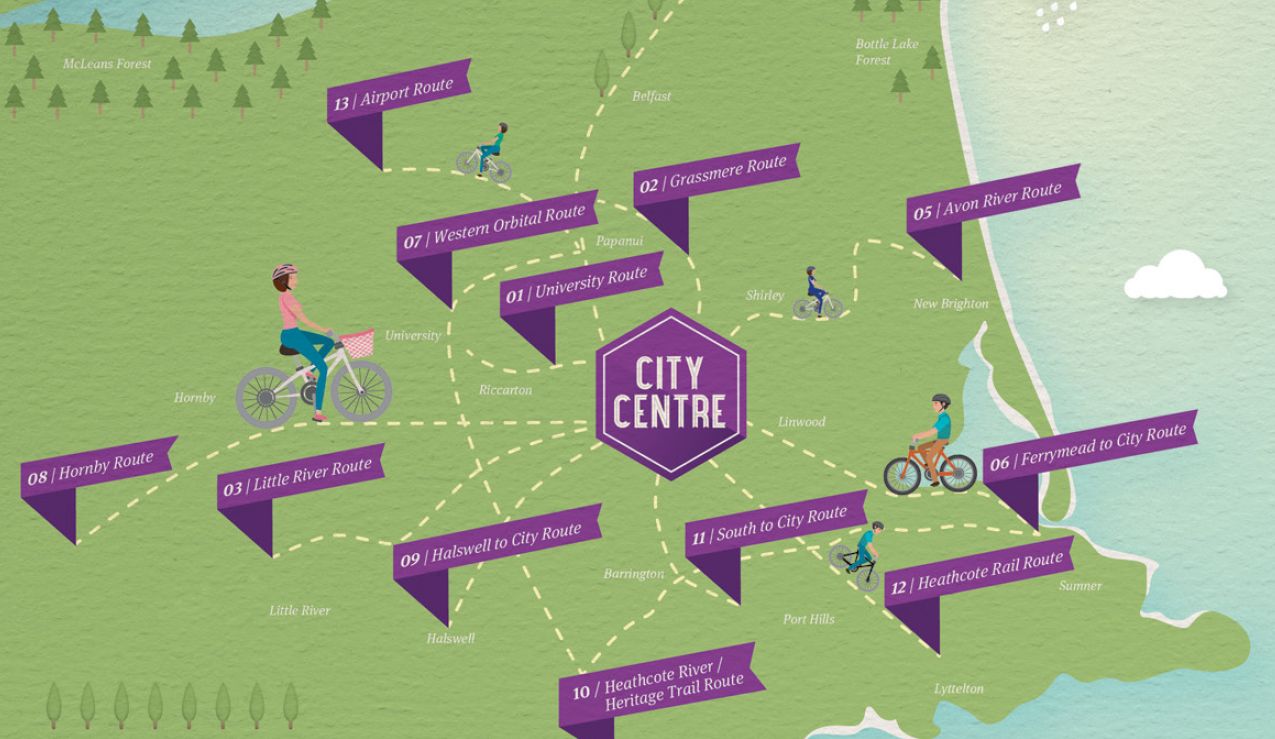
The first bits of information about the programme are now being promoted via the Future Christchurch website. There you can find some background details about the Council’s plans, including a tentative map of the 13 indicative major routes. The route details are still being finalised over time, so don’t get too hung up on the precise locations shown; some are likely to change in places.
The City Council are also running a competition to name the 13 cycleways. Currently the routes have some fairly generic working titles, but here’s your chance to give them a bit of a truly local flavour. Is there some heritage along the routes that should be reflected? Perhaps some famous local Cantabrians we should honour? You’ve got until 12th January to come up with some ideas and be in to win a new bike prize package!
As well as the major cycleway routes, background planning is also underway to roll out various more minor initiatives as part of the Targeted Cycleway Improvements (aka “Quick Wins”) programme. This will look at simple enhancements to the citywide cycling network, such as more signage, separator posts, and intersection improvements. More on that in later posts (and opportunities for you to put in your suggestions…).
So what’s next? Well the new Councillors will be briefed on the planned programme and design principles in the coming months for their sign-off. And within the next year, you can expect to see parts of the first 3-4 cycleway routes starting to appear on the ground. There will of course be opportunities for public consultation when the detailed plans roll out for each cycleway section. And further promotion efforts will continue to “sell” the benefits of this cycleway network to the general public and then help to explain how to use it when it starts to get into place.
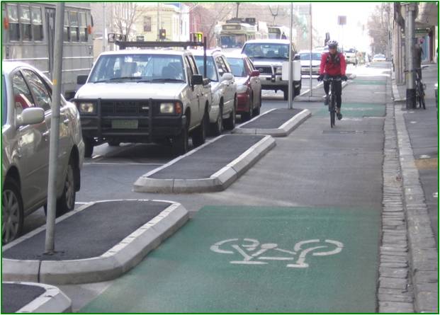
Key Elements of Chch Cycleways for “All Ages and Abilities”:
|

|
If you attend the A&P Show this week (here’s how you can get there by bike!), you can find out more about the cycleways programme and have a chat with Council staff in the Future Christchurch Pavilion. And Newstalk ZB will also be running a radio campaign soon, telling you more about the cycleways too.
I’ve been privileged to be involved in the planning work so far for the major cycleways programme, and I’m looking forward to what’s still to come. Stay tuned for more details as they come to hand…
Super stoked about this. Will they all be paved as there are a few distance skateboarders who currently use the roads and this looks like it will be shareable!
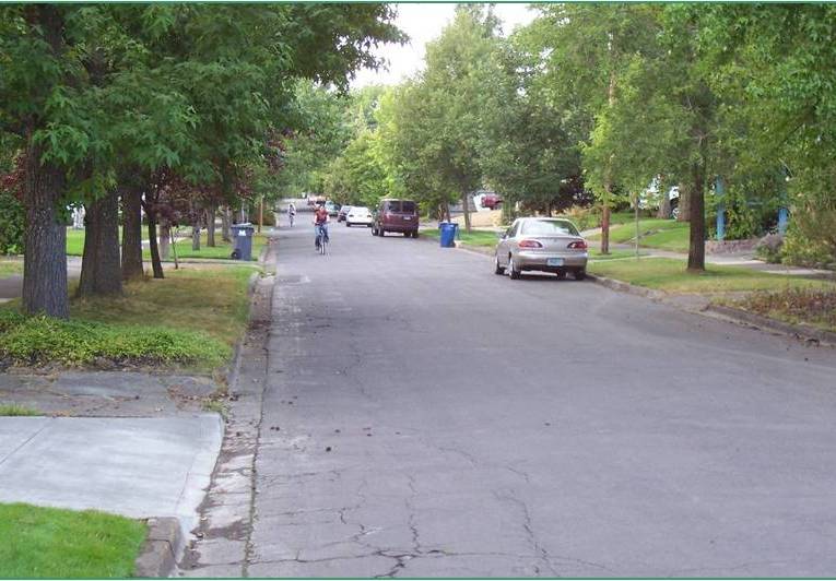
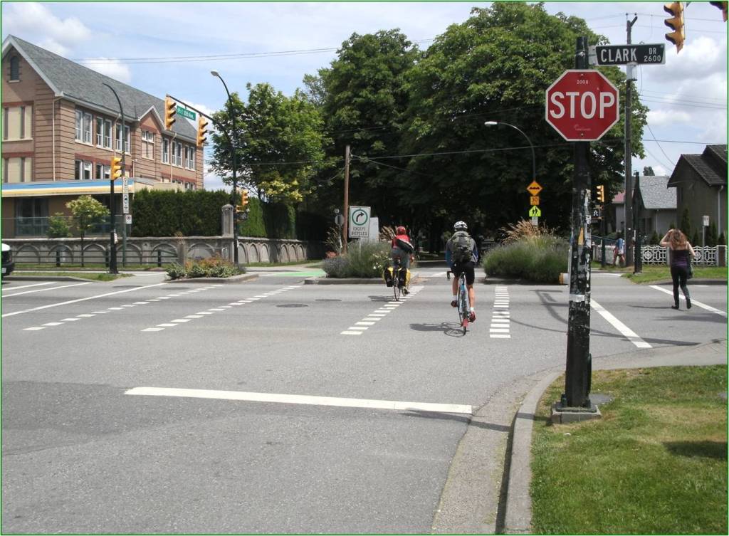
Nat, the photos give you an idea of what you might expect. So yes, I’d expect them all to be paved. Indeed, some will be existing quiet streets.
Really, really pleased to hear the update. Well done for all involved and keep up the good work, whether in council, as contributors or commenters. All making a valuable difference.
I’ll have a think about the naming competition. Nice chance for some creativity I think. Can I enter 13 times???
For the quick wins, I’m thinking stuff that raises profile of biking to all in Chch. Eg better and more bike parks at retail, work and leisure places. Don’t hide them away in inconvenient places, let people see the advantages of encouraging bikes even if they don’t ride themselves. No more chained to railings, benches and drain pipes!
Cheers 🙂
The NE area of town from QE2 Drive north has no routes marked – yet hundreds of cyclists bike to Bottle Lake every weekend. Will they have to continue dodging the trucks going to the Burwood landfill?
Fair comment Gregor, although bear in mind there is a wider network of cycle routes that will also complement these initial 13 cycleways. Also not shown is that there will be a cycleway alongside the planned Northern Arterial (probably similar to the Sthn M’way one) – see http://www.nzta.govt.nz/projects/northern-arterial/ for info. And the Highfield Park development just off Marshlands Rd is likely to include some cycle-friendly routes too – see http://www.highfieldpark.co.nz. But I’ll keep it in mind when we’re looking at quick wins too.
It’s a great idea but what’s the point of having cycle lanes/ cycle paths if they are always full of road work signs and glass lies there for weeks because they are not sweeped after the weekend? If we can’t make the existing ones safe and effective, why spend money on new ones?
Jaimita, that’s an ongoing work in progress too, with discussions with Council/NZTA/SCIRT and their contractors, e.g. see http://cyclingchristchurch.co.nz/general-a2b-by-bike/road-works-around-the-rebuild/. But you can also let them know directly when they’re not doing their job by various ways; see our advice at http://cyclingchristchurch.co.nz/cycle-infrastructure/who-ya-gonna-call/ – they’re pretty prompt if it’s a safety issue.
I ride Heathcote river route’s ultimate direction often taking in parts of it and it’s about as good as it gets for quiet, safe and scenic cycling in Ch-Ch.
It’s of so little practical use practical it shouldn’t even be considered a ‘cycleway’ and a wicked waste of limited resources that would be far better utilized elsewhere.
There are 2-3 of the planned routes that are somewhat recreational; this is one of them. Not all cycle trips are utilitarian and we will probably attract some new riders via casual scenic rides first. As the map indicates, large parts of this one are already there, but it does need work to be acceptable to “all ages and abilities”, e.g. missing links, wider paths, major road crossings, route signage. And, like the Avon River route, it may be that some shortcut links can also be enhanced and highlighted to avoid some of the river loops.
Are you aware you can cycle almost 2/3 of the way from St Martins to Brighton off road on council land? How are those using the Bexley Park facilities going to get there? How do you get from St Martins to Bottle Lake or Brighton to the hills? How does the kid in Aranui get to work in Bromley?
The Heathcote river route isn’t broken and we don’t need a cotton wool padded corridor to nowhere, it’s as much help as race track to solve gridlock.
The City Council have now released some more info about the cycleways, including route descriptions and Frequently Asked Questions – see http://www.ccc.govt.nz/cityleisure/projectstoimprovechristchurch/transport/cycleways/index.aspx