
A few months ago now, we showed you some pics from the western end of the new cycleway along the Chch Southern Motorway. At the time we were hoping that the last part of the cycleway wouldn’t be too far away from sealing and tidying up (seeing as the motorway project was supposedly completed “on time” last December). And then March came and went… and April… and May… Evidently someone finally got on with actually finishing the job (good thinking; let’s wait until after the long dry summer to seal the pathway…), yet even in June there was a short section still waiting to be completed.
Finally we can now show you what all the fuss has been about. However, unlike the western end, which (for the most part) provides a really nice off-road facility, you can’t help feeling that there were a few missed opportunities to get the eastern end better than what’s there. It’s notable that, because it was completed as part of an NZTA state highway project, there wasn’t the same opportunity for consultation on details about the final cycleway design as we typically see for a City Council project…
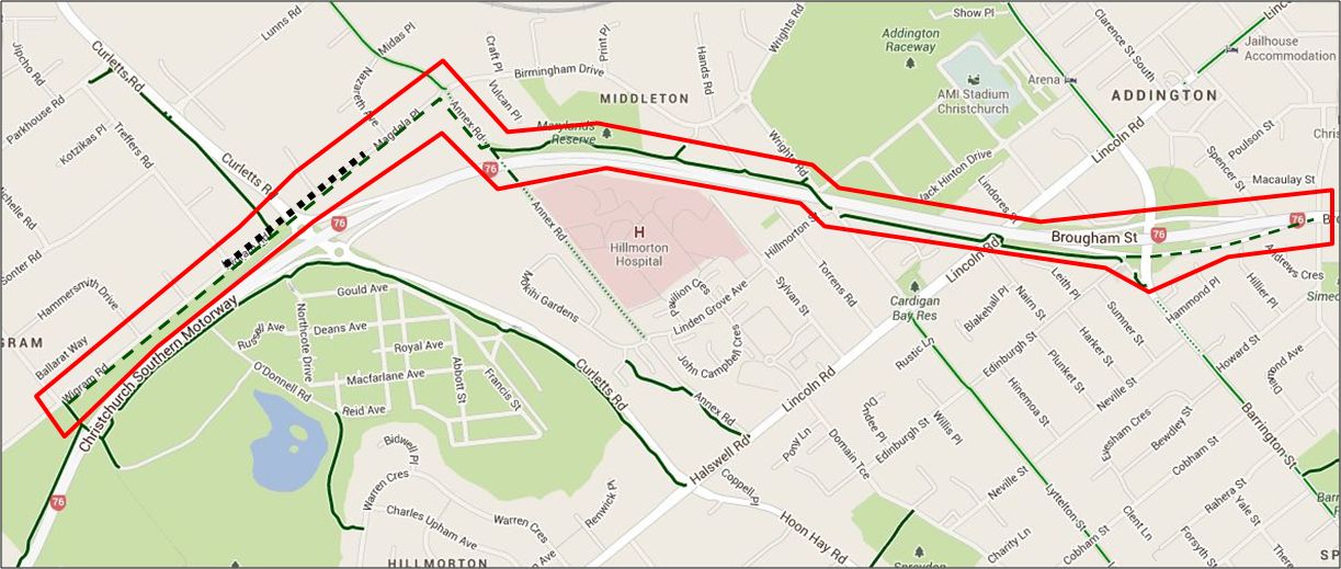
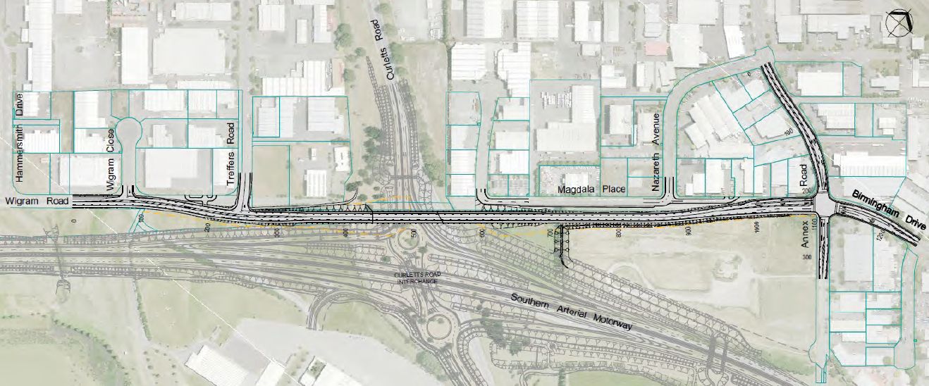
First, let’s get our bearings. When we last left you, we had just finished on the existing pathway that spits you out at Wigram Rd. For now there’s no option but to make your way east along Wigram Rd to the pathway that veers north to Lunns Rd (or alternatively head south on the pathway to Lincoln Rd). However, within the next two years, a new road link will be constructed connecting Wigram Rd over Curletts Rd to Magdala Pl and on to Birmingham Dr. This new “Wigram-Magdala Link” will include both cycle lanes and a 2.5-3.0m shared pathway, which will connect the western end of the cycleway with the existing Annex Rd cycleway.
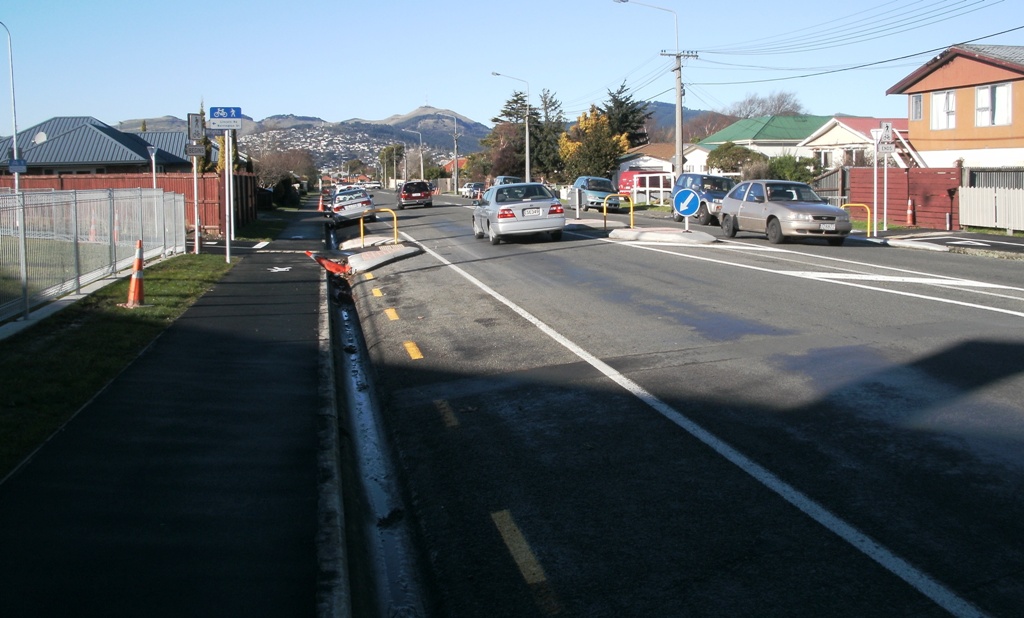
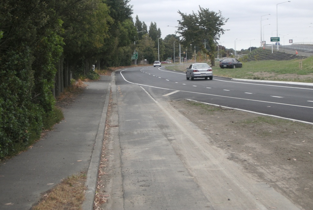
Having gotten ourselves to Annex Rd, we now rejoin the existing cycleway that runs alongside the southern motorway towards Wrights Rd. Unfortunately the motorway project didn’t include any work to upgrade the existing somewhat narrow pathway, so we may have to wait and see whether some further improvements are in store later for this “major cycleway”.

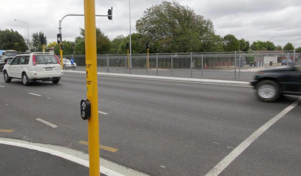
On to Wrights Rd and the pathway has been taken underneath the motorway overbridge to run down the opposite side. This involves creating a new shared pathway across the Hillmorton St side-road to a new crossing point.
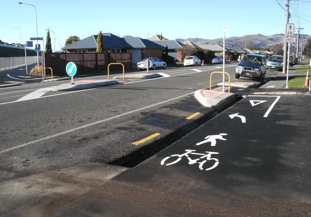
The central island helps with crossing what can be a busy road. However, I do feel they missed a trick or two here. Firstly the remaining gap between the kerb extensions and the central island is rather tight for those people cycling along Wrights Rd rather than across it. And, rather than crossing a side-road and a number of driveways with the shared pathway, wouldn’t it have been simpler to run it along the other (uninterrupted) side of the road?
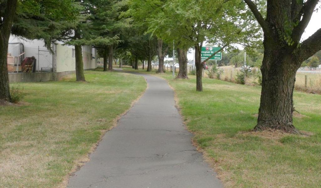
At least the new pathways in between the roads are generally well done; with good width and signage. And with the elevated roadway, there is little noise to speak of.
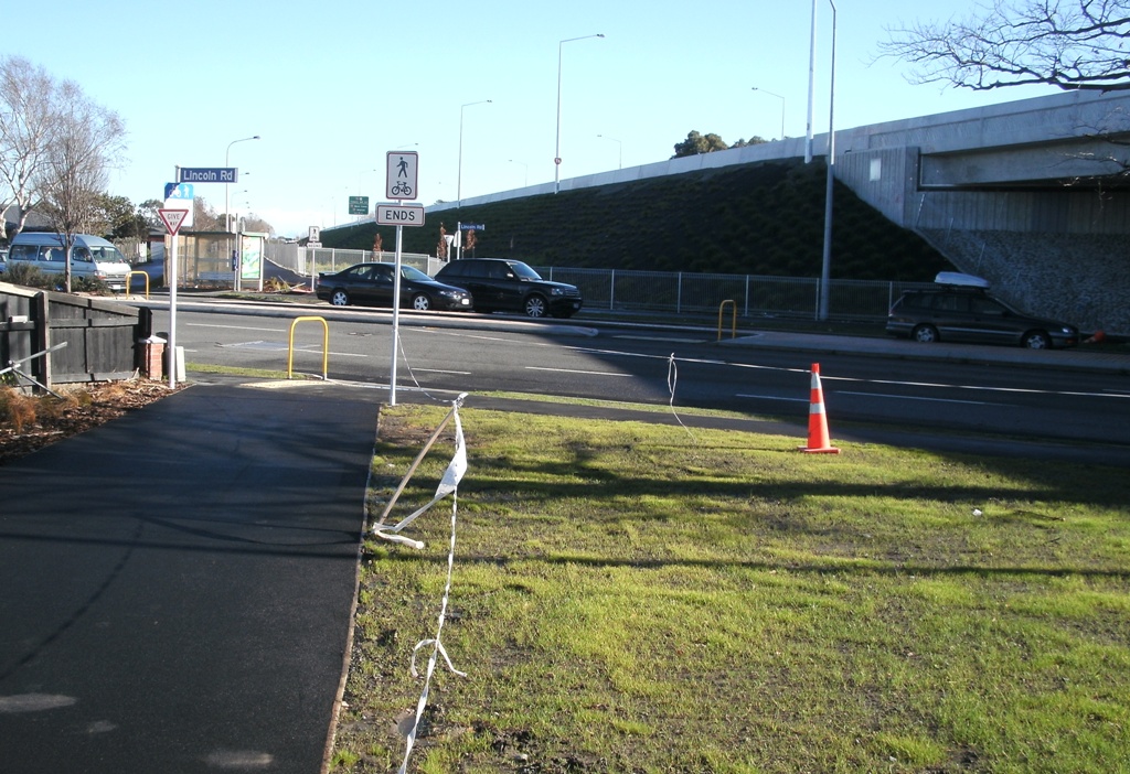
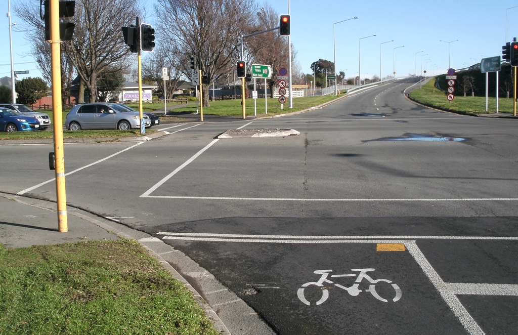
On to Lincoln Rd and there’s another “at-grade” crossing of the four-lane roadway using a central median as a halfway house.However, this is an even busier road than Wrights Rd, so crossing here without priority can be difficult at certain times of the day – CCC have indicated that they will look at the possibility of installing a signalised crossing here.
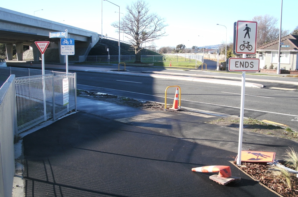
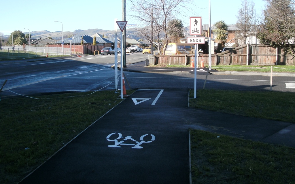
BTW, is it just me or does it feel like overkill to have to use “cycleway ENDS/BEGINS” signs at every single crossing point? Yeh, yeh, we get that we don’t have priority crossing the road; we don’t need signs to tell us this.
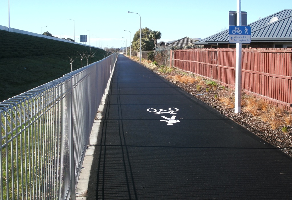
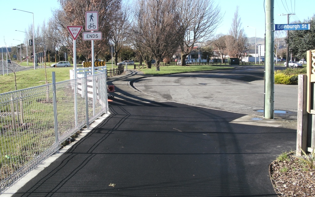
The pathway continues on east to Barrington St, actually coming out at the Edinburgh St cul de sac first. Interestingly there isn’t actually a kerb ramp right at the Edinburgh St entrance – did they think everyone was going to follow the pathway?
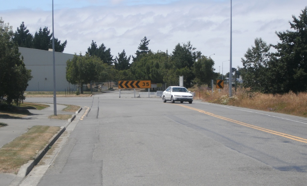
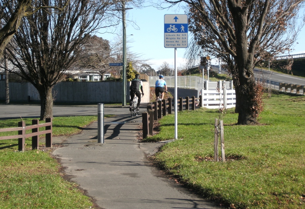
Throughout the cycleway, one of the nice features has been the introduction of various destination signs showing how far it is to various intermediate points (almost too precisely, actually). Signage like this will help less familiar riders know where all this new infrastructure can take them to.
Once at the Barrington St intersection, the picture becomes less clear about where to next. In earlier project plans that I saw, the pathway continued east to Simeon/Collins St, which made sense as there is a fairly good north-south cycle route there. But for now there is nothing, despite plenty of space to do so.

CCC are considering an alternative link through the park immediately to the north-east; however that won’t be of much use to anyone wanting to head south down Simeon St.
Finally at the Simeon/Collins St intersection itself, the previous signalised intersection has been closed off, but a signalised crossing retained for pedestrians and cyclists. Unfortunately, someone in their wisdom felt that putting a ridiculously long median zig-zag made sense, coupled with some really awkward crossing points to get to/from on each side.
So there you have it. With the impending construction of the Wigram-Magdala Link, this will now provide a continuous pathway connection all the way from Barrington / Brougham Sts to Halswell Junction / Springs Rds. But, for one of the Council’s designated “major cycleways”, it feels a bit under-done in places.
What do you think about this new cycleway?
Not quite sure you could call this thing a “continuous” cycle way. It’s like the one along the railway, stretches of bike path then horrible crossings with weird alignments.
I really hope there is some real cycle transport engineering of the new ones for CHCH
I haven’t seen the cycleway, but isn’t it sad that years ago (many years ago) engineers needed to draw on the insights of cycling advocates to get the details right – many ‘bloopers’ in cycling facility design. Since then, we’ve seen the mainstreaming of innovative cycling facility designs in tools like MOTSAM, plus the ‘Fundamentals’ planning and design training course, attended by a great many professional engineers, yet STILL basic mistakes are made, which only need a bit of forethought, rather than cash. Progress is slow – but on the positive side, at least some progress is being made (slowly). Not so long ago, instead of a cycleway, there’d have been a dismissive comment that cyclists ‘shouldn’t be’ on this sort of road.
Looking at what they have planned for the Wigram Magdala link and the intersection with Annex road and Birmingham Drive/Magdala, they have completely missed out the fact that a large number of cyclists actually turn left when heading south down Annex road to ride down Birmingham Drive. There is good provision to go straight through to the underpass and the link down the back by the motorway but if you actually work down Birmingham drive this is of very little use. Most mornings on the way to work I would be regularly riding with six or so other bikes into Birmingham drive. If you are asking why I don’t ride down the frequently flooded cycle path it is because I would have to ride past work and then back twice the distance from Annex road back to the office and then I would have to run the gauntlet crossing Birmingham Drive. The other way shouldn’t be as bad if it is busy you can then duck down Annex road heading south turn around and you should have traffic lights to let you across.
I frequently cycle the eastern half of this cycle-way and, although it works okay, I think LennyBoy has high-lighted very well some of the missed opportunites here. It’s a shame there didn’t seem to be a lot of opportunity for community input into this project. And just a point about the old, narrow cycle-way between Wrights and Annex Rd – it frequently floods whenever it rains and at the moment the western end is covered in mud.
I’ve cycled this path to work a few times and am thinking I might make it my regular route. It definitely has a few shortfalls, but is still a hundred times better (safer anyway) than my old route mainly via on-road cycle lanes. I don’t really have a problem with the crossings at Lincoln Rd and Wrights Rd, it’s the way it just stops at Barrington St and leaves you a bit stranded that I think is the biggest problem (hopefully this will get sorted at some point in future).
Riding this workaday since it reopened before xmas I mostly concur and In spite of it’s shortcomings it’s encouraging to see the traffic increasing.. I don’t think Lincoln Rd crossing lights are justified (yet) as it’s not difficult at peak times. Hillmorton St gutter bridge heading NW is terrible when there’s cars queueing to turn left into Wrights Rd, the alernate bridge towards Birmingham Dr involves a tight left turn into an uphill dog’s breakfast of useless paths and mud.
“Barrington St looking west: While it seems clear where to go to from this direction” Not so clear with a pedestrian or 2 waiting to cross.
In the pic looking the opposite way east across Barrington St the strip of dirt beyond the cone is now sprouting grass over the tracks of pedestrians and cyclists who have fallen prey to the 150mm deep boggy soil. When they ripped out the steep Wrights Rd enbankment path and gutter bridge they gave it this treatment and someone left a track through it down to the deep gutter where they almost certainly crashed.
The city side of the motorway from Lincoln Rd to Barrington St is passable if you don’t mind grass, which reminds me of the old dirt track Barrington St-Wrights Rd before NZTA blocked access for years.
The cycleway stop/start signs are indicator of a wrong mindset in my opinion.
The cycleway does cross the road. The space it shares with other road users needs to be designed as well if not better than the rest of the cycleway.
A giveway sign on either side of the road for users of the cycleway would indicate who had right of way without implying that the cycleway suddenly did not exist for the next x meters while you made your way across the road.