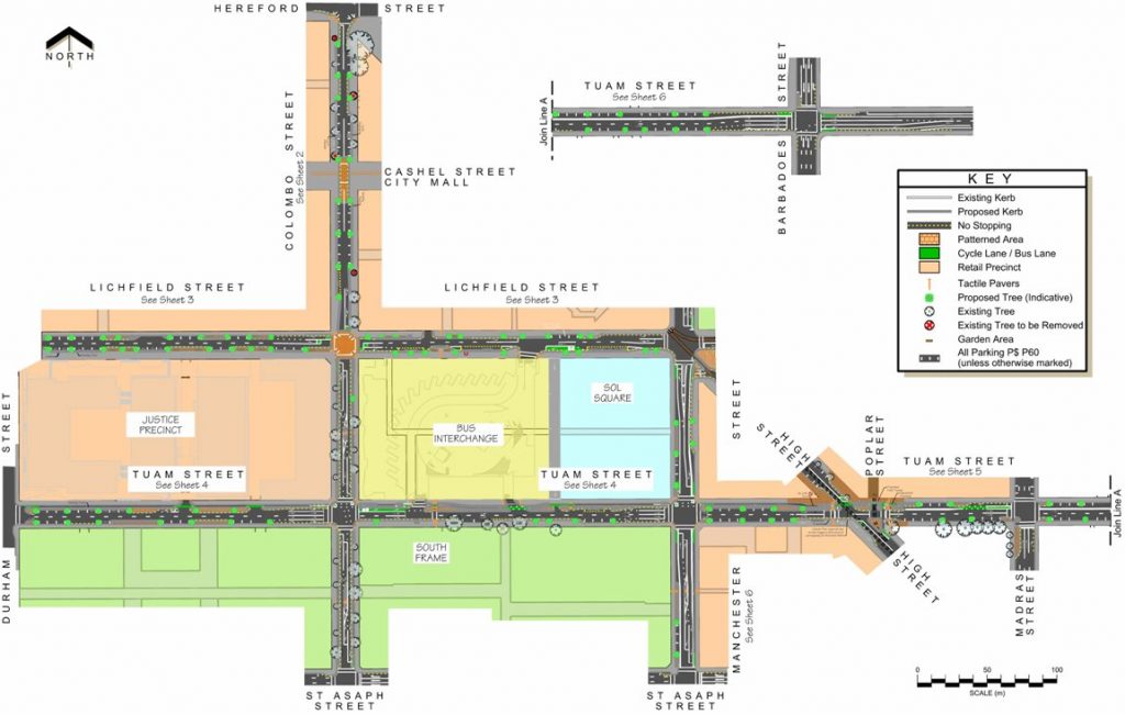
Now things are getting interesting… Hot on the heels of the recent proposed works at Hospital Corner and Hagley/Moorhouse, further works along three-and-a-bit central streets are now out for public consultation.

As you might recall, the Accessible City proposals by CERA are envisaging quite significant changes in how transport operates in our central city. From a cycling perspective, there were promises of friendly separated cycleways and a 30km/h “slow core”. These plans are now slowly coming to fruition so that we can see what is being proposed. It’s a fairly large endeavour to redo the entire central city transport network, so the work has been broken up into parts; however, it does make it rather hard to keep track of what’s been done where.

A key change in the central city is the switch of eastbound one-way street from Lichfield St to Tuam St. As part of these works, one-way separated cycleways are planned in each direction along Tuam and St Asaph Sts (it would be nice if contra-flow cycleways could also be provided on these routes…). These will connect the major cycleways coming into the city from the south/west (Hagley Park and Antigua St) and southeast (High/Ferry). It looks like the separation here will be largely via kerbed island of some kind; the details aren’t clear. Once the cycleway reaches the High St cycleway link, conventional painted cycle lanes will continue further eastward, although they will have an additional painted buffer strip (the consultation notes say this is to provide extra width away from parked cars, but it’s shown as being on the traffic side?).

One issue that I know had the transport team scratching their head a bit was how to deal with the cycleway as it went past the new transport interchange. Potentially this could be quite a conflict point between riders on Tuam St and buses entering the interchange (putting the cycleway on the south side was considered but that introduces other problems, especially at intersections). It looks like some kind of special traffic signals might be used to manage the differing flows, by halting pedestrians and cyclists when buses are entering.

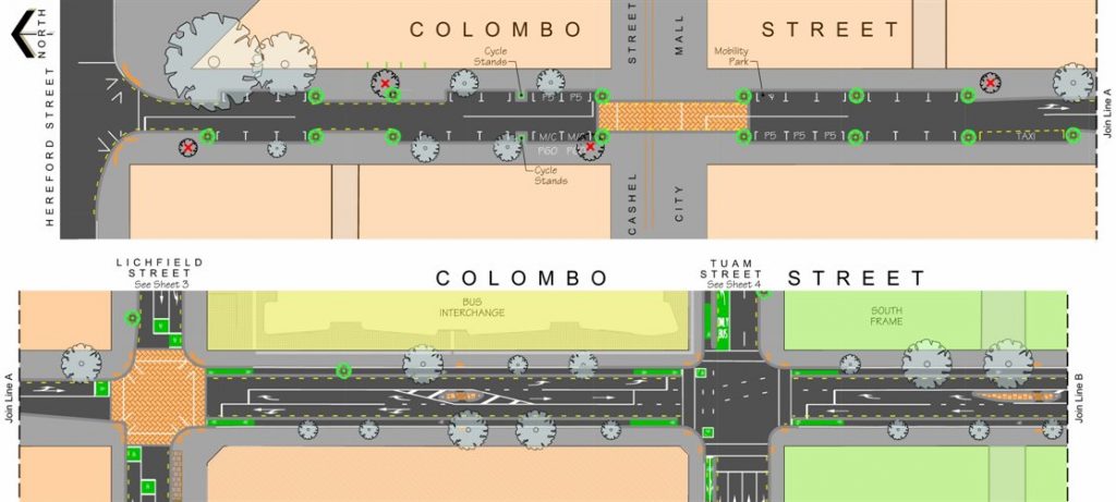
Colombo St will also provide a key cycling route north and south, so special attention has also been paid to this. North of Lichfield St, there is not expected to be much traffic and the 30km/h zone will be in force, so a shared street arrangement without specific cycle facilities has been proposed. I’d be more comfortable with this arrangement if there were more speed management treatments in place to keep speeds down, e.g. raised/paved surfaces at points in-between the intersections. Perhaps a few sharrow markings in the traffic lanes as well, to also reinforce the shared nature of the street?
South of Lichfield, separated cycleways are proposed; in this case it is suggested that they be “Copenhagen style”, i.e. stepped up from the traffic lanes. To fit these cycleways in, shock horror, all on-street parking is being removed along these sections of Colombo St. Great to see priority being given to cycle safety over driving convenience.
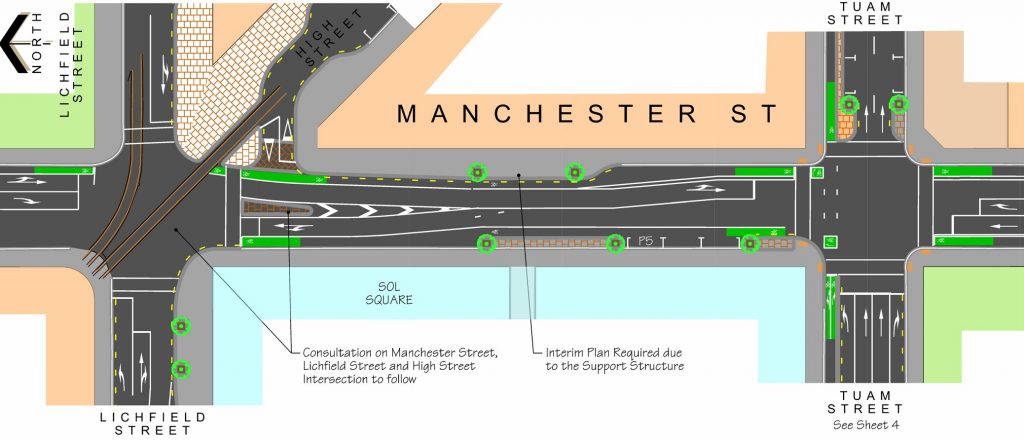
Other streets are not part of designated routes, so they don’t have the same level of protection. Manchester St for example, between Lichfield and St Asaph, has conventional painted cycle lanes just like at present. A few cycle lane separators at the intersections would be useful though, to keep turning traffic out of the way.

Lichfield St meanwhile doesn’t have any particular cycle facilities at all (apart from advanced stop boxes at the Colombo intersection), although again the route is expected to be low volume and low speed (30 km/h). How successful this will be for anyone cycling there is up for debate; some major car park buildings are planned along here, and again there appears to be very little in the way of traffic calming treatments. Getting rid of the centreline would also help to lower traffic speeds.

Overall, the proposals are an improvement on what has previously been provided for cycling in town; the separated cycleways in particular will be quite the game-changer (once they are connected to the rest of the Major Cycleway network). Also good to see some hook turn boxes at many intersections to help with right turns (although Tuam St could also do with some more at Madras and Barbadoes).
A couple of minor quibbles: it’s hard to tell exactly how much width is being provided for the cycle facilities, as no detailed cross-sections are provided anywhere (my guess is that the separated cycleways are ~2.1-2.2m each way). And very little on-street bike parking is shown; yet there are heaps of planned kerb-extended areas that would easily provide some space for a few bike parks here and there.
If you want more details about these proposals, a couple more information sessions are planned this week at the BNZ Lounge at EPIC:
- Monday 29th September, 11am–2pm (30 minute presentation followed by drop-in session)
- Thursday 2nd October, 11am–2pm (30 minute presentation followed by drop-in session)
All feedback on these proposals must be sent to Council by 5pm on Wed 8th October.
What do you think of the Central City Transport proposals?


Really keen to seen the Copenhagen style cycleways!
Good point about the traffic calming. It appears to me that NZ is really reluctant to put in traffic calming measures. Apparently in the Netherlands ( I have not looked up other countries) over 45% of residential streets are 30 Kmh zones ( https://www.swov.nl/rapport/Factsheets/UK/FS_Residential_areas.pdf ). I have serious doubts about whether a 30 kmh sign alone will do the trick. I think it is not unlikely that those drivers who are careful around cyclist anyway will stick to the 30 kmh while the less careful driver will disregard the signs if there is not enough traffic calming.
The stats appear to be even more pronounced: Over 75% of the total length of residential streets in the Netherlands have now been converted into 30 kmh Zones …