
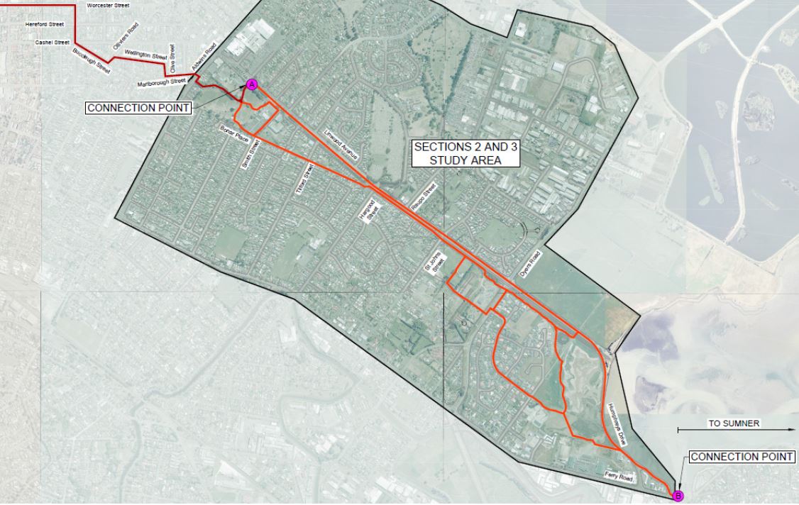
The consultation season continues with another Major Cycleway out for consideration. While work is underway to start constructing Stage 1 of the Rapanui / Shag-Rock cycleway, plans for Stages 2 & 3 are now publicly available. This takes the cycleway from its current terminus at Linwood Park out through Woolston and Charlesworth to join the Chch Coastal Pathway at Ferrymead.
The route largely follows Linwood Ave and Humphreys Dr, with two different options presented. Compared with other recent cycleway consultations, what’s interesting is that virtually no parking is affected anywhere along the route. What’s rather annoying from a consultation perspective is that there are elements of both options that make the most sense (and in some cases no reason why they weren’t presented with the other option too), which makes it rather hard to indicate preference for one over the other.
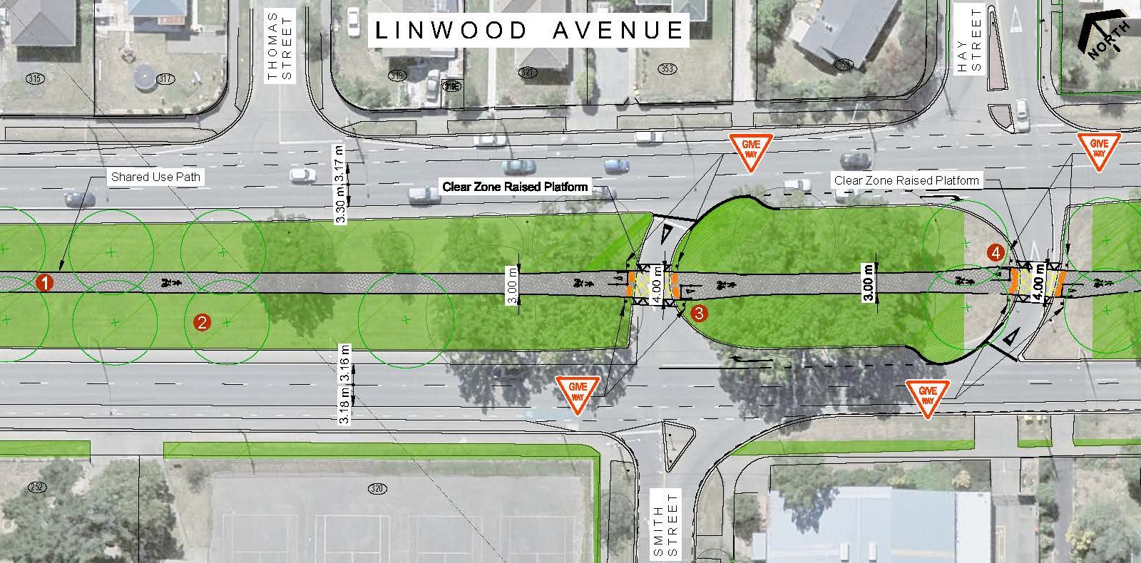
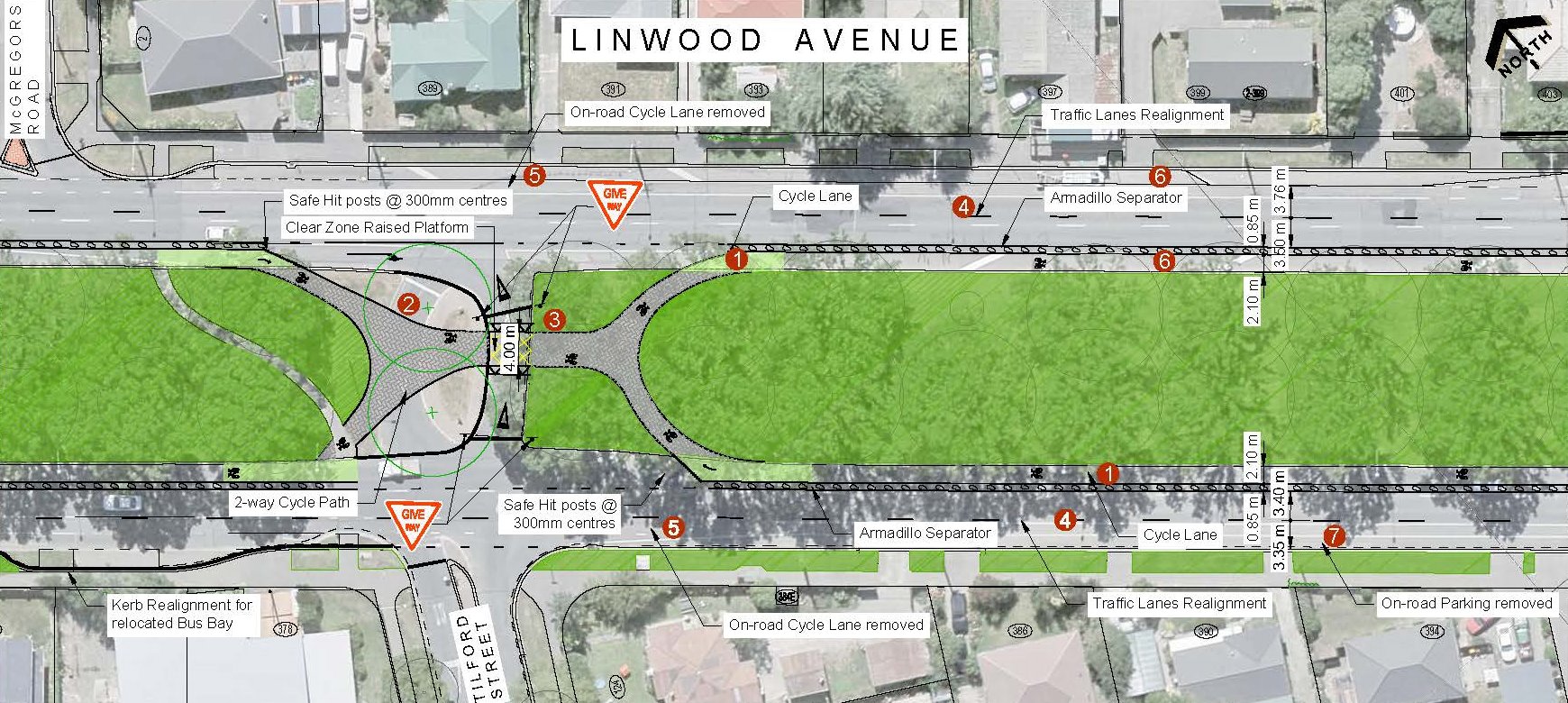
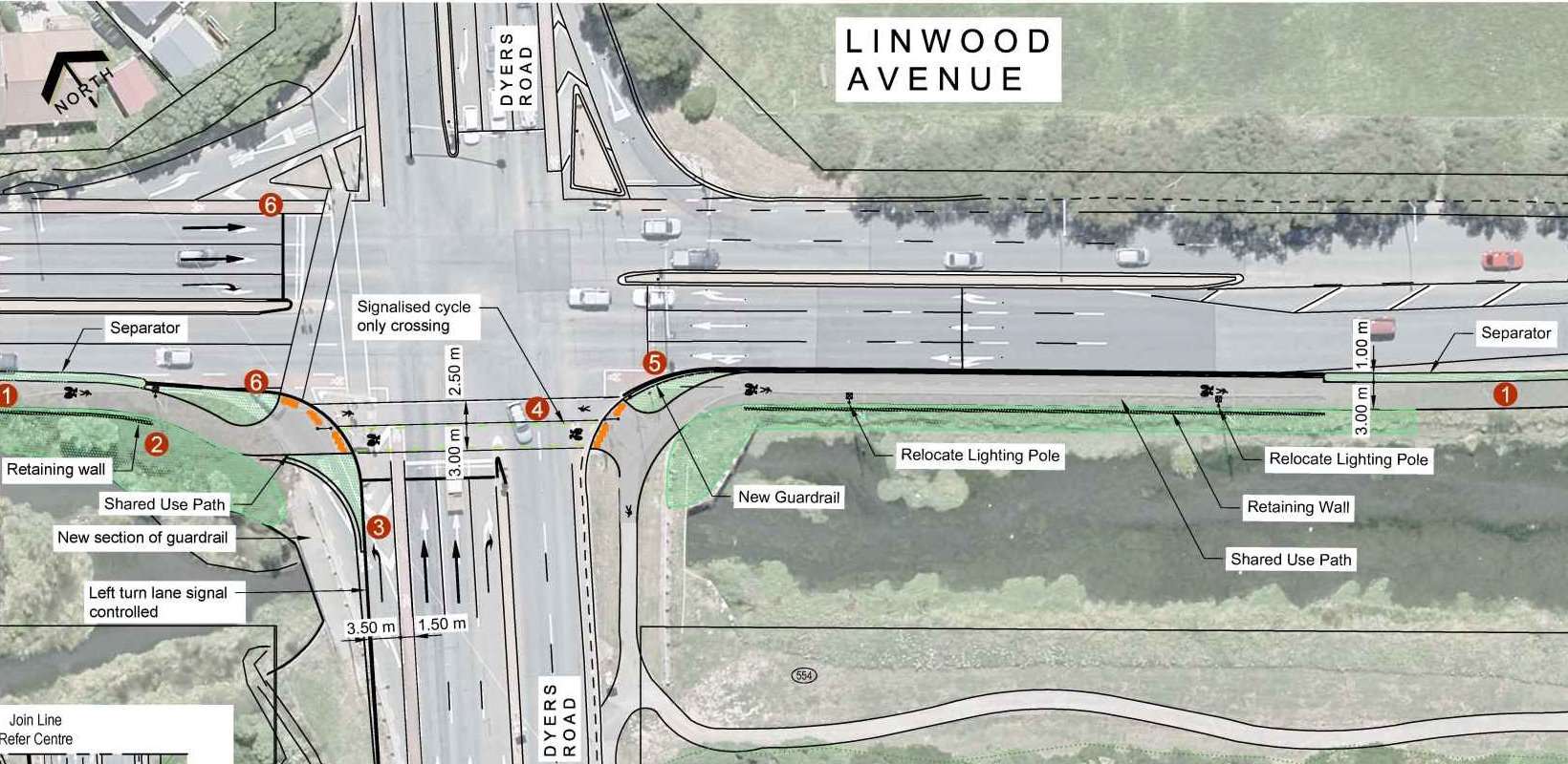
For the preferred option, the rather intriguing treatment for the first part of the route is to run down the middle of the wide tree-lined median along Linwood Ave, connected by the existing signals at Chelsea St and a new signalised crossing at Hargood St. If you’ve ever stood in the middle of Linwood Ave along here, you’ll know that it is quite a pleasant experience being some distance away from the adjacent traffic lanes. Some of the u-turn lanes along here are also being closed off to reduce conflicts with turning traffic. And the existing on-road cycle lanes will also remain in place.
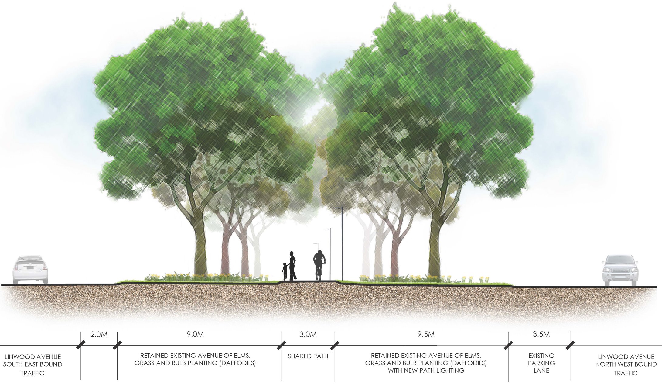
There are a couple of problems with the preferred option details. Firstly, the pathway is made to give way to the remaining u-turn lanes, which makes no sense given their relative levels of importance. Secondly, there is a need to easily access the side roads, by means of some additional connecting paths. Interestingly too, the route is billed as a shared path, but I’m not sure it’s as useful a connection for pedestrians (and at only 3.0m wide, not ideal for shared use).
The alternative option is to run one-way separated cycleways down each side of the central median, which come together to cross over the u-turns. This option seems rather strange, although it probably saves money by using the existing roadway. But that comes at the cost of the cycle lanes on the kerbside, and having to duck in and out at each crossing would also start to get a bit annoying. This option would also seem to make it even harder to get to the cycleway on the opposite side of the road to you.
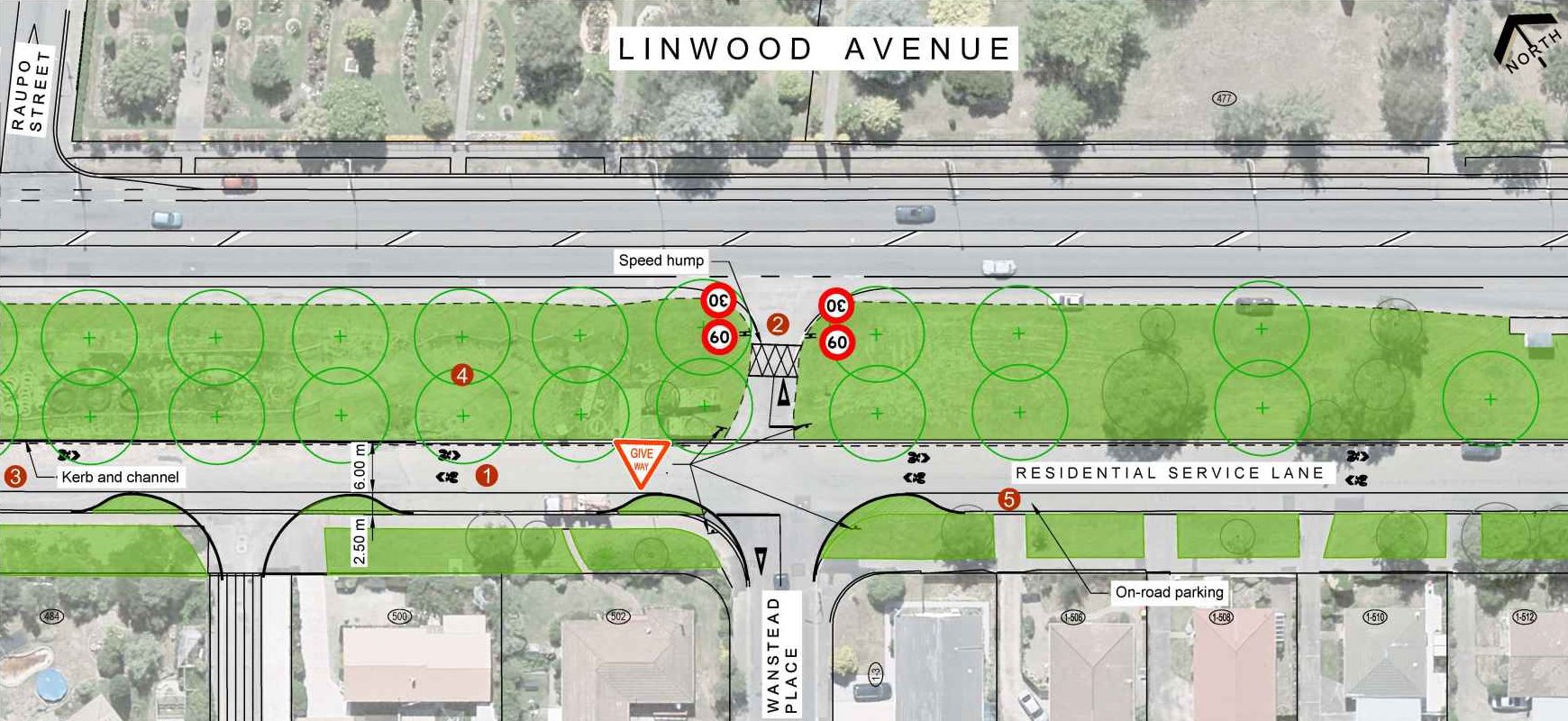
Once the wide median finishes as Hargood St, a signalised crossing takes the cycleway over to the existing service lane (on-road cycle lanes continue along Linwood Ave too). The preferred option proposed is to have a 3.0m shared pathway alongside the service lane, which seems pointless with a low volume street like this right next to it (again, it also requires the cycleway to give way to the minor service lane accesses).

The alternative option is to use the service lane as a neighbourhood greenway, complete with 30km/h speed limit. Perhaps a couple of raised platforms would help to manage the speeds even better along here.
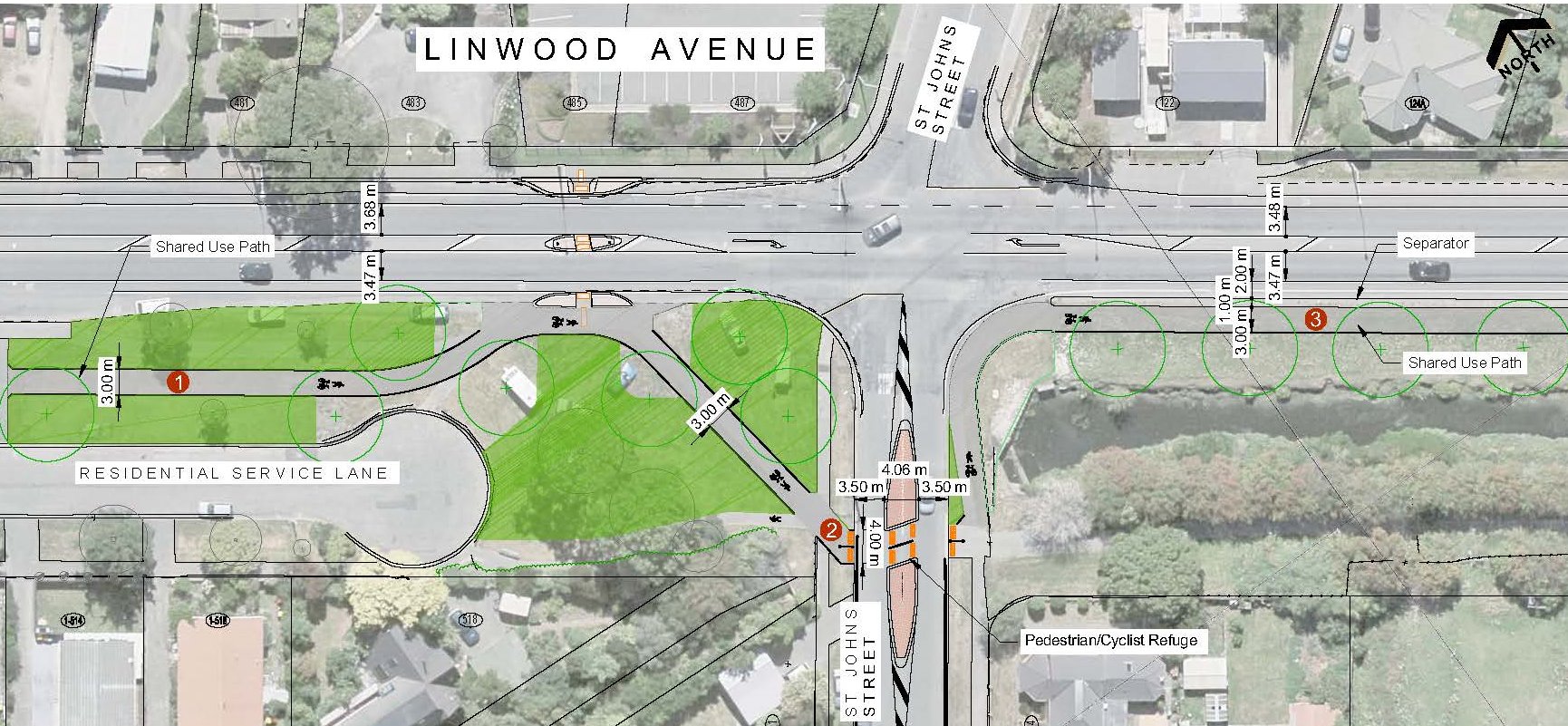
At St Johns St, the preferred route continues alongside the edge of Linwood Ave next to Linwood Drain, again as a 3.0m shared path. Rather oddly, the side-road crossing of St Johns St is very indirect for no apparent reason.
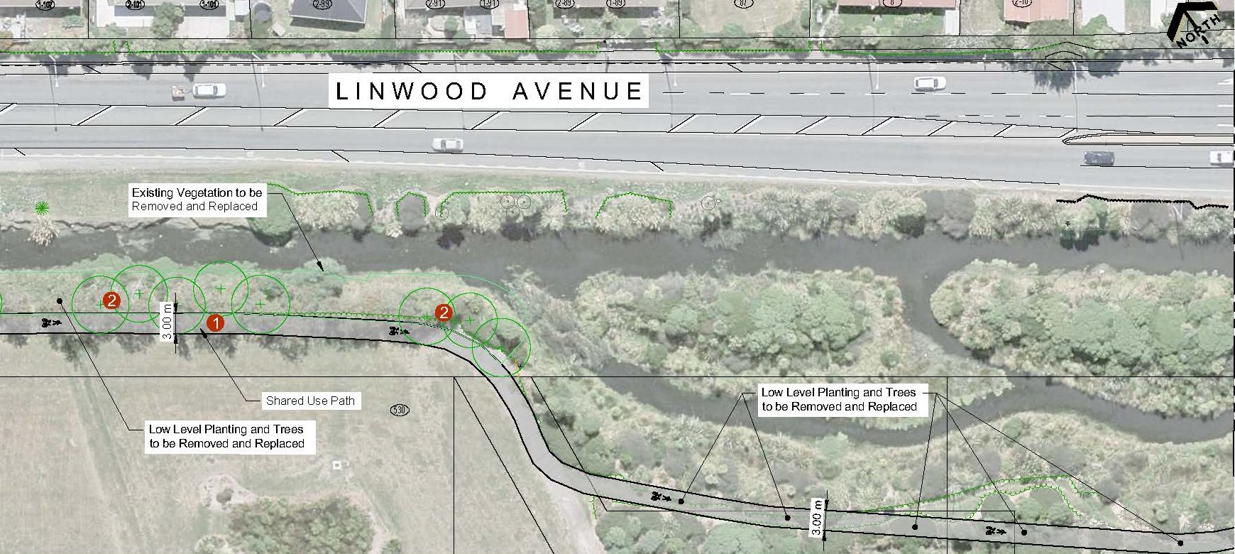
The alternative option follows the other side of the drain, with some of the existing vegetation removed to improve visibility. While this seems like a more pleasant option than running alongside Linwood Ave, it is fairly isolated, which could make it rather uncomfortable for many people at night-time (the lighting had better be good; it’s very dark in there at night).
At Dyers Rd (SH74), the existing signalised crossing is upgraded to get cyclists across the State Highway. Again, the preferred option runs the shared pathway between Linwood Ave and the drain.
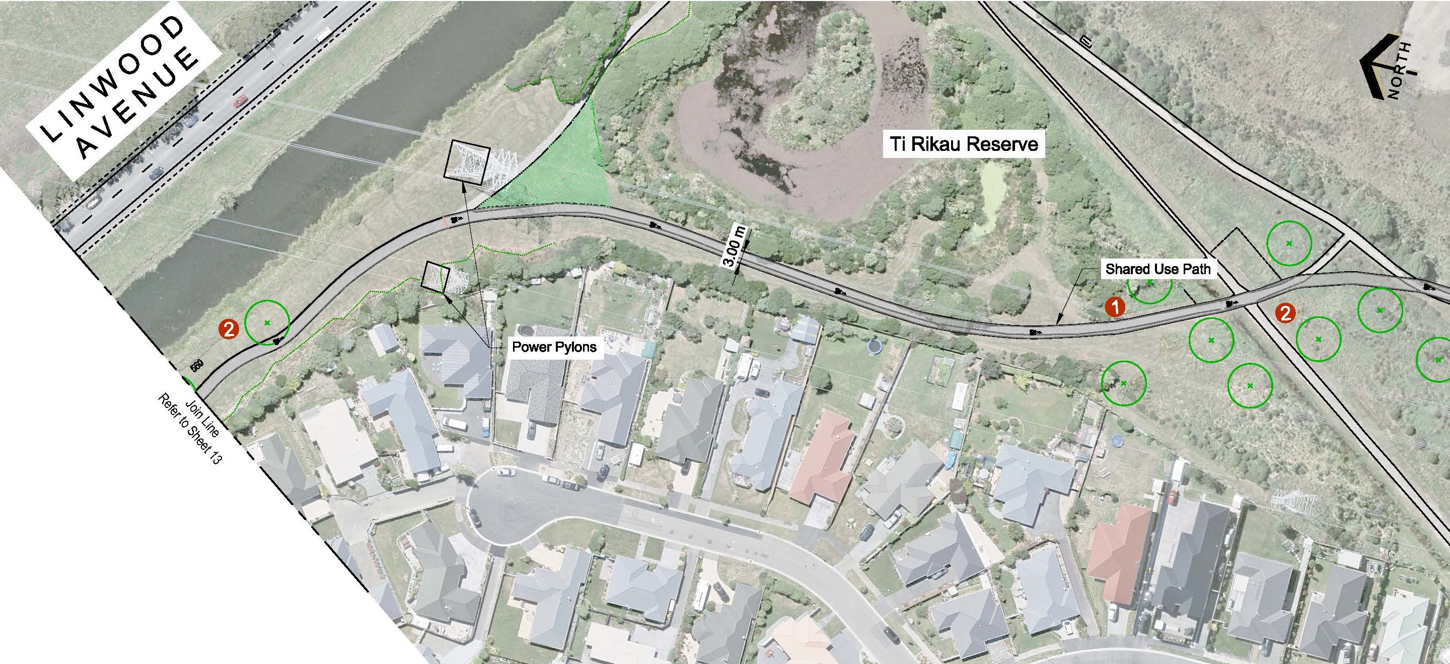
Alternatively, the existing pathway through Charlesworth (Ti Rakau) Reserve is widened and sealed all the way through to the Ferrymead shops. While being a pleasant off-road route (and a more direct connection to Ferry Rd), again it suffers from some night-time security concerns if it was the main cycling option for people (e.g. commuters in the winter darkness).
The preferred option crosses over Linwood Ave via a new signalised crossing near the existing Charlesworth Bridge over the drain (does it have to be so perpendicular though?). This then allows the pathway to continue on towards the estuary edge. Meanwhile, the plans are rather vague about whether or not there remains an on-road cycle lane westbound along here.
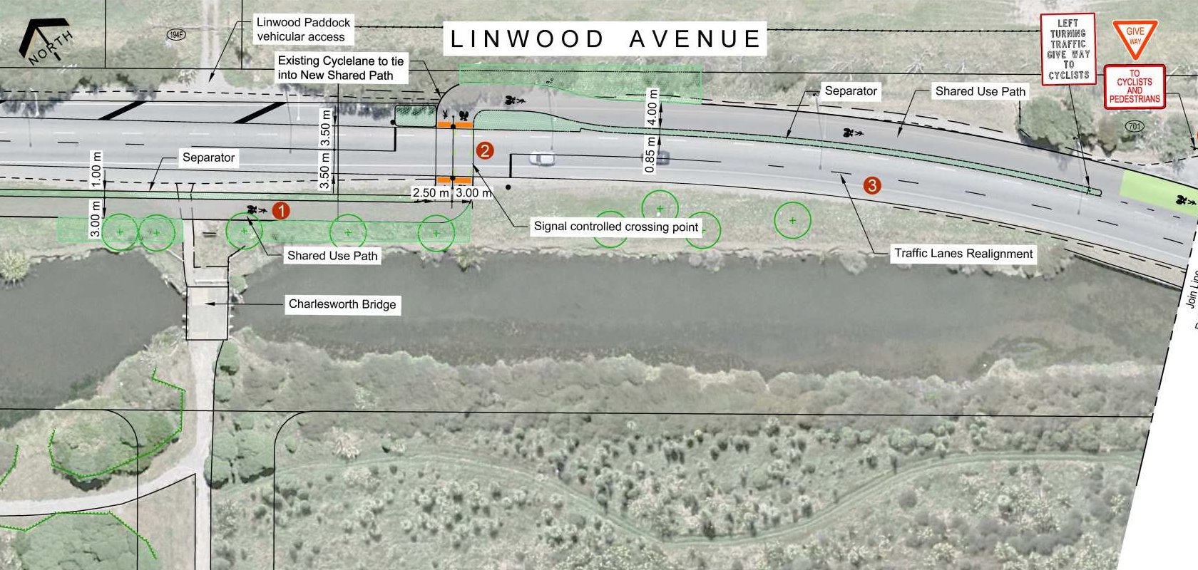
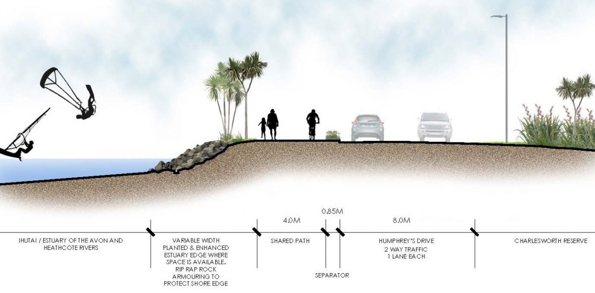
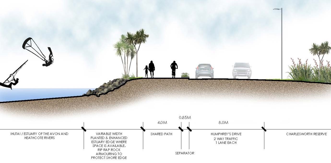
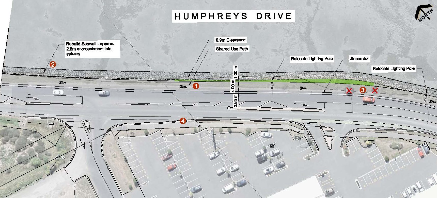
At the estuary, the existing seawall damage will be repaired to allow for a 4m-wide shared pathway along the water’s edge, adjacent to Humphreys Dr. In the long-term, there is a plan to continue the pathway all the way around the estuary to New Brighton.
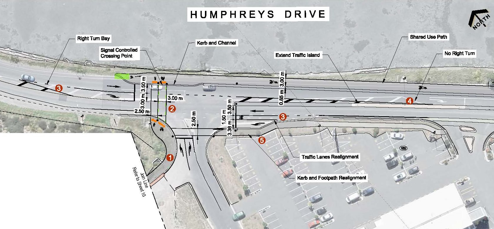
Approaching the Ferrymead shops, the preferred route pathway seems to have fairly limited options for crossing over to the retail area; there’s not even gaps shown in the physical separator. As a means of connecting cyclists with local destinations, this doesn’t seem very useful.
The alternative route has the advantage of already being on the correct side of the road, although even then there doesn’t seem to be a desire to make it easy to connect anywhere to the actual shops. On reaching Humphreys Dr, a new signalised crossing helps people get across to the estuary side.
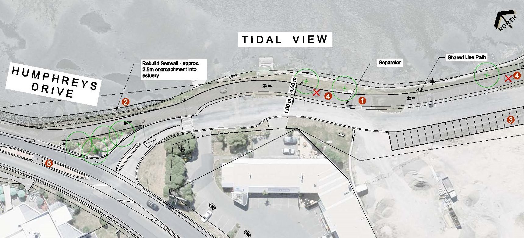
Finally, the cycleway turns into Tidal View, to follow the estuary edge around to the Ferrymead Bridge and the start of the Coastal Pathway. This is the only section with notable car parking loss, estimated at 16-18 spaces.
In summary, there are some good elements throughout the route; rather annoyingly they are scattered between the two different options. Some of the proposed shared path widths (3.0m) also seem on the skinny side, but in most places there is opportunity to revisit that and widen it later if need be. At the eastern end, I have some sympathy for the alternative route away from the road, especially as a link to Charlesworth and Ferrymead, but it would need considerable effort to be a comfortable route 24 hrs a day. The designers also need to remember that many people will be joining and leaving this cycleway somewhere along the way (e.g. to side-streets and shops) and provide suitable connections for those trips.
Submissions close on this project by 5pm Thu 15th Dec, so have your say now! Again, people have the option of providing a conventional submission (via paper or the online form) or using the interactive online map to post specific feedback. If you want to know more about this cycleway and the Heathcote Expressway also out for consultation, then why not join Spokes Canterbury for a guided ride along both routes this Sunday 11th, starting at 10am from C1 Espresso (cnr High/Tuam).
What do you think of the proposed Rapanui / Shag-Rock cycleway?
Giving way to cars doing a U turn seems very odd. We need to move away from the concept that cars get the right of way whenever possible. The cars are crossing a cycle way so just need to stop and look before turning. Allowing this defeats the purpose of these cycle paths.